

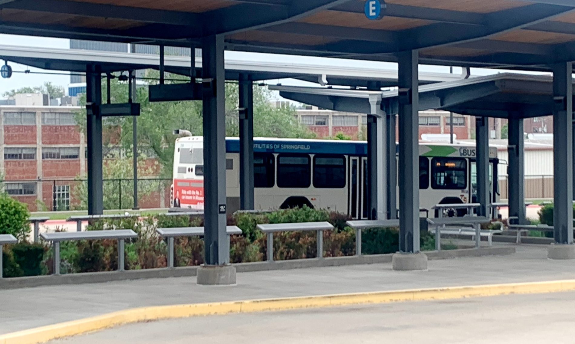
The most popular navigation application on the road tends to send drivers on three Springfield streets.
North Glenstone Avenue, West Chestnut Expressway and Trafficway are all choice routes for Google Maps. According to market and consumer data analytics at Statista.com, Google Maps is the navigational app of choice for about 72 percent of the U.S. population that uses mapping applications. Where the app recommends, drivers go.
Unfortunately, they're all sort of ugly. City leaders are considering changing that.
The Forward SGF comprehensive plan is a master plan for the growth and development of Springfield from now until the end of 2040. The Springfield City Council will consider the plan for formal adoption in October. On June 2, one of the leading consultants hired to write the 200-plus page planning document shared how the algorithms in Google Maps led to the writing of specific plans to redevelop the corridors of North Glenstone, Trafficway and West Chestnut Expressway.
The consultants' recommendations are very preliminary, as exact project specifications, funding sources and project timeframes have not been identified.
What is Forward SGF?
The final draft of Forward SGF will be used to communicate Springfield’s vision for itself, to inform developers looking at Springfield about what sort of economic environment they will be getting into, to set the framework for development regulations, to coordinate initiatives on housing and recreation, to point out opportunities for investment and to help the Springfield City Council and other government groups set their budgets each year.
The first step in development is to identify sites with the potential to be something greater than they are, and then devise ways to spur development through discussion, said Houseal Lavigne Associates Project Manager Brandon Nolin, a consultant for the City of Springfield.
“If you don’t put it in the plan, you can’t have a conversation,” Nolin said. “What’s the appropriate land use mix? What are the needed infrastructure improvements, development characteristics, any kind of key sites for development?”
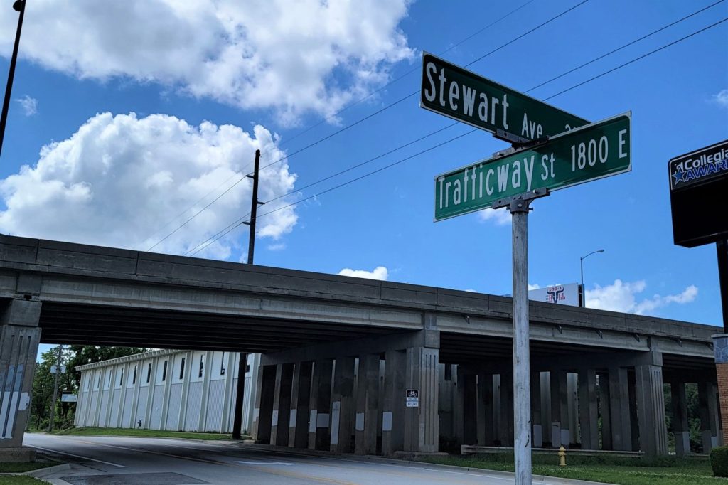
Trafficway
If you’ve ever sped out of downtown after a day of work, or sped toward Hammons Field trying to make it in time for the first pitch at a Cardinals game, you’ve probably sought the relatively uninhabited east-west corridor of Trafficway.
While it offers few stoplights, it’s also home to some empty industrial buildings that even Springfield Mayor Ken McClure can attest won’t win any awards for civic beautification.
“Trafficway is not the way I was hoping people would view the town,” McClure said.
Nolin encouraged the mayor and the Springfield City Council to forget what they know about Trafficway and to imagine it as something different.
“Really, we’re talking about this area transitioning to more of a mixed-use district,” Nolin said. “This kind of represents a transition of the downtown, and extension of the downtown to some extent.”

Springfield Senior City Planner Randall Whitman noted that Trafficway is close to historic neighborhoods, Rountree and Walnut, and that mixed-use developments have succeeded in that part of town. The intersection of East Cherry Street and South Pickwick Avenue is viewed as a model of what can be in other parts of Springfield.
“The success we have at Cherry and Pickwick can really be an extension of that. (Trafficway) is really close to those neighborhoods, so it’s a great opportunity,” Whitman said.
Nolin compared the buildings on Trafficway, in terms of potential, to the Crossroads neighborhood in Kansas City. Near downtown Kansas City, the Crossroads has emerged as a food and arts district. Buildings that were once warehouses have been repurposed to house art galleries, and there are more than 40 places to go for food and drinks. The neighborhood also has about 2,000 residents.
Nolin suggested that some of the buildings on Trafficway could be redeveloped as galleries and/or “maker spaces,” community studios where artists and creators can share tools, resources and ideas. The Springfield-Greene County Library operates a technology makerspace called the Edge at its Midtown branch, which features a 3D printer, a laser cutter and a vinyl cutter. The commercially-owned Millet and Hammer workshop on Boonville Avenue offers woodworking and ceramic work space to its members.
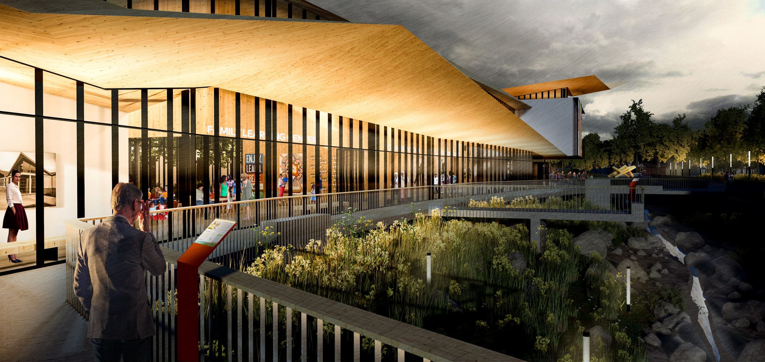
The idea, ultimately, is to turn Trafficway from “an industrial road to a cool destination,” with sidewalks, outdoor seating areas and public amenities.
“It’s meant to be a district, right? So it’s going to be an area where congestion might be a good thing, to be honest. You want activity there. If the people don’t want to spend time there, they’ll go around it, because there’s definitely other routes they could go pretty easily,” Nolin said.
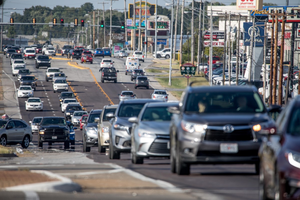
North Glenstone Avenue
Another key site the authors of the Forward SGF plan identified for redevelopment is the section of Glenstone Avenue from Interstate 44 to Kearney Street. It’s the first part of Springfield that many first-time visitors see when they exit I-44.
“This was chosen because it’s a key gateway to the city coming off the interstate,” Nolin said. “Google Maps routes lots of people through this area. It’s where you have most of your hotel rooms in the city. It really is a front door for Springfield.”
Nolin suggested that Springfield establish some type of “gateway enhancement,” a wall, a landscaping feature, a piece of art and/or a sign that welcomes people into Springfield from the highway to North Glenstone.
“Looking at the available right-of-way and what could be improved upon, how do we make that something where when you come off an interchange, it welcomes you to Springfield? Right now, it’s just a pretty plain interchange,” Nolin said. “We’re suggesting getting something on the south, because that’s where most of the traffic goes.”
The consultants from Houseal Lavigne identified places around North Glenstone that need roadway extensions in order to connect commercial work sites with the surrounding neighborhoods. Nolin said that the interchange of Glenstone and Interstate 44 should be viewed through the lens of a public amenity, as opposed to strictly as a transportation connection.
“The intersection itself by the interchange is a key opportunity to be a better gateway coming in,” Nolin said.
Behind the scenes, the consultants look at infrastructure such as sidewalks, natural gas and utility lines. Two major mid-block crosswalks with lighted signals are proposed for North Glenstone Avenue.
“It’s very auto-oriented right now and hard to navigate if you’re not in a vehicle,” Nolin said. “Imagine if you’re staying in a hotel and want to walk to a restaurant across the street; it’s probably not going to happen.”
Making pedestrian connections happen, Nolin said, could turn North Glenstone Avenue from a commercial street into a commercial district, where people visiting feel safe and welcome and are more apt to spend money at stores and restaurants during their stays in town. Councilman Andrew Lear asked about the Missouri Department of Transportation’s involvement with adding pedestrian crossings to a street that is five lanes wide.
“How big of a deal is it to get MoDOT to sign off on something like that?” Lear asked.
“I don’t know,” City Manager Jason Gage said. “I think we want to talk to MoDOT about that, and I think what they would be looking at is distance from Kearney as a major intersection, distance from I-44 as an interchange, then the first thing they don’t want to do is have cars back up into those intersections or into the interchange area.”
Gage said the calculation for any anticipated backups is based on distance and historic traffic levels. He said the city of Springfield would need to work with MoDOT to analyze the technical data to determine the best location for crosswalks.
Lear said he thought adding crosswalks would be a good idea, but he wasn’t sure of the crosswalks’ potential to have residual impacts on traffic.
“We know that human behavior being what it is, whether there’s a crosswalk or not, people are crossing there,” Lear said. “The only way to stop that would be a barrier like they did at MSU with a fence or something.”
“We have other issues of loud traffic, speeding traffic, unsafe conditions,” McClure said.
Master planning, at this stage, is about setting a larger vision and then breaking it down into smaller, attainable goals. Gage said that Forward SGF has some cases where people will be asked to think beyond the streets and neighborhoods that they have known in the past.
“We’re beginning to vision those state corridors through our community differently than we ever have,” Gage said. “It used to be just about traffic volume and traffic safety — and certainly, those things are a top priority — we have to have the ability to deal with volume in a safe way.”
After safety come some new concerns, and they all translate into making Springfield a quality place to live and work. It’s less about moving people, and more about helping people to better enjoy their treks into the busiest parts of Springfield.
“We’re thinking about the pedestrian linkages, the multimodal in all aspects, the aesthetic, because all roads lead right to the heart of our city,” Gage said.
West Chestnut Expressway
A plan to spruce up West Chestnut Expressway from the Springfield-Branson National Airport to the Westside and Heart of the Westside neighborhoods was included in the Forward SGF planning documents at the request of members of the City Council.
Nolin started his discussion of Chestnut Expressway by sharing some of his own experiences flying from Chicago to Springfield on business trips for the Forward SGF planning contract. Upon landing at the airport, he drives or rides into the downtown area.
“I usually take West Bypass and Chestnut every time, and this is a key corridor that I always see coming into town, and I want to see it do better,” Nolin said. “It needs to be prioritized as a key community asset.”
The consultants broke West Chestnut Expressway into three pieces: I-44 to North Westgate Avenue, Westgate to West Bypass, and West Bypass to College Street.
Nolin said available open space would allow for development of trails and streetscapes, especially along the railroad corridor.
“No more cow paths and lack of investment, we want to see a quality corridor there as you’re coming into town,” Nolin said.
Nolin suggested the City of Springfield coordinate with BNSF Railway to paint railroad bridges with decorative art. If the railroad company wouldn’t allow artists to touch the bridge, which happens in some cities, Nolin suggests decorating areas around the bridge where there is right-of-way.
“It’s looking at that rail overpass as an opportunity, kind of a cool entryway,” Nolin said.
Greenspace preservation, open space use and the growth of trees between industrial and residential areas are all points of the West Chestnut plan. The development is built within Springfield’s existing land use plan with the idea that developers could fill in some gaps in commercial space along West Chestnut Expressway.
On the east end, the intersection of West Chestnut Expressway and College Street offers another opportunity to develop a gateway, welcoming people to Old Route 66.
“It’s an interesting intersection in terms of history and in terms of location,” Nolin said. “You could accommodate a roundabout, make it something really punchy and attractive, providing that opportunity for public art or something in the middle of the roundabout.”
Future of Forward SGF
Forward SGF is a full-scale comprehensive plan that has been in development for three years. It will be the Springfield city government’s navigation map to 2040. The full plan will be revealed to the public with a series of events in July and August, with the Springfield City Council scheduled to adopt the plan formally by ordinance Oct. 3. The plan will go to the Springfield Planning and Zoning Commission for consideration Sept. 15.
The consultants recorded more than 10,000 interactions with Springfield residents, about 2,400 of which were done in person, and 7,600 pieces of input came from online surveys and forums. Nolin said it was one of the most publicly-engaged projects Houseal Lavigne has done.
The comprehensive plan has 13 chapters, with chapters dedicated to land use, community outreach organizations, economic development, plans for certain key areas of the city, a transportation and transit plan, a downtown plan, a public facilities plan and plans for parks, greenways and natural resources.