
OPINION|
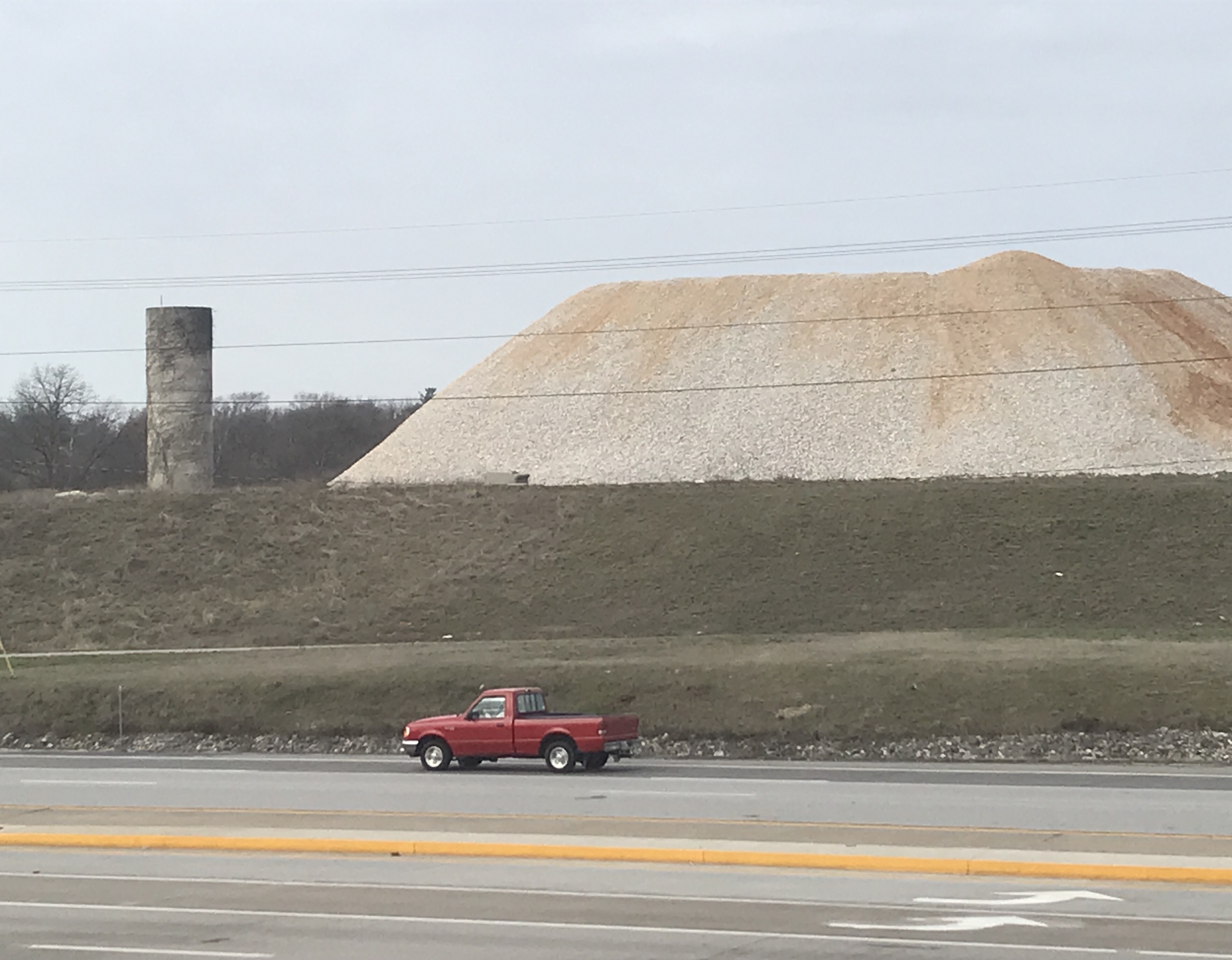
I gazed across the plains of South Campbell Avenue, from my encampment in the Denny's parking lot, at the impressive site of Mount Silo, which rises some 6,100 millimeters into the heavens.
I felt a sense of wonder.
Specifically, I wondered where all that rock came from?
What would become of it? Would there someday be skiing in Springfield?
I will call it Mount Silo because it is next to an old stone silo. It is part of a development called The Ridge at Ward Branch, first unveiled in 2018.
A July 2018 story in the Springfield Business Journal said the development covered about 100 acres of mostly vacant farmland purchased from the Ward family just south of The Library Center.
The plan called for mixed-use buildings, apartments and commercial. For years, there has been talk of a hotel.
The project, when completed, was estimated to have a value of $500 million.
I was curious about this big pile of whatever
The developer was and remains RW-Developments.
The “R” stands for Trip Rhodes and the “W” stands for Phil Williams, brother of Titus Williams, another developer whom I've written about in the past year due to his purchases of property on and near Commercial Street.
The weather was good, and I traveled by vehicle to Mount Silo this week. I was curious about this awesome and immense pile of whatever.
It's some 20 feet high, which is a boring way of saying 6,100 millimeters.
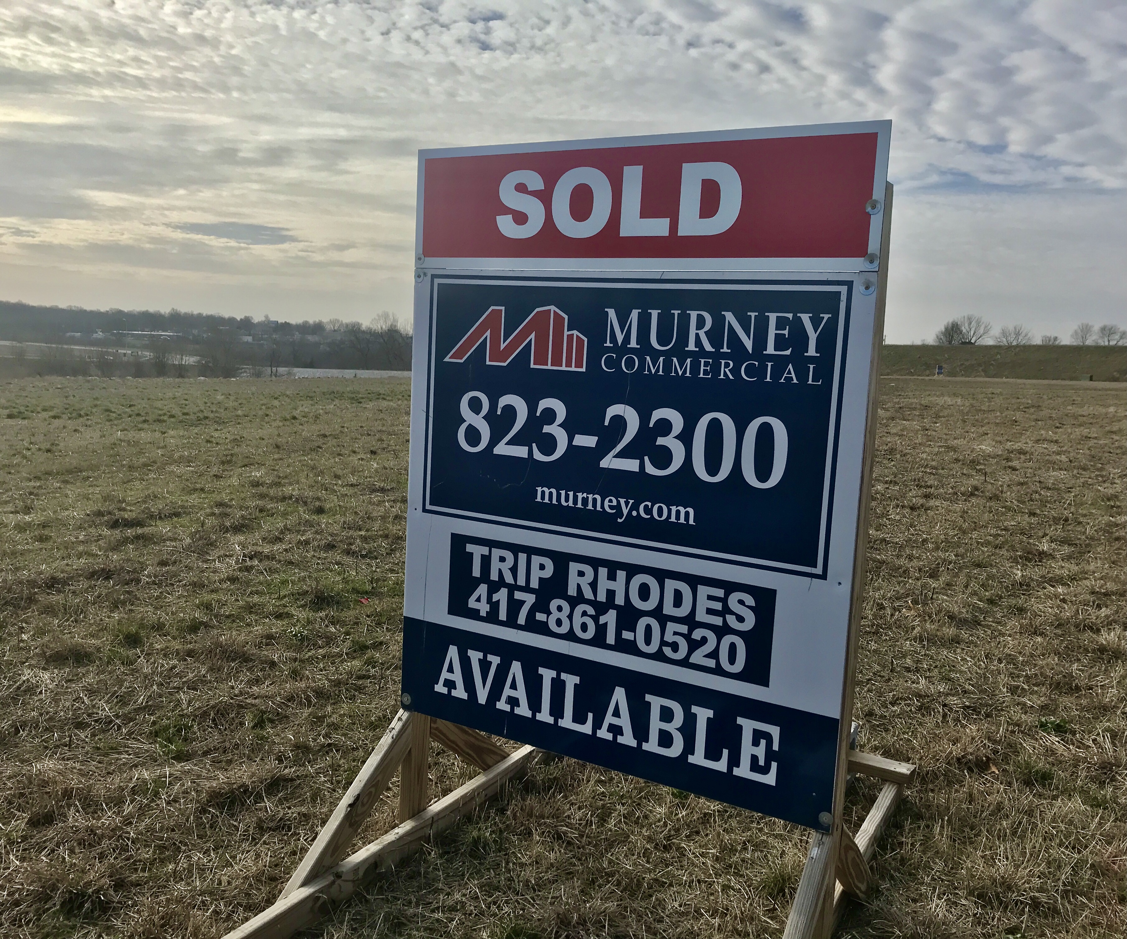
Rhodes is not only half owner of RW-Developments. He is also a real estate agent with Murney Commercial. His name and phone number are on many signs on many of the parcels along the new roads built in recent years. Many of the signs are marked “sold.”
The roads are in; nothing has been built — other than Mount Silo.
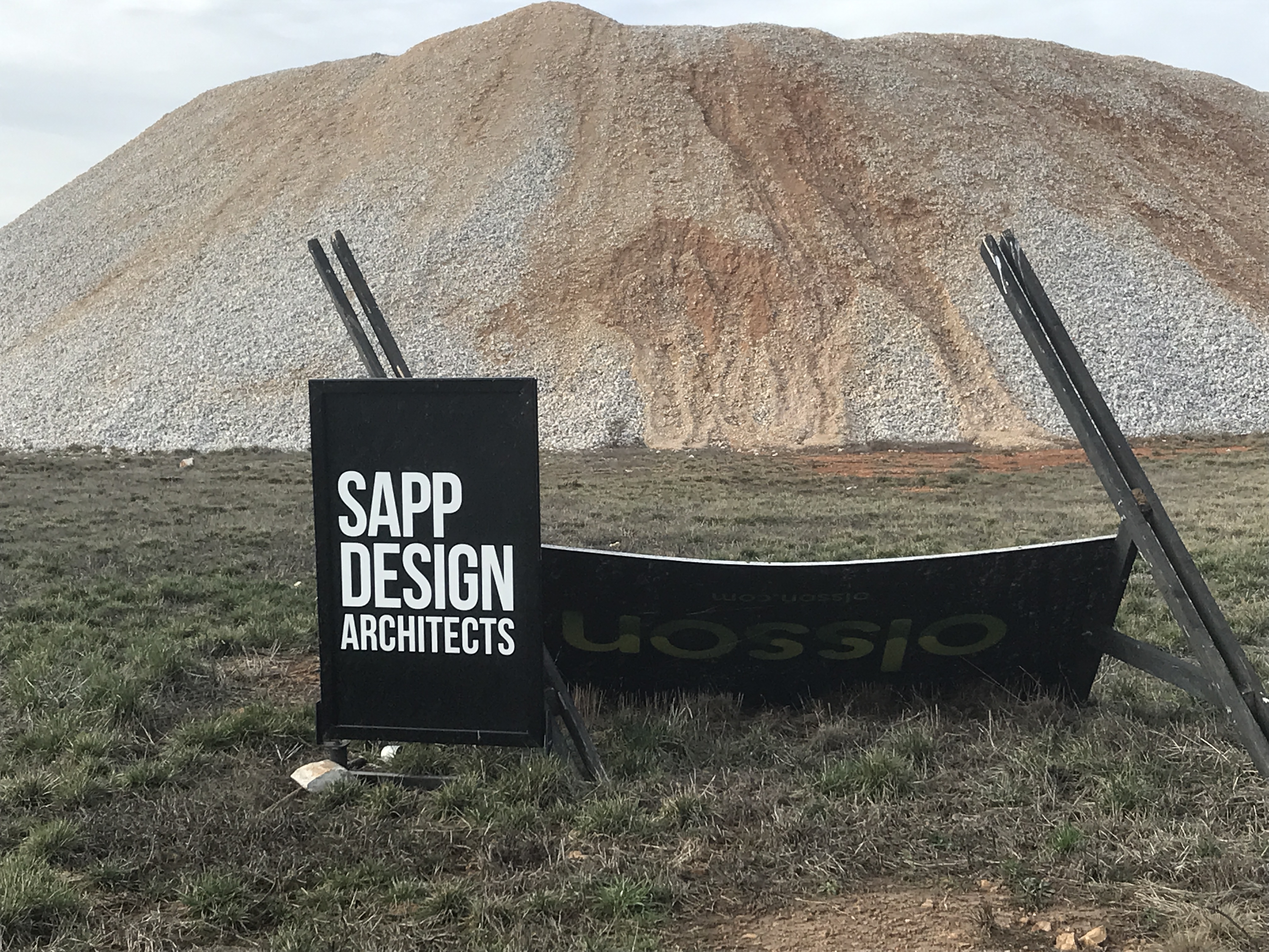
“They had to blast a ton of rocks,” Rhodes tells me.
That rock was then pulverized on site and hauled over to one location.
Why is it still there?
It is still there, abiding like Kilimanjaro, because it will be used as base material for the various construction sites.
Original vision remains the same
The original Big Picture overview remains the same, Rhodes says. It includes multi-use and commercial, restaurants and, possibly, a hotel.
The actual construction — also known as “going vertical,” I learned — is coming soon.
Rhodes didn't want to name the stores or businesses coming or that might be coming.
“My goal is to get us to the finish line. I do not want to promise something that is coming and then it's not.
“I think 2023 has more promise than any year. We have sold millions of dollars of dirt out there.
“We are in a very strong financial situation. We have turned down several deals that we did not think was appropriate for neighbors.”
The residential part of the development will be at the back of the acreage — farthest from Campbell and closest to existing homes.
‘Build it and they will come'
The project has taken longer than anticipated, he says, because of COVID-19 and a marked increase in the interest rate on commercial loans.
Interest rates have risen and had a negative impact on commercial projects, he says.
This impact is even greater than on home mortgage loans, which typically are 30 years. Most commercial loans are for 20 years, he says.
“We just decided that we will build it and they will come. Most developers don't do that, but most developers don't have a piece of property like this.
“I'm a developer. I bought the land and put the roads in.
“It is still going to be built out, 100 percent,” he says.
Big rocks in the dirt a costly problem
Rhodes did not mention another early set back.
His development company years ago had requested tax increment financing status from the City. But the Springfield Land Clearance for Redevelopment Authority unanimously denied a blight-designation application.
His partner Williams said back then his company needed assistance with finances because it would be necessary to remove enough rock “to cover a football field 150 feet high,” according to a 2020 story in the Springfield News-Leader.
That's a lot of rock. A lot more, apparently, than the size of Mount Silo, but Mount Silo is post-pulverization. (I don't know the equation for converting the size of a rock to the size of the same rock pulverized.)
In that same news story, there was mention the developers might, instead, seek to form a Community Improvement District, which would allow the businesses that eventually locate in the development to charge up to a 1 percent extra sales tax.
That extra money would reimburse the developer for the estimated $13.6 million in public improvements.
According to online city records, there is a Community Improvement District for the Ridge at Ward Branch. It was established in 2020 and can last up to 40 years, or until the cost of improvements is recouped.
This is Pokin Around Column No. 99.