
Answer Man: What is the mystery development at Highway 266 and Farm Road 99? I looked on the Greene County GIS map and it doesn't provide any information on who owns it. Lots of dirt being moved around. — Dalton Swindle
This doesn't happen often in my duties as Answer Man, but I ended up going to the same intersection last week to answer two separate questions.
One question was focused on a solitary grave marker at Highway 266 (which is what Chestnut Expressway is called out by the Springfield-Branson National Airport) and State Highway AB.
And then there was your question, Dalton, about dirt being moved at Highway 266 and Farm Road 99.
To plot my course, I looked at a map to see how far Highway AB was from Farm Road 99 and, lo and behold, it's the same road. It changes names at Highway 266.
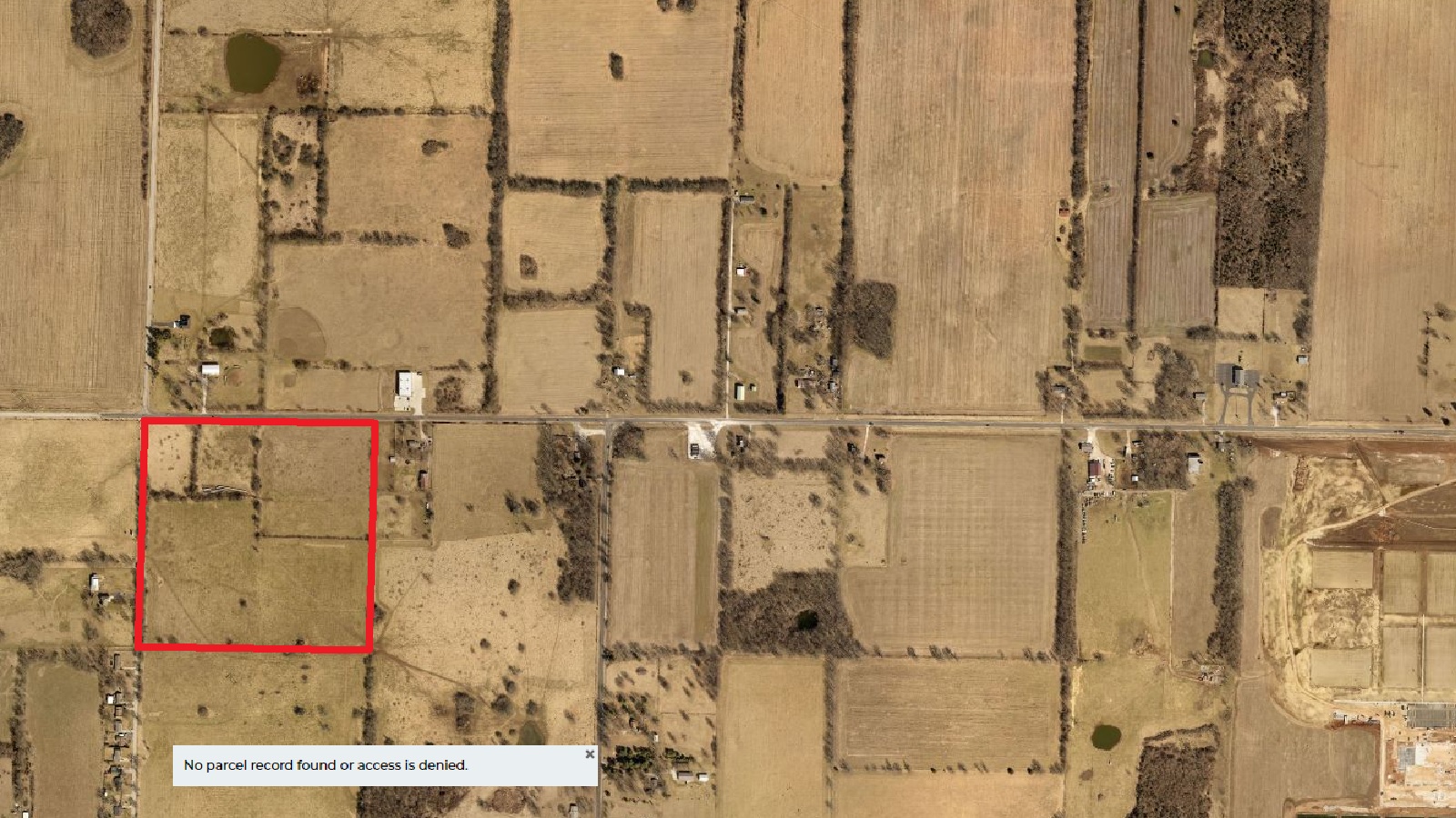
By the way, you're right. For some reason, when I pull up the property you call the “mystery development” on the Greene County Assessor's website, I'm informed, “No parcel record found or access denied.”
Access denied? What's going on here?
Really? Access denied? What's going on? Another Area 51 Roswell, New Mexico?
I went to the Greene County Planning Department on the third floor of the County Building at 940 N. Boonville ready to demand any and all files on Space Aliens.
But they don't have any such files.
It's a 20-acre parcel that will become a self-storage facility. The company is named 66 Self Storage, LLC.
According to Missouri Secretary of State's Office online records, the registered agent is Rita Williams, and the address if 4175 N. Willard Road. That happens to be where the Frisco Trail Mini Storage is at.
I've got bonus info for you, Dalton. The 20-acre parcel was once part of a 40-acre parcel.
The other 20 acres, which borders Farm Road 99, belongs to someone else. It's scheduled to become headquarters to a company called Vroom Solar.
I know little about Vroom Solar, other than it is a Hauxeda partner.
This is Answer Man column No. 44.