
The Springfield metro area has a rich network of trails that are especially bike-friendly for any age or gender. Whether you’re just getting started on a bike or want to shake up your outings, try one of these trail routes next time you’re ready to roll.
Additional trail information and maps can be found at the Ozark Greenways website; you can also keep up with Ozark Greenways on their Facebook page.
Galloway Creek Trail / Sequiota Park / Honor Trail
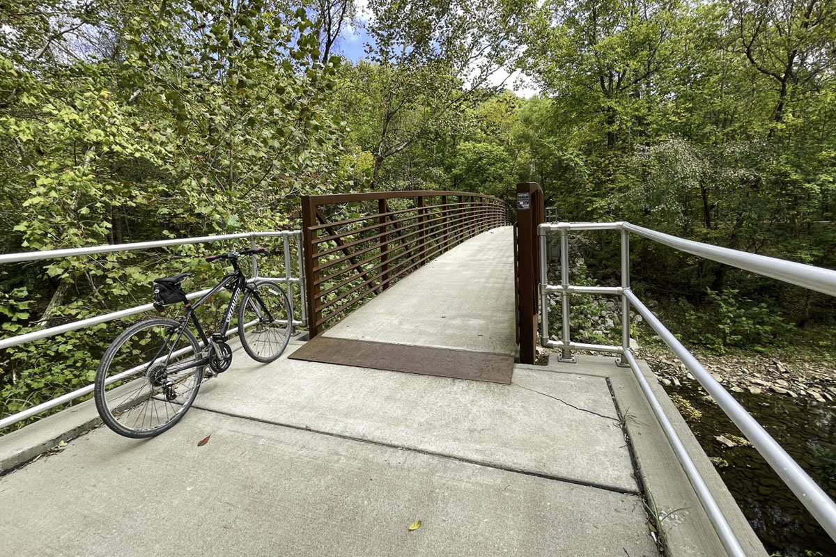
For a versatile ride you can expand — or not — start with the easy Galloway Creek Trail in southeast Springfield, where points of interest include Sequiota Park, Galloway Creek, the Iron Bridge, James River, the Honor Trail sculpture and benches, Missouri Veterans Cemetery and several sculptures along the north end of the trail.
For trail route and tips, click here to expand the story.
For a five- to six-mile jaunt that’s mostly level with a few bits of elevation, start in Sequiota Park (3500 S. Lone Pine Ave.). From here, ride the path south, going through a wooded area of the creek, past The Rock at Quarry Town, past Galloway Grill and curving around the pet cemetery. From here, continue under the James River Highway/U.S. 65 flyover until you reach the Nature Center connector path, a good spot to turn back for a four-mile ride. Or continue as the path curves up a short hill and under the James River Freeway. Keep going up an old road and turn right to reach the James River Iron Bridge — a great spot to rest, take photos and drink water. Turn around and head back to the park.
To extend your ride by roughly three miles (for a total of nine to 10 miles), cross the bridge and take a right onto East Timbercrest Street, heading downhill for half a mile (yes, you’ll have to ride back up!). At the lake’s Southwood Access for kayaks and canoes, continue onto the one-mile out-and-back Trail of Honor (a segment of the James River Trail), which follows the James River arm of the lake within view of the Missouri Veteran’s Cemetery. Prepare to ride a short steep hill up to the old railroad bridge where you can follow the path until it dead ends at the lake. (Tip: If there’s been rain, sometimes the trail is too muddy near the end) Return from here to Sequiota Park.
To make it a 12- to 13-mile ride, when you return to Sequiota, continue north and go to the trailhead at Pershing Middle School, then ride back to Sequiota. Or park near Pershing (2713 E. Seminole St.) to ride all the way out and back. Another parking option is at the Iron Bridge (3398 E. Timbercrest St.) or at the Southwood Access (3000 E. Timbercrest).
For things to do around Galloway Creek and Sequiota Park, read our Galloway Village Neighborhood Guide. Learn more about these trails at the Ozark Greenways website.
South Creek Trail / Nathanael Greene-Close Memorial Park / Wilson’s Creek Trail
Another good ride you can adjust according to skill and time is the South Creek Trail, roughly 12 miles if you do the whole thing out and back. The South Creek Trail can be accessed best by parking at McDaniel Park and riding it west to the end and back, or by parking roughly in the middle at the Springfield Botanical Center and Nathanael Greene-Close Memorial Park. Points of interest include those parks (including a ride by Lake Drummond and the new Thomas Kachel fountain nearby), Carver Middle School and Horton Smith Golf Course.
For trail route and tips, click here to expand the story.
The South Creek Trail connects a mix of nature’s beauty, local neighborhoods and business districts. It’s an excellent trail for hopping on and hopping off when you’re riding east-west across town near Sunset Avenue. And it leads through some beautiful wooded areas near the creek. Parts of the trail may be somewhat challenging for hilly spots, but, for the most part, it’s a well-loved trail used by riders, runners and walkers of all ages. Plus, it connects to the Wilson’s Creek Trail via Battlefield Road.
Many South Creek Trail riders park at the Botanical Center / Nathanael Greene-Close Memorial Park (2400 S. Scenic Ave). From the park, you can ride one way or the other for a shorter trek, roughly five miles out and back riding west (the easier, prettier direction) or seven miles out and back riding east.
Riding west from the park, the trail continues under Scenic Road, around Horton Smith Golf Course and heads southwest toward Carver Middle School. Past Carver, the trail eventually swings left under Battlefield Road and continues into a neighborhood area, ending at South Burlington Avenue. From here — or anyplace along the trail — turn around and return.
If you ride west from the park, you’ll head down a long hill to the fenced inverted-V bridge over Kansas Expressway (prepare for a hill climb!), continue along the daylighted creek on Sunset Avenue, eventually (with a few road connectors) ending at McDaniel Park trailhead (2405 S. National Ave. at Sunset Street). Or start at McDaniel to ride out and back.
You can also ride on paths around the park, stopping to see the Roston Native Butterfly House, Gray/Campbell Farmstead, Mizumoto Japanese Stroll Garden, the fountains near the Botanical Center and many varied gardens.
For a longer or more advanced ride, connect from the South Creek Trail to the Wilson’s Creek Trail: Near the west end of South Creek, a ramp ascends to Battlefield Road. Ride west on Battlefield, crossing West Bypass to Farm Road 123. Turn left and go to Tal’s Trailhead (3233 Farm Road 123). From here you can take Wilson’s Creek Trail north toward Rutledge-Wilson Farm Park (crossing a few pastures where you go in and out of gates). Or if you like to ride hillier terrain, take Wilson’s Creek Trail south. Find a trail map on the Ozark Greenways website.
For things to do near the Springfield Botanical Gardens at Nathanial Greene-Close Memorial Park, read our Neighborhood Guide. Learn more about Ozark Greenway Trails at the Ozark Greenways website.
Fullbright Spring Trail / Lost Hill Park
A really fun ride is possible on the Fullbright Spring Trail now that a section was completed between the David C. Murray Trailhead and Lost Hill Park in north Springfield. Points of interest include a bridge over the South Dry Sac Creek, scenic prairie, an old silo and farm ruins, a natural bridge, creek crossings and Truman Elementary School. You’ll ride nearly 12 miles out and back between Murray and Truman, or shorten your ride a number of ways.
For trail route and tips, click here to expand the story.
This pretty trail has several places to start. One good option for a 12-mile stretch is to park at the David C. Murray Trailhead (4769 N. Farm Road 141) and start riding east. The trail crosses a picturesque bridge over the South Dry Sac Creek and winds through woods to open prairie. It continues from here about two miles into Lost Hill Park, where you can stop to explore or have a picnic near the old silo and farm ruins.
The trail continues through the park, which includes the South Dry Sac Creek. There are several places to explore around the creek including a natural rock arch. The trail continues beyond the park by crossing a low-water bridge (a sign recommends walking, not riding, through the creek). From here the trail continues to Truman Elementary School.
You can do the same ride in reverse by parking at Truman (3850 N. Farm Road 159), or shorten your ride by turning around in Lost Hill Park (4705 N. Farm Road 151).
If you have gravel tires, don’t mind a hill and want to add a mile to your ride, you can also start in Ritter Springs Park. Find a trail map on the Ozark Greenways website.
For things to do around the Fullbright Spring Trail, read our North Central Springfield Neighborhood Guide. Learn more about these trails at the Ozark Greenways website.
Frisco Highline Trail
For a mix of concrete and gravel, head for the Frisco Highline Trail, a 35-mile rail-trail that stretches along an old railroad track from northwest Springfield to Willard, then Walnut Grove and continues all the way to Bolivar. Advanced riders have done the entire trail, but shorter segments make a nice, picturesque ride for any skill level.
For trail route and tips, click here to expand the story.
There’s a simplicity to riding the Frisco that makes it a great trail for anyone to try. It’s also a flexible trail for a variety of bikes. If you only have a road bike, ride the roughly eight-mile paved section between the Springfield Trailhead (3845 W. Kearney St.) to the Willard Trailhead (107 E. Jackson St.) and beyond to where the pavement ends (a 16-mile out-and-back ride). You can shorten that ride to 12 miles by turning around at the Willard Trailhead. Another fun option: Start and end at the Willard Trailhead, then get a meal or refreshments at The Hive nearby.
If you have a gravel bike, ride 19 miles out and back between Willard and the Walnut Grove Trailheads. To shave off five miles, start where the pavement ends in Willard, or turn around anywhere along the trail to make it even shorter.
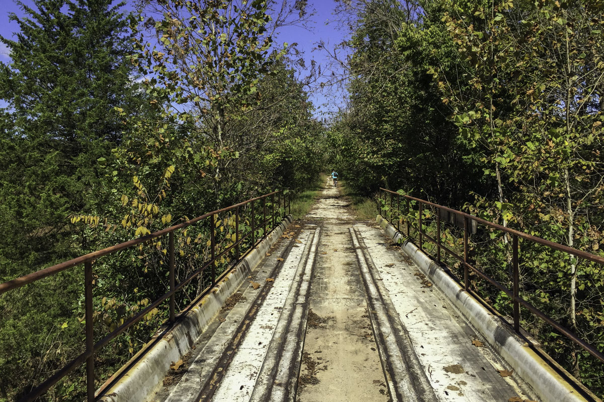
For a beautiful trek 14 miles out and back that’s more like a hike, park and ride from the Walnut Grove Trailhead (11956 State Highway BB) to the Sac River Bridge, seven miles away. You’ll cross four historic railroad bridges before reaching the Sac River. One heads-up: The trail feels flat but it’s actually a 3 percent grade downhill to the bridge, meaning it’s a steady 3 percent grade back to Walnut Grove. Find a trail map on the Ozark Greenways website.
Mountain Bike Trails
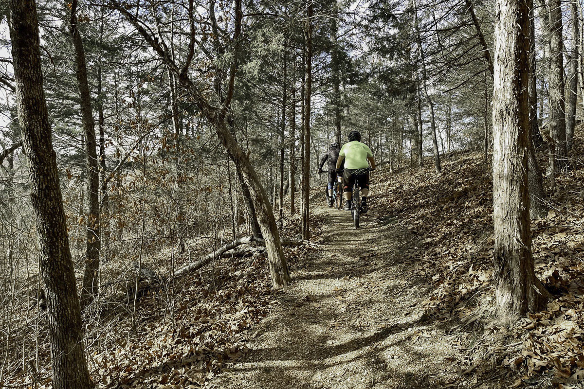
Interest in mountain biking has exploded and Springfield has a growing number of trail options. If you are interested in trying the cycling sport, here are three great local places to go:
Dirt 66 at Fellows Lake: More than 25 miles of interconnected multi-use Dirt 66 trails weave through woods and pastures, luring hikers, bikers and runners. Learn more on the Ozark Greenways website, where you can download a map. (For more things to do near Fellows Lake, check out our Northwest Springfield Neighborhood Guide.)
Sac River Mountain Bike Trails: A 300-acre park with more than 14 miles of interconnecting trails weave through woods in northwest Springfield. It’s recommended to review a map before rolling out. Learn more on the Ozark Greenways website, where you can download a map.
Two Rivers Bike Park: About 30 minutes south of Springfield past Nixa, this popular park was built for mountain biking, but its multi-use trails can also be hiked. Learn more about Two Rivers and find a map from Trailforks. (If you’re interested in hiking, too, read our Two River Bike Park trail guide.)