
Hiking, kayaking, cycling, fishing: Any time spent in nature is time well spent. But if you aren’t up to hiking or it’s too cool to float, you can still get nature therapy by taking a scenic drive.
We love road trips through rolling hills and forested byways with overlooks, side trips and beautiful (yet easy) stops. That goes double when trees are sporting their colorful fall fashions. And there are several great drives in southwest Missouri and northern Arkansas.
So pack a picnic, pull up your map, roll down the windows and play your favorite tunes while exploring a scenic byway from our fall drive guide.
Learn more about fall color foliage and change reports from the Missouri Department of Conservation.
Glade Top National Forest Scenic Byway, Mark Twain Forest
Scenic distance: 23 miles
Starting locations: Just south of Ava or just south of the Hercules Glades Wilderness
Road surface: Gravel
Online: fs.usda.gov
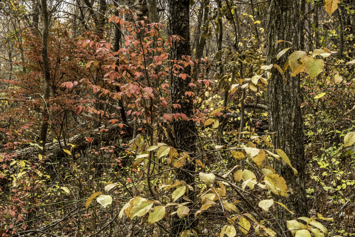
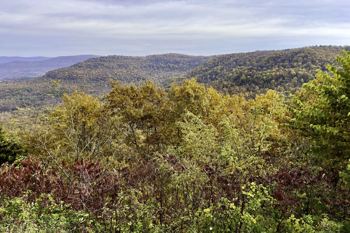
You won’t miss fall color along the Glade Top National Forest Scenic Byway, a beloved gravel drive — also known as Glade Top Trail — less than 90 minutes from Springfield. It’s the only byway in Missouri to go completely through a national forest, in this case the Mark Twain. Rising roughly 500 feet along the route, you’ll find plenty of colorful fall vistas and points of interest.
This scenic byway, about 23 miles total, isn’t a single straight road. You can start at three points, and no matter which you choose, expect crossroads and spurs, so it’s best to plan ahead.
Click here to expand tips & information for the Glade Top Trail
Check out the United States Forest Service website for links describing 10 points of interest and overlooks along the byway. Some are small picnic stops or places for dispersed camping; others are overlooks such as Stop No. 3, Arkansas View, which looks south to the Arkansas’ Boston Mountains. The biggest picnic spot (and the only one with a vault bathroom) is the Caney Picnic Area (Stop No. 5 on the map).
Stop No. 7 is Wolf Junction. About 11.5 miles south of the byway’s northeast entrance near Ava, it’s the junction where Glade Top splits, with one spur going to the west entrance off Missouri 125 (just south of the Hercules Glades Wilderness) and the other spur going southeast to the byway entrance near Longrun at Missouri 95.
Starting in Springfield, it’s about the same drive time to reach the northeast or west entrances. It might make sense to start on the west side if you also hike in Hercules Glades Wilderness — a great way to expand your day out — but the northeast Glade Top Trail section close to Ava has more byway points of interest.
No matter where you start, Glade Top Trail — our guide’s scenic drive closest to Springfield — makes a great day trip out.
Scenic Missouri 19 / Salem to Eminence, Ozark National Scenic Riverways
Scenic distance: 43 miles
Starting location: Salem
Road surface: Pavement; some gravel side trips
Online: nps.gov, salemmo.com, visiteminence.com
The Ozark National Scenic Riverways area is more than a great place to float or fish. It also has beautiful landscapes to explore, especially in the fall. This is the land of natural springs, tall bluffs, trails, scenic views, beloved state parks and wild horse sightings.
The backbone of this area is the scenic Missouri 19, which leads (via multiple side roads) to any adventure you might like. It’s also a beautiful drive for fall leaf-peeping in itself. In fact, there’s so much to see and do through this corridor, we split our Scenic Missouri 19 guide into two parts. This section covers Salem to Eminence. The next section is a multi-road drive with more stops at springs, mills and waterfalls.
Salem is a good place to start your scenic drive to Eminence. It’s about two-and-a-half hours from Springfield via U.S. 60 (our preferred route because it’s prettier), but you can trim 15 minutes off by going up I-44. Or adjust your plans by starting anywhere along the rural highway at a nearby point of interest. We share several potential side trips and pretty stops along this scenic drive.
Click here to expand tips & information for Scenic Missouri 19
If you like quaint shops and dining experiences, spend a bit of time in Salem before you start your drive. Or stop at Montauk State Park before you get to Missouri 19 to see where the Current River begins. Nearby is Bo’s Hollow, an old-timey “village” open May through October that’s a step back in time.
Heading south on Missouri 19 from Salem, a side trip west onto Missouri K leads to Aker’s Ferry or Cedar Grove access points on the Current River. Nearby are trails to Welch Spring and Devil’s Well.
Farther south on Missouri 19, Missouri EE leads to the Pulltite Campground, another wooded side trip to view the Current River. About a mile south of the EE turnoff is the road to Current River State Park, built in the 1930s as a corporate retreat. Find hiking trails, picnic areas, a fishing pond and access to the Current River here.
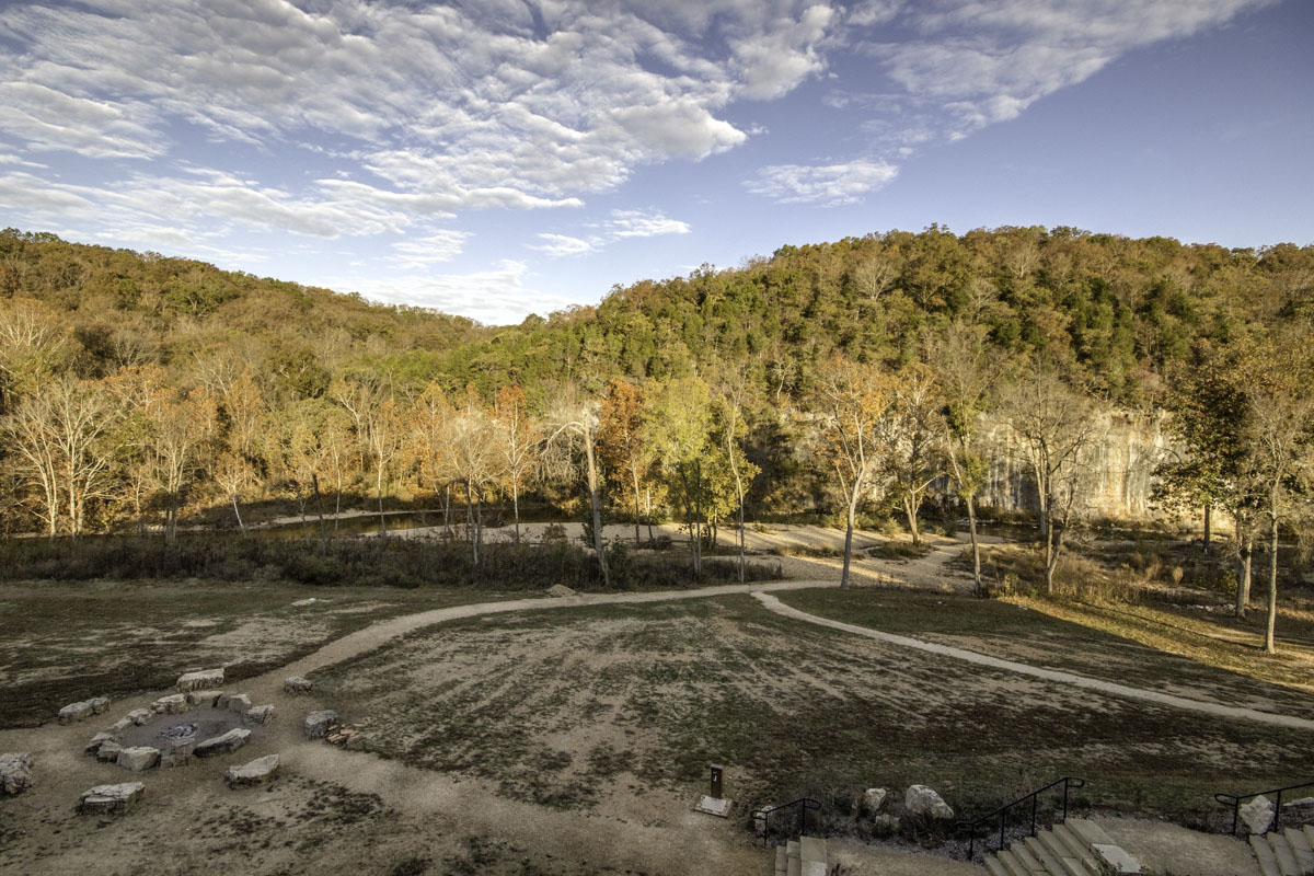
About two miles farther is the entrance to Echo Bluff State Park, one of Missouri’s newer parks famous for its tall bluff, a backdrop to the pretty Sinking Creek. The family-friendly Echo Bluff has accommodations and camping, dining, a park store, picnic and playground areas, and good trails for hiking and biking — plus it’s a known location for spotting the wild horses of Shannon County.
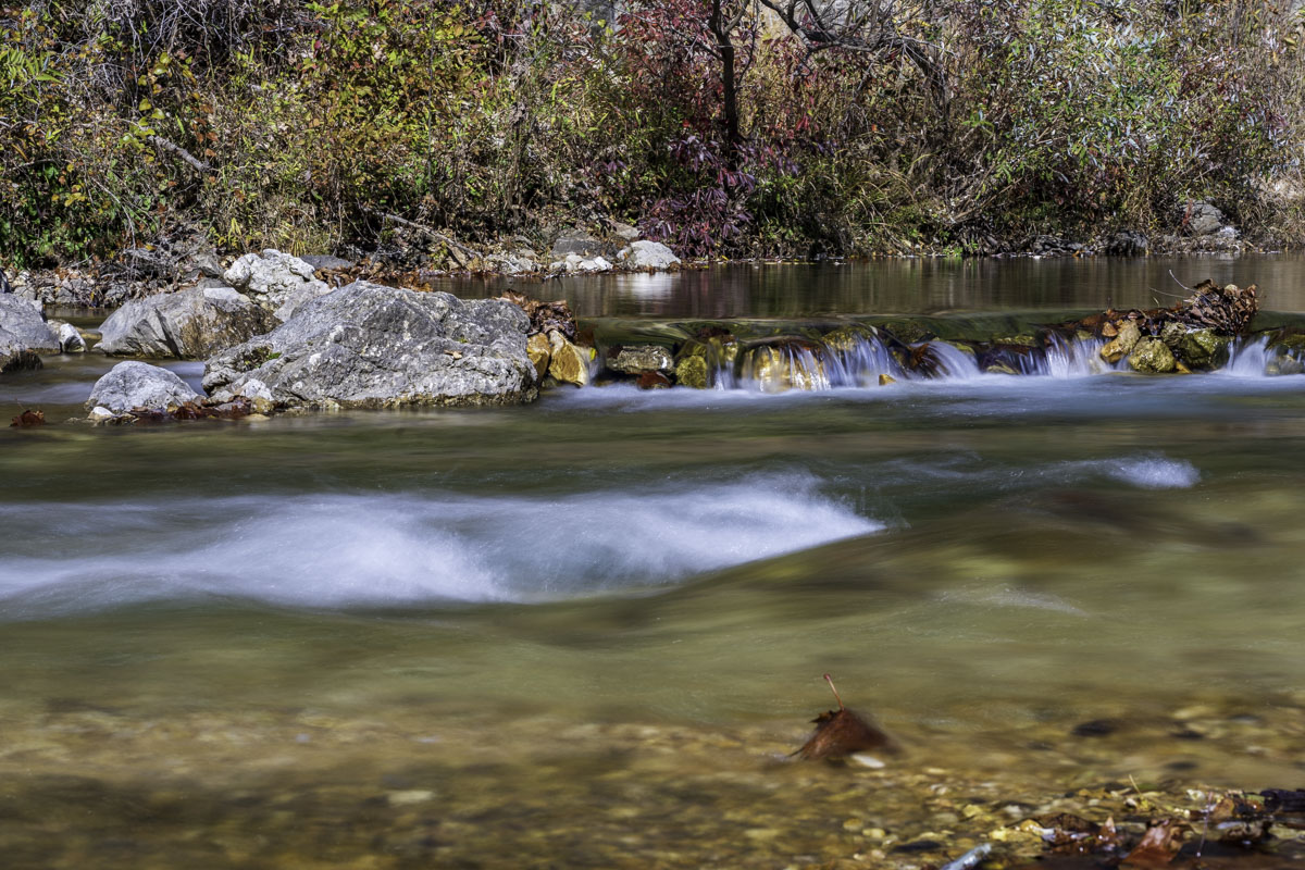
About three miles past Echo Bluff are Round Spring and its campground, managed by the National Park Service. Round Spring is a quick, pretty stop with an easy short trail to view the circular deep blue spring.
The rest of the drive curves through scenic forested areas (stop at an overlook about 10 miles past Round Spring, shortly before reaching Eminence). If you make this drive in October, don’t miss the last month for Dairy Shack, a popular seasonal Eminence ice cream shop. You can even get fried pickles there!
Scenic Missouri 19 / Missouri 106 / Route H triangle, Ozark National Scenic Riverways
Scenic distance: 83 miles (for all stops) or less
Starting location: Alley Spring & Mill
Road surface: Pavement and gravel
Online: Check out our guide to 5 scenic Ozarks wonders
A multi-road route south of Eminence in the Ozark National Scenic Riverways makes a fun adventure to five potential scenic stops, plus one moderate trailhead. If you’re a photographer, this drive is especially for you!
Not only will you enjoy this drive for its rugged fall beauty, but you can also flex this route to include any or (ambitiously) all of our six suggested stops. (Tip: If you stay in the area for a weekend getaway, it’s easy to combine elements from both Scenic Missouri 19 guides.)
This drive includes three primary roads with extraordinary stops. Alley Spring & Mill, Rocky Falls, Klepzig Mill, Blue Spring and Falling Water Spring are described with more detail in this Daily Citizen guide, and a hike in Greer Spring is described in this Daily Citizen guide. You probably won’t have time to see and do all six in one day with shorter daylight hours, but we’ve laid out the drive as if you could. It’s easy to adjust based on what you want to see (or photograph) most.
If you make this route a day trip, we suggest starting at Alley Spring and Mill, a 2.25-hour drive from Springfield. If you’re spending a weekend nearby, start where it makes the most sense for your location.
Click here to expand tips & information for Missouri 19, Missouri 106 and Route H
Alley Spring & Mill is probably the most recognized point of interest and includes the red mill (and museum), a turquoise spring pool, dancing cascades, an easy short trail (with a new bridge to make it even shorter), a historic schoolhouse and picnic areas.
Check this road trip guide to Alley Spring and four other stunning locations for greater detail, but we summarize the route here.
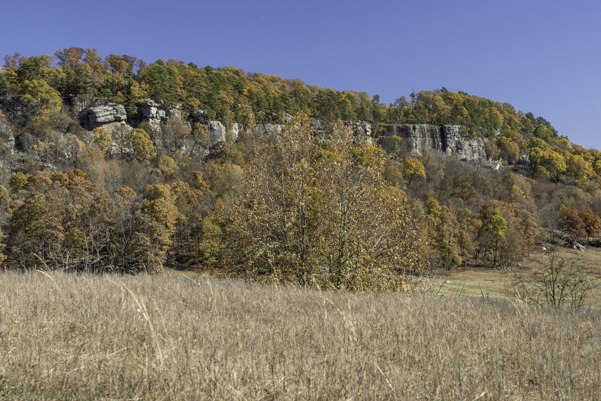
From Alley Spring, drive Missouri 106 to Eminence, your best bet to stop for gas, a snack or a meal. Continue east on 106 to reach the farthest stop, Blue Spring (which includes a steep gravel road and short trail). A Missouri gem, the color of this very blue spring looks almost unreal.
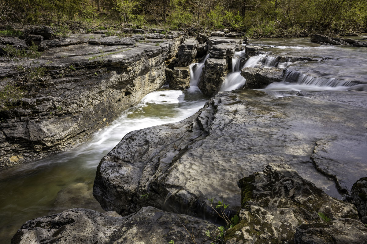
From Blue Spring, backtrack to the Route H intersection and head south to reach Rocky Falls and Klepzig Mill via Route NN (includes gravel roads). Rocky Falls has an easy parking lot and picnic area, and fall is the best time to photograph this tumbling shut-in waterfall. Just up the road, Klepzig Mill is a bit rougher to reach but it’s worth a visit this time of year.
To visit Falling Spring Mill, about 22 miles away, head back to H and go south to Winona, turning west on U.S. 60 for a short drive to reach Missouri 19; then head south. Turn southeast on Forest Road 3170 (a.k.a. County Road 156) to Falling Spring Mill, another easy-to-view old mill, waterfall and spring lake with a picnic area.
It’s 11 miles from Falling Spring to reach the Greer Spring and Greer Spring Mill trailheads on Missouri 19, about one mile south of the Eleven Point River bridge. Both sites require short hikes to reach, which are described in this Daily Citizen guide. Greer Spring is like a fairyland and the wooded trail is lovely in the fall. The mill trail is fairly new.
From Greer Spring, continue south on 19 to Alton or return to your home base. You’ll want to spend time reviewing your incredible photos.
Arkansas Scenic 7 Byway, Ozark National Forest
Scenic distance: Up to a 50-mile stretch (out of 290 total)
Starting location: Just south of Harrison, Arkansas
Road surface: Pavement
Online: arkansas.com
They don’t call Arkansas “The Natural State” for nothing, and driving Arkansas Scenic 7 Byway is a great way to see it. This winding road along bluffs, woods and glades climbs up and around the Ozark Mountains with plenty of easy, beautiful stops to make. In the fall, when leaf color is at its peak, this drive is stunning. Depending on how far you go, Scenic 7 includes the quaint mountain town of Jasper, views of the Buffalo National River, what’s known as the Arkansas Grand Canyon and several side drives.
All told, the Arkansas Scenic 7 Byway is 290 miles long from its northern tip in Diamond City to its southern point at the state border. But for a lovely autumn day trip, we suggest a shorter section that starts south of Harrison, about 80 minutes southeast of Springfield. From Harrison, turn south onto Arkansas 7. From this point, it’s about 50 miles to Pelsor, the farthest you might want to drive for a single day’s outing.
This scenic drive includes many points of interest, sideroad options and even hikes if you want to add one, so you may not make it all the way to Pelsor. But it’s an outing you can easily tailor. We include a few ideas here, and if you need even more for this area, read our Buffalo River guide.
Click here to expand tips & information for Arkansas Scenic 7 Byway
Heading south from Harrison toward Jasper, enjoy head-turning vistas and, if you time it right, peak color. Plan to stop at Pruitt, about 14 miles south of Harrison, for some lovely fall views of the Buffalo National River. After crossing a bridge over the Buffalo River, a short road to your right leads to picnic areas, a bathroom, a trailhead for the Buffalo River Trail and a pretty little riverside path to photo-worthy views of the bluff and bridge.
If you didn’t pack a picnic, stop in Jasper for lunch at the legendary Ozark Café, a tradition since 1909. You can check out the Little Buffalo River here and even do some boutique shopping. Or farther south, stop at the Cliff House Inn and Restaurant for a meal and a great view of the valley, known as the Arkansas Grand Canyon. If you want to add a nearby hike, try the Round Top Mountain Trail, just off Scenic 7 less than 2.5 miles south of Jasper.
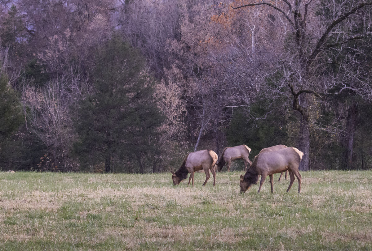
Add a scenic side trip from Arkansas 7. From Jasper to Ponca, take Arkansas 74 and continue into Boxley Valley on Arkansas 43, another gorgeous scenic drive at the Buffalo River (watch for elk!). Arkansas 74 also goes by Horseshoe Canyon Ranch, which is beautiful in the fall. Or if you get all the way to Pelsor, you could add to your trip by turning east onto Arkansas 16 to hike in the Pedestal Rocks Scenic Area trails or go even farther to see Falling Water Falls. If you turn west near Pelsor, Arkansas 123 leads to the stunning Haw Creek Falls Recreation Area.
There are so many ways to enjoy the Arkansas Scenic 7 Byway that you’ll return again and again. (We have!)
Pig Trail Scenic Byway, Ozark National Forest
Scenic distance: 24 miles
Starting location: Brashears, Arkansas
Road surface: Pavement
Online: arkansas.com
Go a little farther south in Arkansas and you’ll squeal with glee (at least to yourself) over colorful fall foliage along the Pig Trail Scenic Byway, one of Arkansas’ most iconic roads. It’s named, some say, for the Arkansas University college students who drive it to games (Arkansas Razorbacks!); others say the name reflects the road’s twists and turns (like a pig’s tail). No matter — it’s a must-drive at least once. But expect two-wheeled company: This byway is a favorite among motorcycle enthusiasts.
The official trail along Arkansas 23 in the Ozark National Forest starts at Brashears, Arkansas, about 2.5 hours from Springfield by the shortest way. But you can extend your pretty fall adventure by taking a route to get there through Eureka Springs. The Pig Trail is 19 miles through the forest between scenic byway signs and 24 miles between Brashears and the town of Ozark.
Click here to expand tips & information for Pig Trail Scenic Byway
Whether you do this drive as a full day out or combine it with a weekend away (for instance at Devil’s Den State Park, an hour west), enhance your fall outing with scenic stops and short waterfall hikes along the byway or nearby.
They include an overlook about six and a half miles south of Brashears. Go another six and a half miles to Turner Bend, a must-stop along your drive. Turner Bend is a little bit of everything: store, deli, river outfitter, campground and lodging. It’s a fun stop to poke around and you can catch a view of the Mulberry River here. There is also a wet-weather waterfall near the store. Not quite two miles south of Turner Bend, Pig Trail Falls can be seen from the road at a bend.
Add a hike by accessing the Ozark Highland Trail at Cherry Bend Recreation Area, about five and a half miles south of Brashears. From here you can also get to the challenging Murray and Senyard Falls trails.For an easier waterfall hike, take a side trip from Cass about 10 miles east on Arkansas 215 to High Bank Twin Falls near the Mulberry River. The rocky .4-mile trail follows a stream to the 71-foot twin bluff seasonal waterfalls. There are more trails and scenic spots to visit in surrounding areas including White Rock Mountain (worth the drive to the top).