
Picture the Ozarks
This story is part of an ongoing series about photo-worthy destinations near Springfield. We call it “Picture the Ozarks.”
HIKING GUIDE |
Imagine waterfalls flowing into waterfalls flowing into even more waterfalls and cascades.
Sound breathtaking? It truly is.
That’s why the short trail in northwest Arkansas to see Paige Falls and Broadwater Hollow Falls — practically a stone’s throw from each other — has become a go-to favorite for target-rich photo ops that don’t take long to reach. For one thing, the Broadwater Hollow creek area is only 95 miles south of Springfield, less than two hours away. And it takes small effort to reach big rewards. For both of those reasons, this trail makes a nice addition to other nearby day trip hikes — or make a day of it!
Not that it’s exactly easy to reach: The turnoff isn’t marked (but we’ll get you there!) and a two-mile downhill gravel road leads to the unmarked trailhead. It’s the very definition of a “hidden gem.”
And it’s worth discovering.
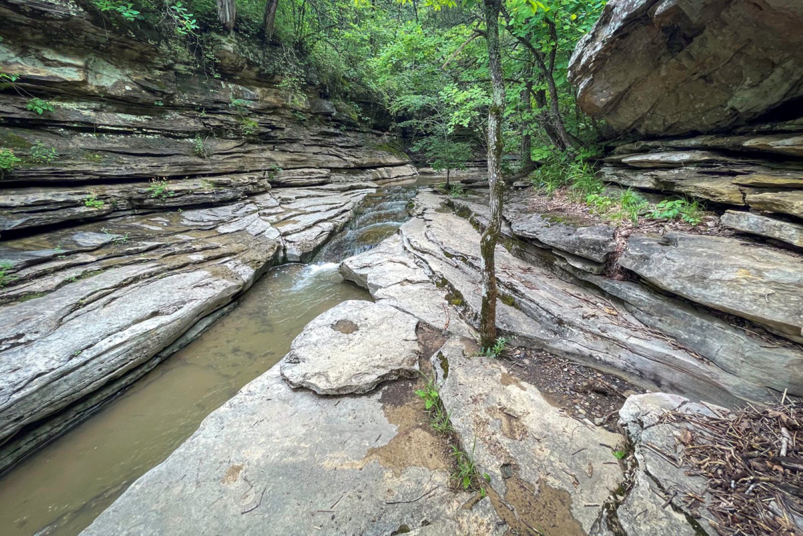
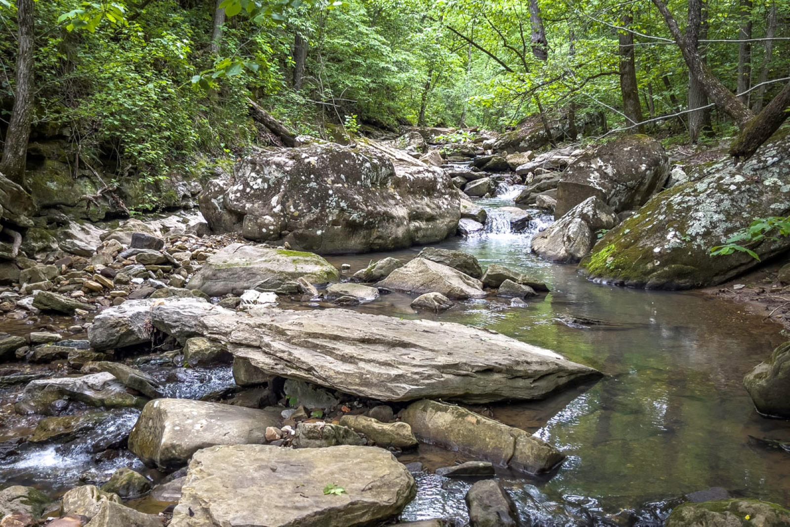
Besides the two primary waterfalls, this scenic creek gorge features interesting rock formations, crevices, bluff overhangs, huge boulders and lots of pretty cascades. In wet seasons, especially spring, you’ll find many small waterfalls too.
What makes this trail even better? It’s incredibly adaptable.
That’s because you can hike a few hundred yards to Paige Falls, continue the trail to Broadwater Hollow Falls about 100 more yards downstream — and return from there. Or, if you don’t mind a bit of bushwhacking and rock-hopping, add to your adventure by exploring off-trail around the falls. I’ve found new spots to see — and photograph — nearly every visit.
And if you have the time and inclination to hike even farther, continue the trail beyond Broadwater Hollow Falls. It continues down the hollow (with a couple of ‘side trail’ photo-worthy stops), passes an old cave and eventually crosses a creek leading to a wonderful campfire circle with stone chairs that make a great lunch stop. Best of all, it’s next to yet another photo-worthy scenic spot with an emerald pool.
Whether you only visit the waterfalls or expand your adventure, this guide shares all you need to know about finding the trail, with insider tips for what to expect and what not to miss.
We guarantee you’ll go home with photos you love on your phone or camera.
Reaching the trailhead
Unlike maintained trail areas such as Lost Valley and Sweden Creek Falls, with designated parking lots and clear signage, the Paige and Broadwater Hollow Falls trail is obvious but unmarked. You just have to know how to find it.
That starts with the two-mile CR 2660, an unobtrusive gravel road off Arkansas 43 — easy to overlook if not for the bright red Compton Fire Station built right across the road from where you turn. (Coming from Springfield, if you reach JB Trading Company, less than a mile farther, you passed the turn-off.)
Getting there from Springfield (click to expand)
Location: Compton, Arkansas, about 17 miles past Harrison off Arkansas 43.
GPS: 36.10526004674426, -93.26501006342859
Distance: About 95 miles south of Springfield
Drive time: About 1.75 hours
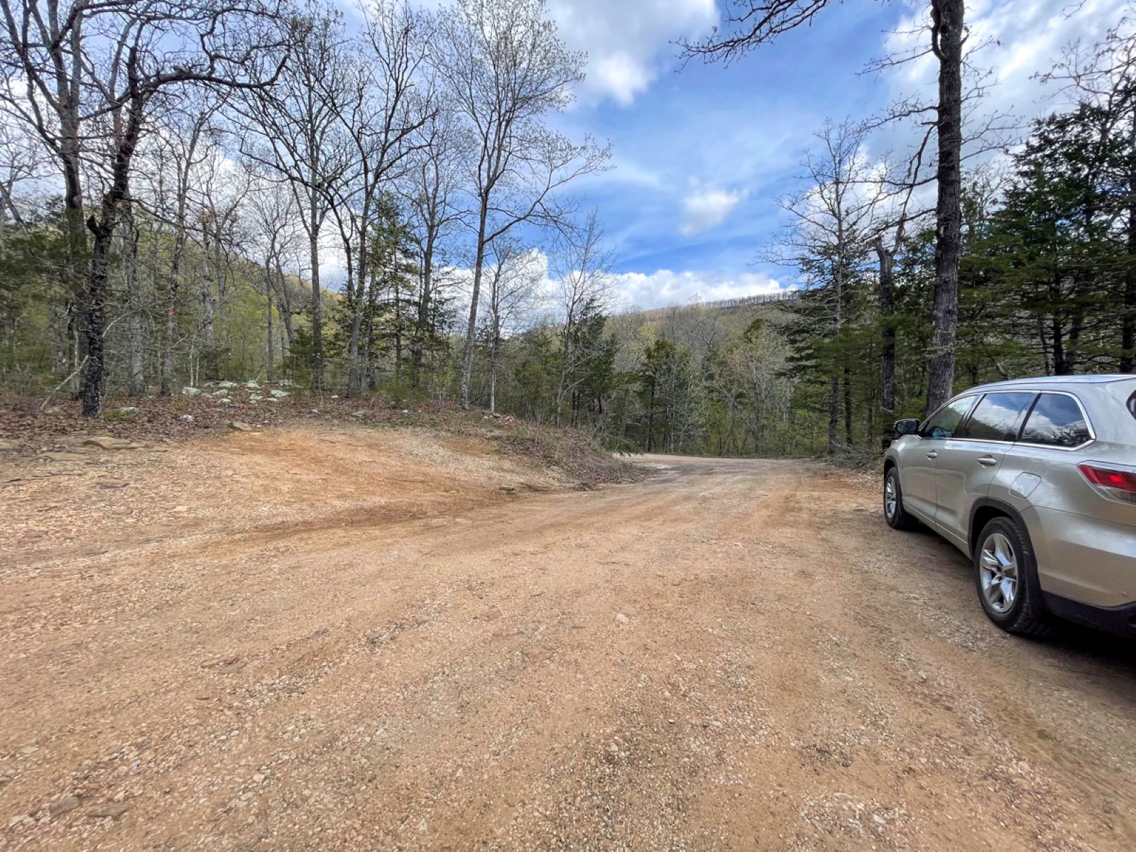
General directions: Head to Harrison, Arkansas, from Springfield and continue on U.S. 65, following GPS to get to Arkansas 43 in Compton. From the highway in Compton, turn east onto NC 2660 (across from the Compton Fire Station, a bright red building) and travel two miles downhill on a gravel road.

Parking: Small gravel pull-off; no facilities
Gravel Road Tip: NC 2660 goes consistently downhill and is somewhat steep in a few places. It’s typically groomed well enough and vehicles driving slow should do fine when it’s dry; however, an AWD or 4WD vehicle may be best if it’s wet. Use your own best judgment about your vehicle’s capability.
Travel Tip: A bathroom, gas, snacks and supplies can be found at JB Trading Company, less than a mile past the NC 2660 turn-off. We always overshoot to stop at JB’s before returning to the turn-off road.
It takes longer to drive down CR 2660 than it does to hike to the first waterfall. The gravel road has been groomed enough on our drives down, but you’ll encounter some steeper, rough spots along the way. Whether you need a four-wheel drive is a matter of opinion and personal choice. (Some reviewers on Alltrails say cars do fine going slow. We’ve never had a problem in our four-wheel drive SUV.)
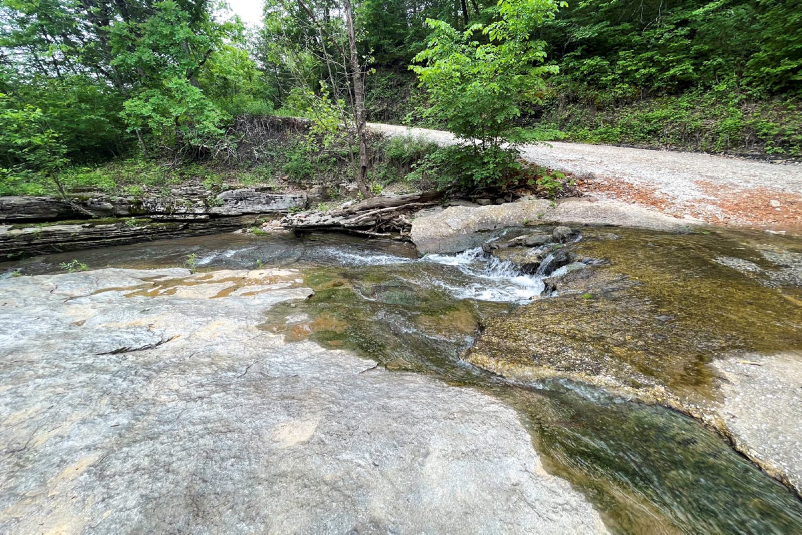
At two miles, the road levels out a bit and you’ll see a couple of widened pull-off areas to park — one on the right side and another, hillier, area on the left. From here, you’ll walk the last short section of the road downhill to a low-water bridge where you can see the narrow trailhead across the pretty creek.
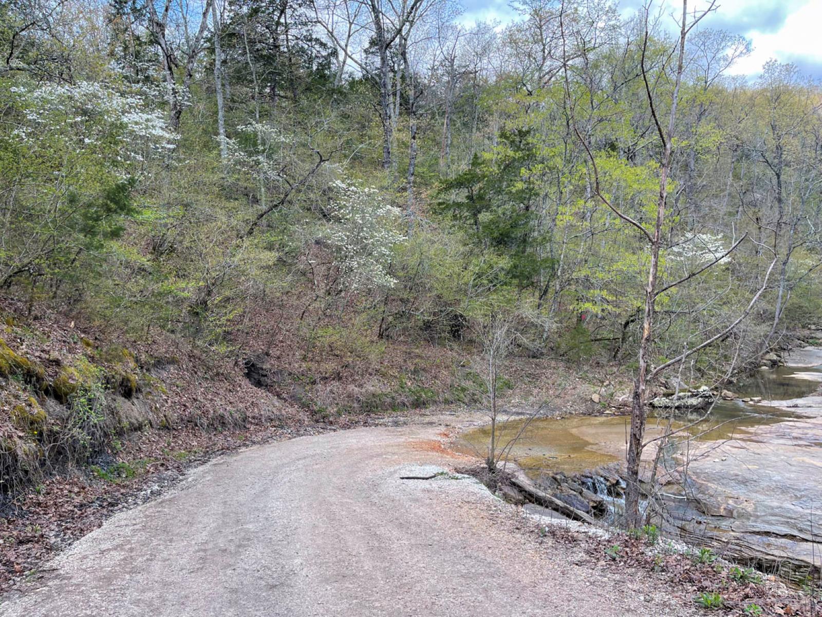
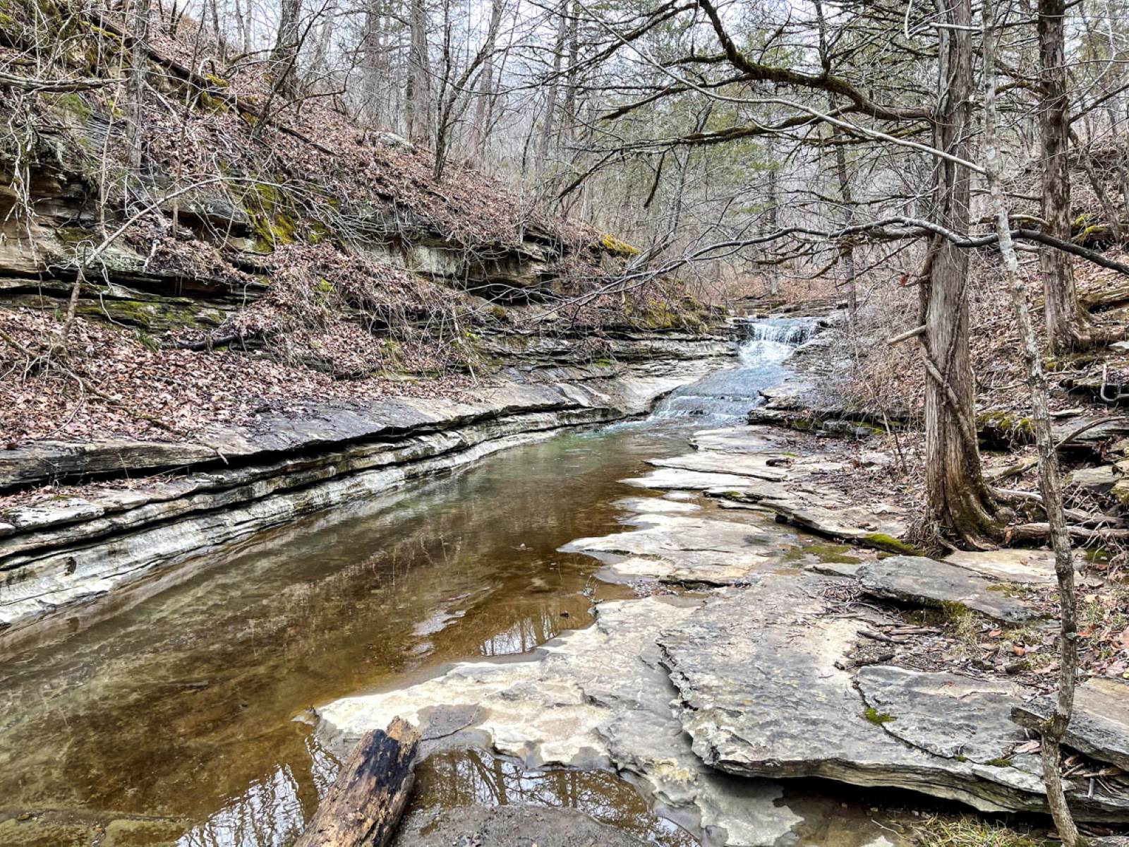
The narrow trail starts across from the low-water bridge and follows the creek. To reach it, cross the water. Usually there are some rocks to hop but you may need to step into the creek — typically shallow over the road — to reach the other side. Watch for potential slick spots, but we’ve always crossed easily. The pretty spillway cascades where the creek crosses the road are the first taste of what’s to come on the trail a few hundred yards away.
Exploring the Hollow
So many northwest Arkansas waterfalls require a long or hilly hike before reaching the visual reward. But the reward is nearly immediate with this waterfall trail, which leads first to Paige Falls and then to Broadwater Falls in less than a quarter mile.
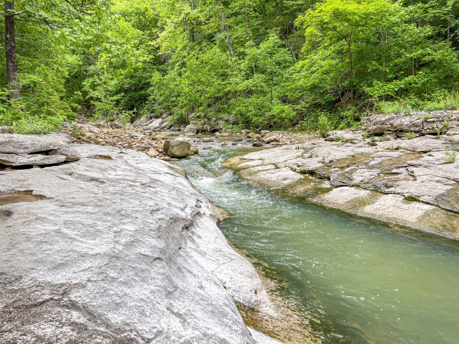
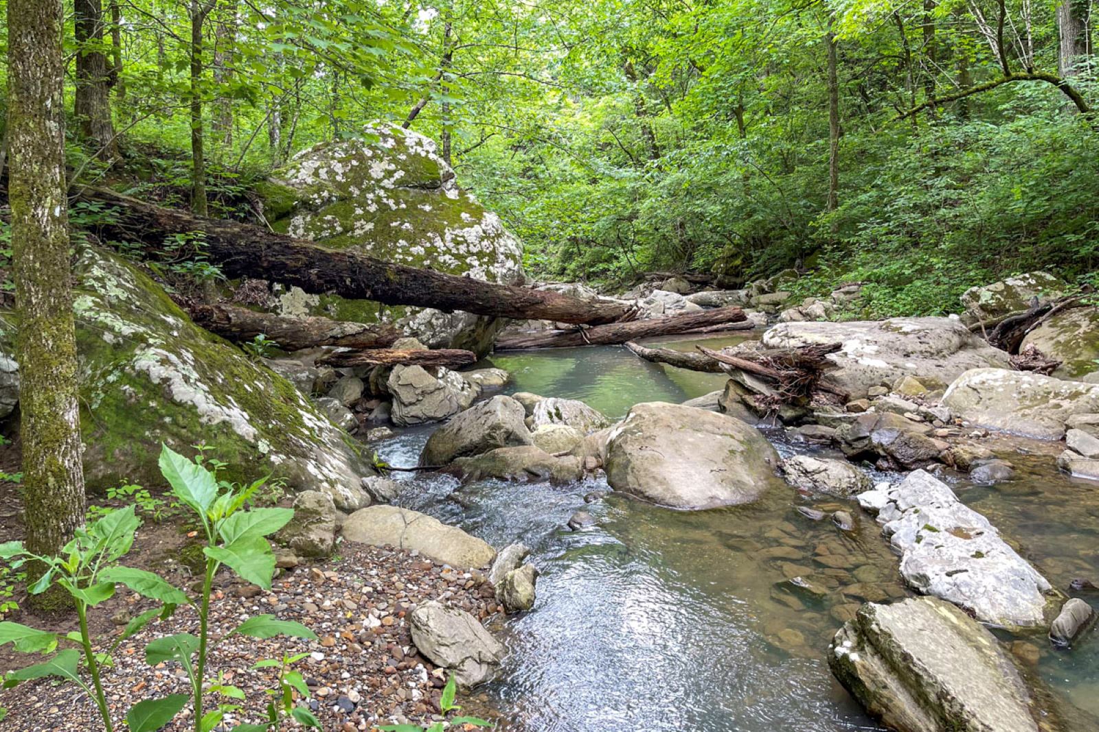
Except you’ll probably go off the trail too. That’s because this adventure is more about exploring than hiking — especially if you like to take photographs. Plus you’ll find much more to see (and photograph) than the primary waterfalls. From the point it crosses the road, the creek starts a cascading journey along a rocky creek bed, tumbling over low shelves, high bluffs and around boulders on its way to Cecil Creek.
That’s what makes this hollow so beautiful, and why — in spite of the short trail distance — I could spend half a day here. It’s what brings me back again and again.
And, bonus, you can expand your adventure because the trail doesn’t end at these two waterfalls. It continues through the creek hollow and eventually connects with Cecil Creek, the Cecil Cove Bench Trail and the Cecil Creek Trail. Plus there’s a spur to Thunder Canyon Falls. But that’s a guide for another day.
Need-to-know details about the trail (click to expand)
Length: The trail to see Paige Falls and Broadwater Falls is less than half a mile out and back; to hike down to Cecil Creek and a nice lunch spot, add another two-thirds of a mile one way, making a total hike of just over a mile and a half. (Do note: The trail past Broadwater Hollow Falls continues downhill so you’ll hike up that hill coming back.)
Level: Easy to moderate
Dogs: No, according to Alltrails
Kid-friendly trail: Generally yes, but watch young ones carefully around the bluff top at Paige Falls; rocks near Broadwater Hollow Falls may be difficult to maneuver for the littlest legs.
Photo-worthy: Pretty cascades start right at the creek that crosses the road and the beginning of the trail. Paige Falls and Broadwater Hollow Falls are worth taking a tripod for slow-shutter photos. And there are more rocky areas, plus a small spring waterfall downstream from Broadwater Hollow Falls. If you continue the trail to the campsite/picnic area on Cecil Creek, there’s a pretty emerald pool nearby. Plus there are lots of large rock formations and giant boulders. Tip: To see the waterfalls flowing, this hike is best done in spring, fall and after winter rains; however even dry, the rocky trail area is still worth seeing.
Cautions: Some high bluff areas; wet-season slippery rocks and mud; rocky, rooted narrow trail; at least one creek crossing to reach the trail; trekking sticks are useful
More information: alltrails.com
Nearby: Smith Creek Preserve; Lost Valley Trail; Boxley Valley Historic District and Buffalo National River
Not far: Hawksbill Crag /Whitaker Point Trail; Glory Hole Waterfall Trail; Magnolia Falls Trail
Reminder: Bugs, snakes, ticks, wildlife, cliffs, and other hazards may be encountered in any wilderness area. While outdoor areas in this series are recommended from the firsthand experiences of an average-ability hiker, readers must determine their own abilities and hike at their own discretion.
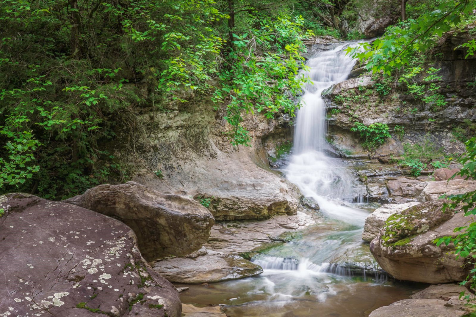
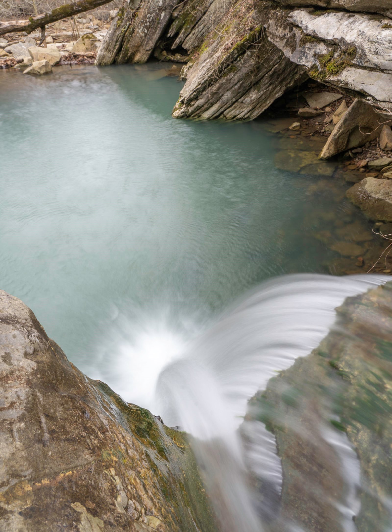
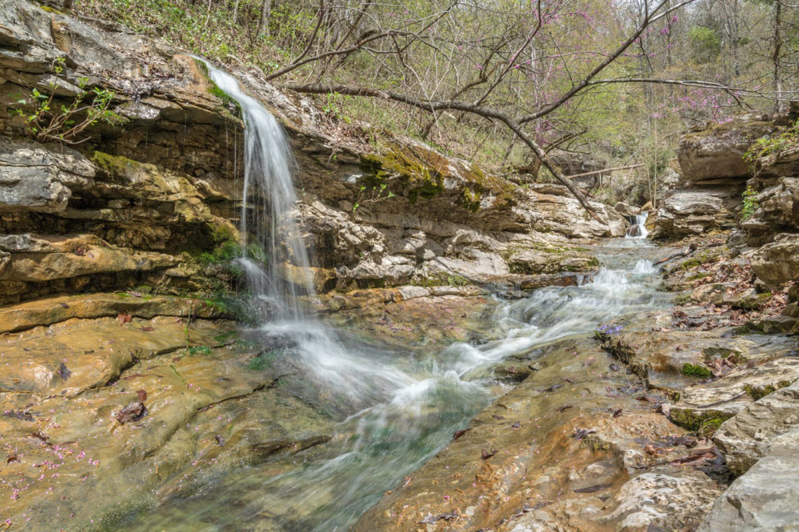
Paige Falls
Just after starting the trail, pretty cascades and a small unnamed waterfall foreshadow what’s to come. (Tip: The small waterfall can be reached later by walking back up the creek bank.)
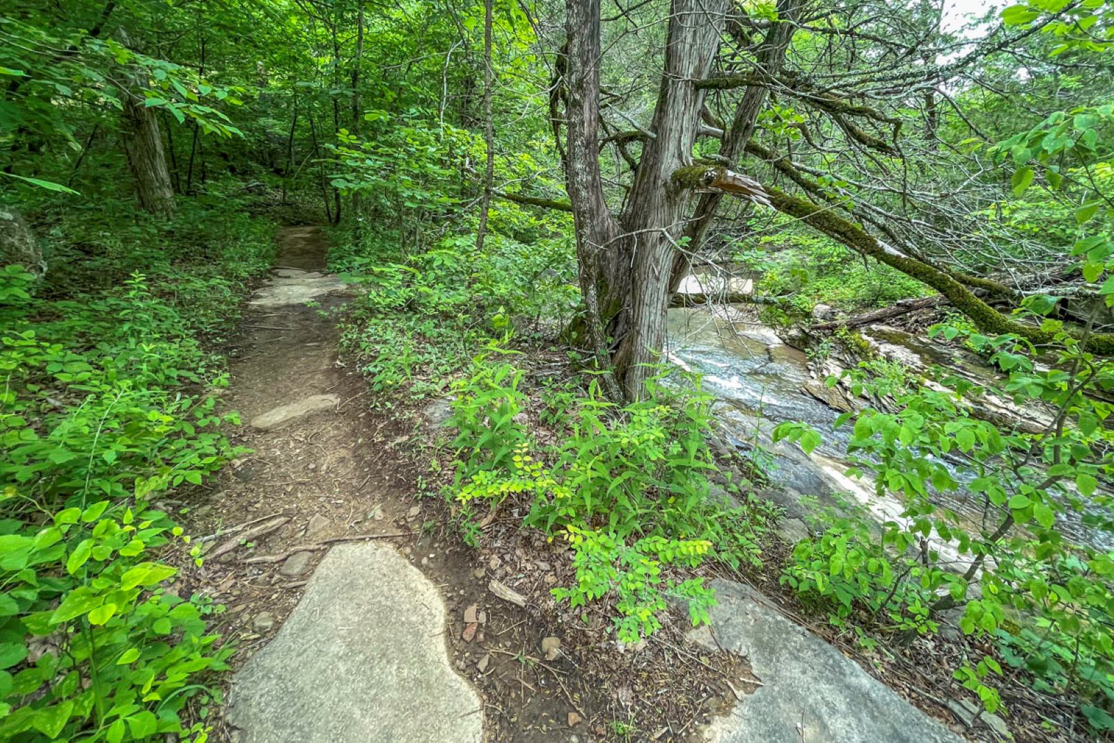
The trail is narrow and mostly level as it follows the creek into the hollow and leads first to Paige Falls. The nearby creek flows merrily over a rock bed as it curves into a small pretty v-slot and eventual waterfall.
Using the trail, hikers can get to the top of Paige Falls and then to its base.
Shortly after starting the trail, hikers reach two huge boulders on the left with a crevice opening between them. You have three options here: go through the crevice to the other side for an elevated bluff-top view looking down at the top of Paige Falls; go left around the boulders which reach the same spot; or do as we do and pick your way over a rocky, sometimes muddy spot in front of the boulders to reach the stream bed.
After picking our way to the creek, we love this spot for the view from the top of the falls and of the scenic creek as it tumbles down the solid v-slot and over the edge as Paige Falls.
From the v-slot at the top of Paige Falls, you can walk back upstream to see and photograph the small waterfall you passed. Or scramble up the short, steep bank next to the v-slot for that elevated bluff-top view of the falls and pool. Another option is to go back to the boulders and around their left side, or to go through the crevice between them. (Note: On our last visit, a tree had fallen into the crevice, which could make it more difficult.)
After enjoying an elevated view of the top of Paige Falls, start following the trail past the boulders toward the hollow. Eventually you’ll pause at a spot where you can view the waterfall and its pool from afar, or even better, scramble down to its base. (This scramble is somewhat steep so trekking sticks are helpful.)
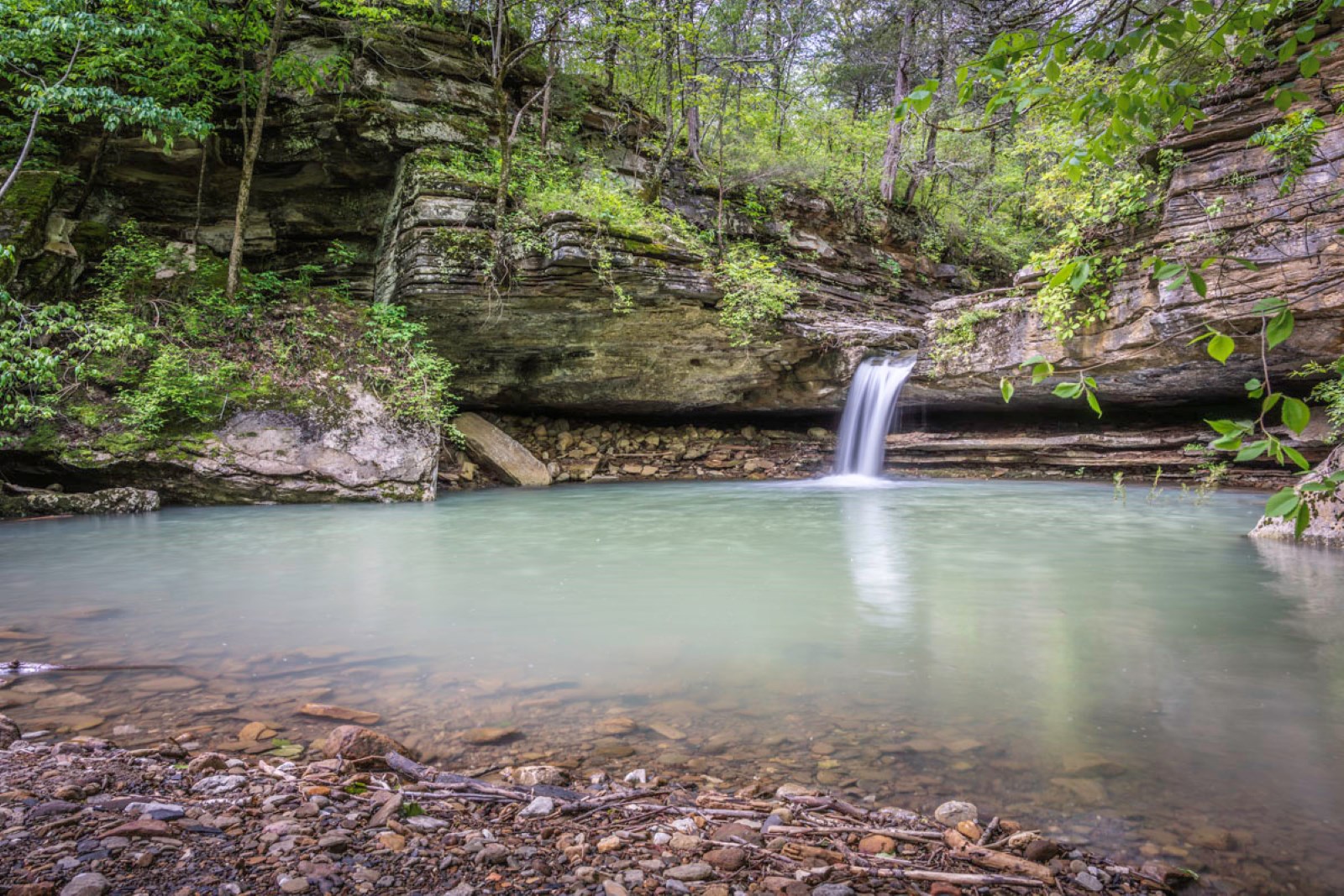
This gravel beach is the best view — and photo spot — for Paige Falls, one of the prettiest natural scenes in the Buffalo River area.
Turn around to see where the creek continues flowing beyond your view. Broadwater Hollow Falls is about 100 yards downstream from Paige. Scramble back up to the trail and follow it to the next waterfall. (Tip: If you like to explore, it’s possible to bushwhack past Paige Falls to the rocky area above Broadwater Hollow Falls. Use your best judgment if there have been recent rains.)
Broadwater Hollow Falls
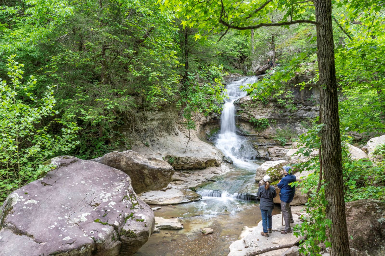
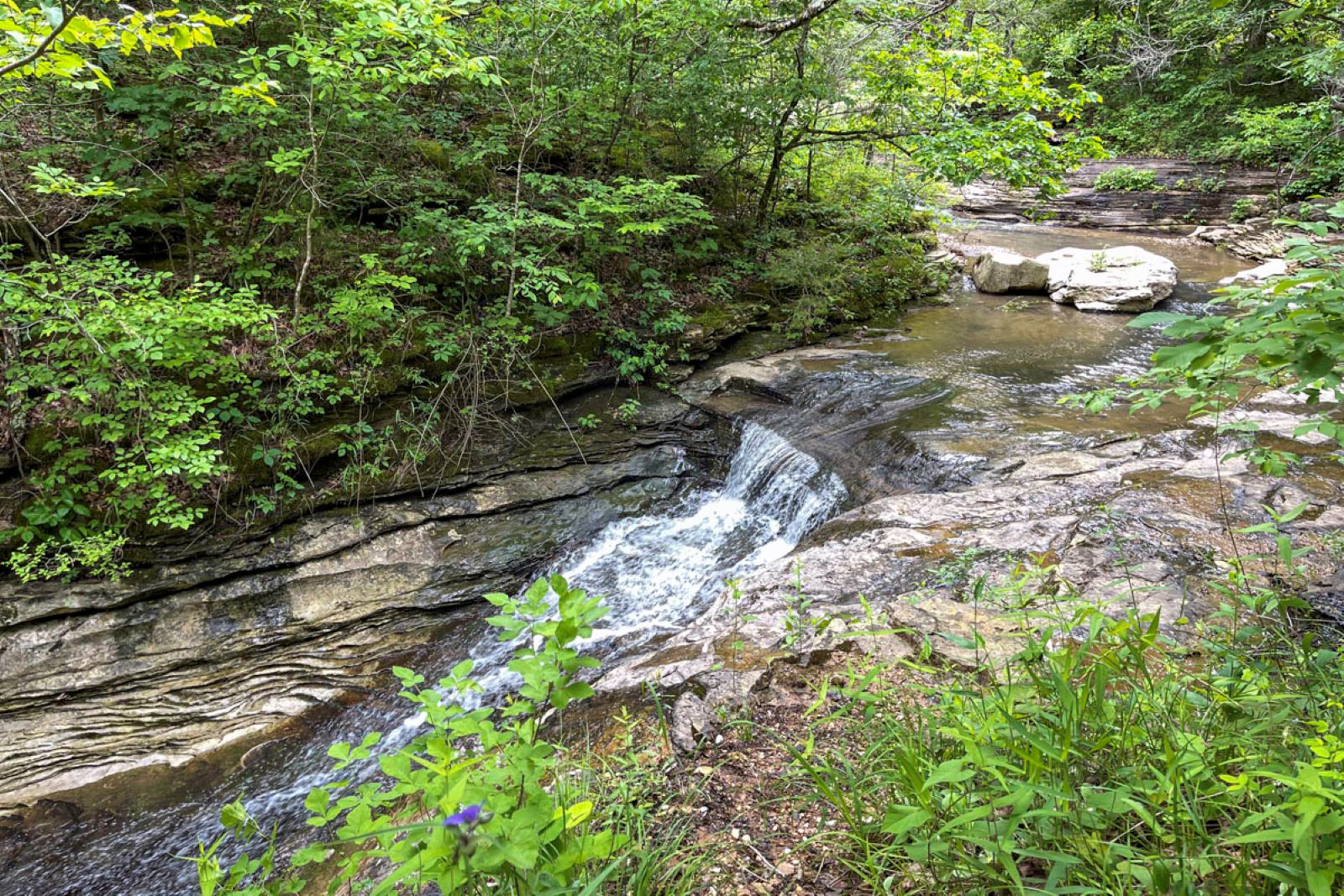
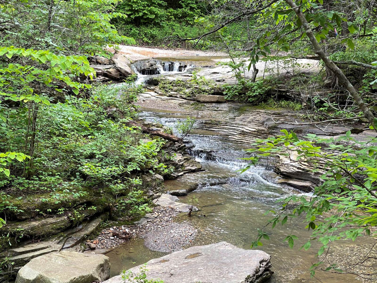
Once back on the trail, continue following it into the hollow. Expect the trail to dip down in a few steeper spots. Listen closely: You may hear Broadwater Hollow Falls before you see it. This waterfall tumbles down a rocky stair-step surface, then flows and cascades from there around a maze of boulders and fallen rocks. It’s a beautiful setting.
You can enjoy views of the waterfall from the trail. But if you’re capable, pick a spot to scramble down so you can explore up close. Plus it’s a great spot for lunch, snacks — and taking photos!
If you like taking photos, either with a camera or phone, here are some of my favorite spots to scramble around:
- Make your way down to a set of boulders close to the base of the waterfall. This makes a good close-up shot, and if there have been recent rains, you might see a second smaller waterfall to the right of Broadwater Hollow Falls.
- Pick your way along the rocky creek bed for a longer view of the waterfall. I also photograph it from the hilly bank for a broader view.
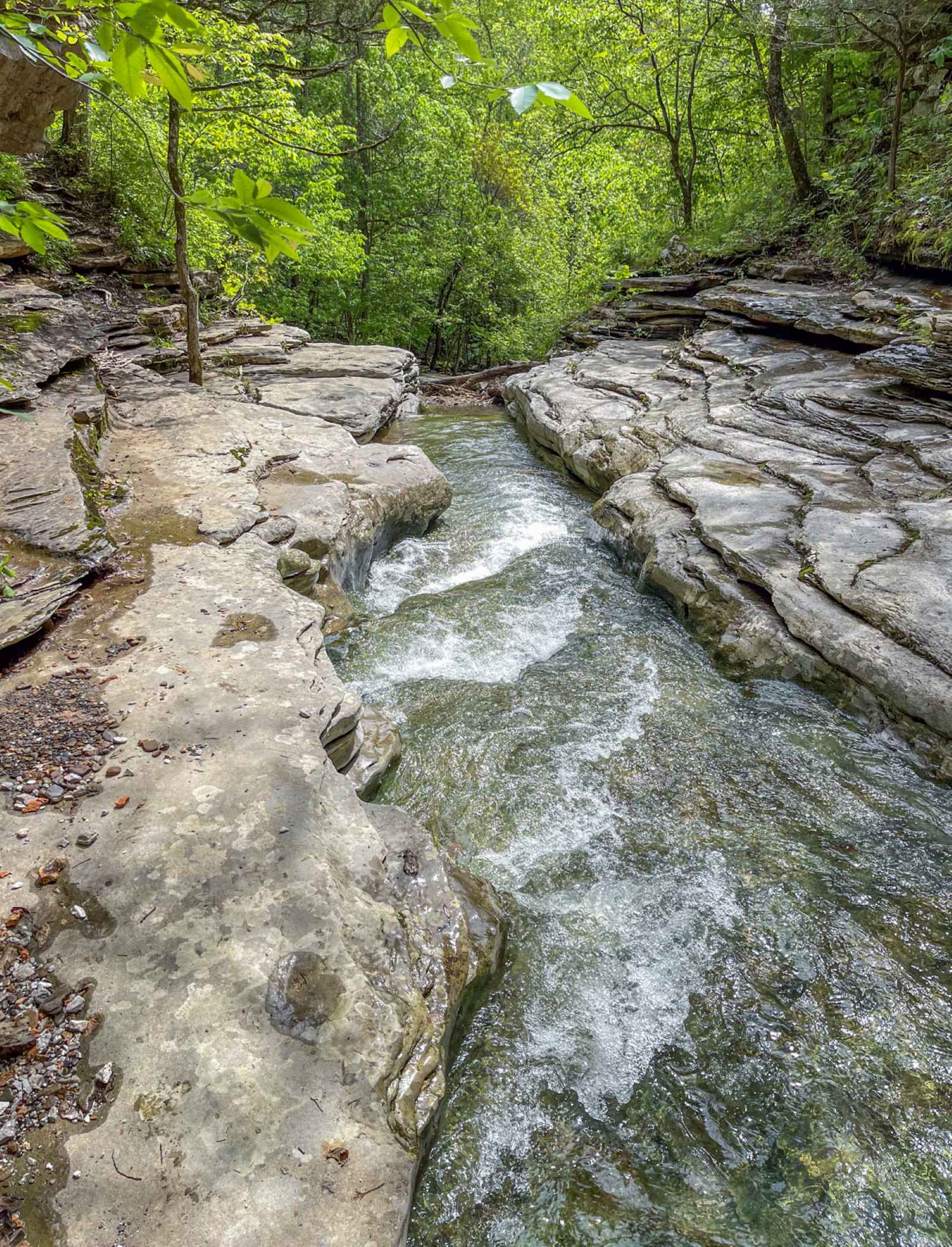
- Make your way downstream as you explore boulders and flat rock areas. You’ll likely reach a pool spot that requires going back up and around the bank to reach the other side of this rocky area.
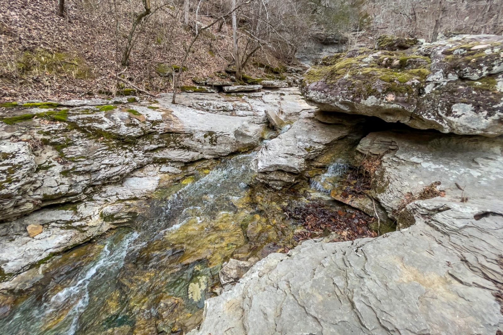
- A bit downstream from the waterfall but within view, there are two giant boulders. The creek flows around the first boulder and into a v-slot against the opposite bank. Just downstream, look for a small spring waterfall flowing into the creek.
- To see the spring waterfall from another angle, work your way back to the trail and hike it down a bit. Then cut back on a short volunteer trail to the boulder’s other side.
Once you’ve enjoyed the Broadwater Hollow Falls area, return to the trail and retrace your steps to the car.
Or continue down the trail.
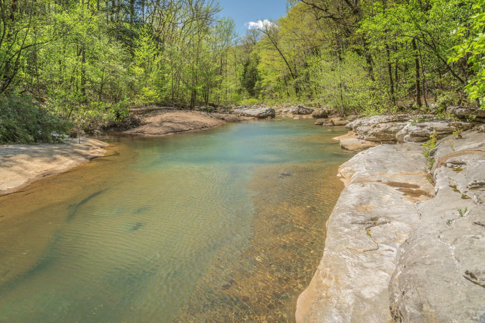
Cecil Creek campfire circle and natural pool
While we most often stick to exploring — and photographing — Paige and Broadwater Hollow Falls, sometimes we add to our day’s adventure by continuing the trail down into the hollow, cutting over to a well-loved campsite and pretty emerald pool on Cecil Creek. Altogether this makes your hike roughly 1.6 miles out and back.
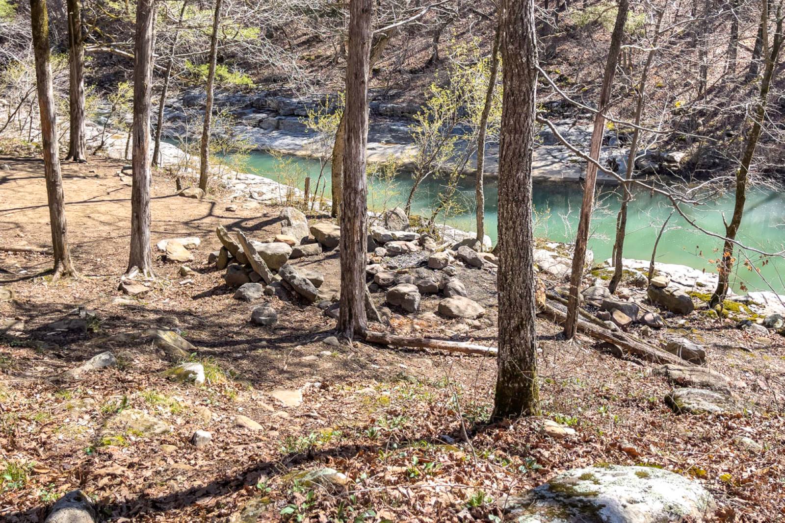
You can’t miss the campsite with its delightful campfire circle that features rock-constructed lounge chairs. You have to see it to appreciate the effort and workmanship. They are surprisingly comfortable, too — and make another great spot for lunch or a snack.
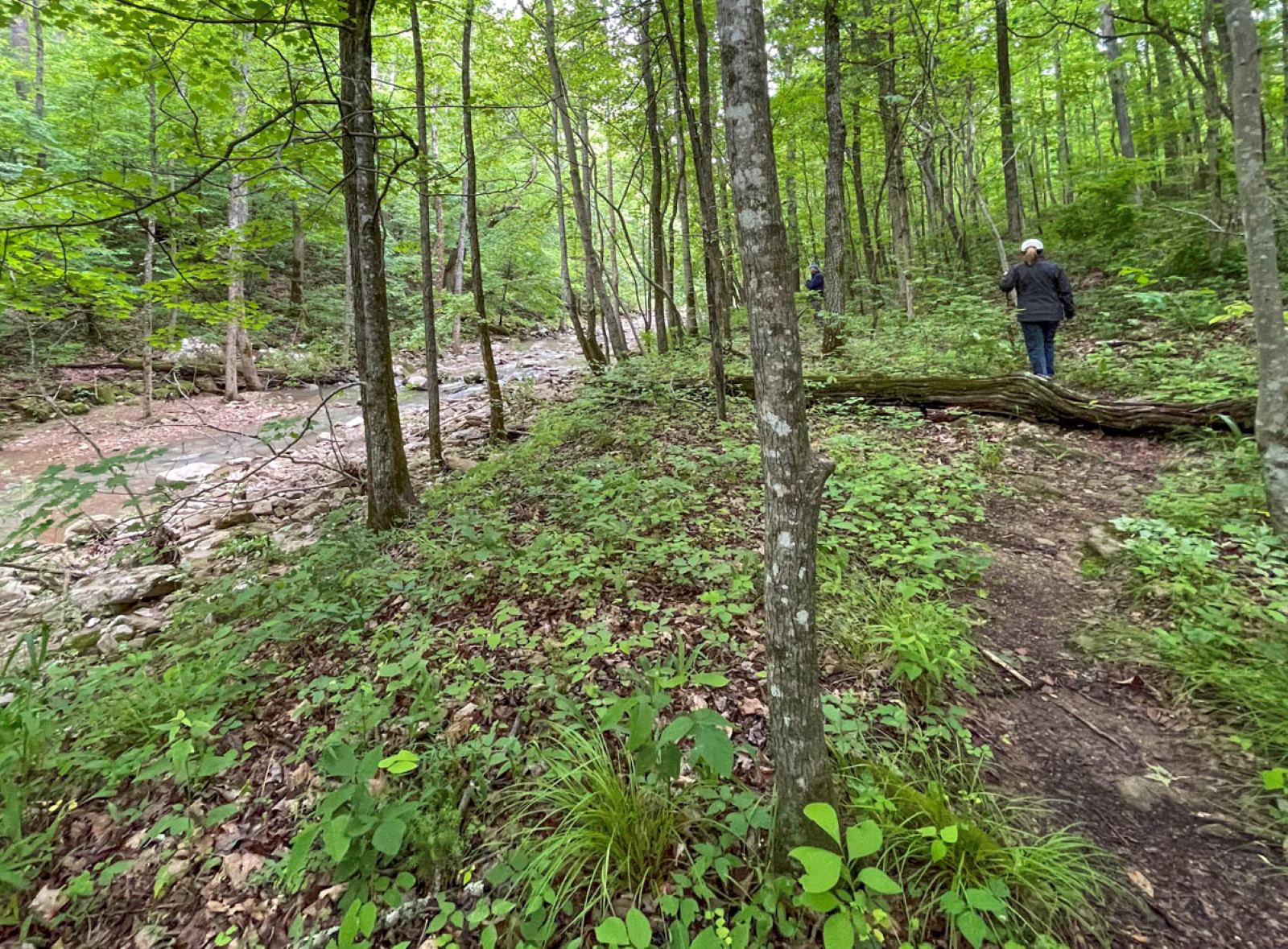
To get there after leaving Broadwater Hollow Falls, follow the trail down into the hollow. The creek will remain to your right. There are a couple of spots to take side trails down for views or photos. The trail also rises to a ridge above the creek in sections.
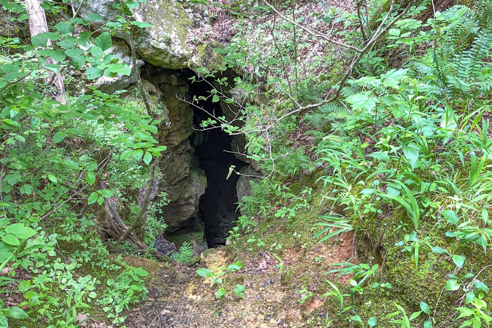
Before long, you’ll pass Devil’s Den Cave, a deep dark hole in the ground about a third of a mile from the trailhead. Signage says it’s off limits and a large thick log acts as a barrier.
If you hike the trail in the spring, enjoy wildflowers, mossy rocks and pretty foliage along the way.
The trail makes its way downhill to the base of the hollow, eventually leveling out close to the creek again. Start watching for a spot to cross the small creek that’s currently on your right. You’ll reach it about three-quarter of a mile from the start of the trail. The spot is a bit elusive and difficult to describe, but it’s roughly at the point where the trail comes close to the rock-strewn creek before it starts heading a bit uphill to the left, away from the creek bed.
Crossing the creek means turning right (or south) from the path you’ve been following. Depending on water levels the creek may be dry; if it’s not, look for a place to rock-hop. Once across, find a lightly traveled trail that continues south about one-tenth of a mile. You’ll start to see Cecil Creek on your left and soon arrive at the fire pit and rock chairs.
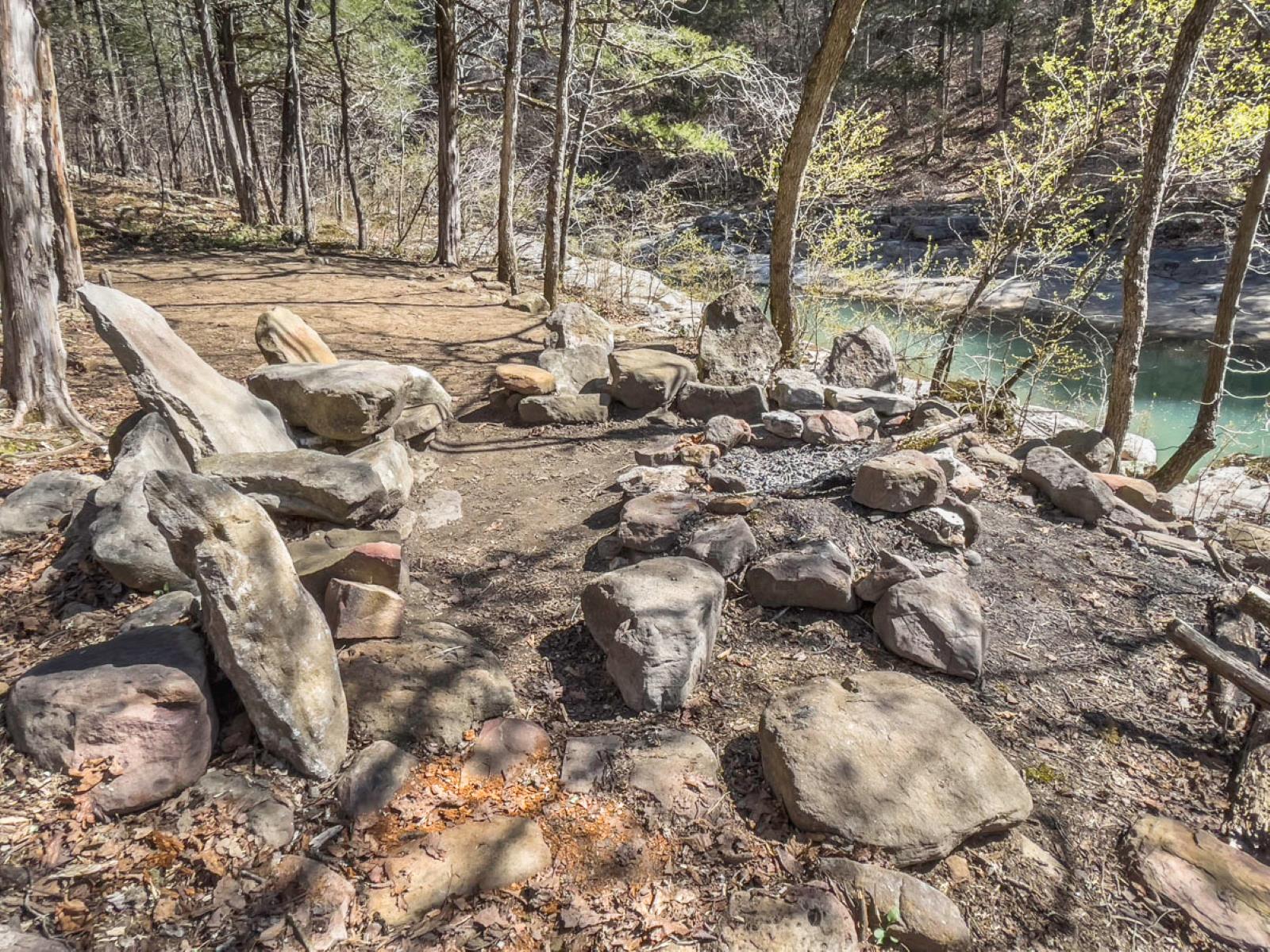
The nearby creek makes a beautiful, photogenic backdrop.
From here, retrace your steps back up the trail, enjoying a second look at the waterfalls before you head back to your car.
Bonus Overlook Trail
Recently we discovered a short, sweet lightly traveled trail that leads from the parking area’s east side to a bluff that overlooks the Paige Falls and pool. About a 5-minute walk, it’s a nice bonus trek before or after your primary hike.