If you’re new to Springfield — or have been in the Queen City for a while — you’ll find plenty of places close by to get out and enjoy the outdoors.
Many forward-thinking people and organizations have built a great network of hiking trails, bike paths, nature areas and fishing spots that are all just a short drive away. When indoors gets to be too much, it’s good to remember there are many easy trails in Springfield.
If you’re looking for a place to go, here are a few at the top of my list.
MAP TIP: Hover over the tree markers to learn more about each spot.
Fellows Lake
Located just six miles north of town, Fellows Lake has been a quiet recreation spot since it was built in the mid-1950s.
But the lake, a key source of water for a thirsty Springfield, has become a recreation hot spot thanks to a new network of mountain biking trails that will eventually surround the 820-acre lake. You can bike or hike the single-track trails that hug the shoreline or take you through dense forest. All are marked by direction posts, so it’s hard to get lost.
If biking isn’t your thing, Ozark Greenways many years ago established a 2.5-mile nature trail through the forest, with trailheads at the main Fellows Lake entrance on Farm Road 66 and near the floating fishing dock on the east end of the lake. Free parking and restrooms are at both trailheads.
The trail is not paved and often rocky — wear good hiking shoes or boots — and keep an eye out for deer, wild turkeys, bald eagles and the occasional osprey. You’ll never see them, but the chewed trees along the shoreline reveal that beavers are close by.
It’s a 5-mile out-and-back experience, with a few steep hills to navigate. You’ll get a workout so bring plenty of water.
Fellows Lake is perhaps best known for its excellent fishing and boating opportunities so close to Springfield. The lake is stocked with muskellunge — a toothy predator that can grow to 50 inches or more — and is one of the farthest south lakes in the country where muskies can be fished. Bass, walleye, catfish and crappie are plentiful, and the Missouri Department of Conservation has created sunken-tree fish habitats, most with shoreline markers locating great fishing spots.
Another draw: The brand new marina.
After floating in one spot for more than 50 years, the old marina was far past its prime. So City Utilities, which owns and manages the lake, replaced the aging structure with a new one in 2020.
The marina is operated by the Watershed Committee of the Ozarks, which rents boats, canoes and kayaks and manages the marina store where annual boating stickers (required by CU) can be purchased. A paved ramp gives boaters easy access to the lake.
Coming next spring: Sailing lessons offered by marina staff.
Getting there: The main entrance is on the north side of the lake, at 4208 East Farm Road 66, Springfield. The lake and trails are open from sunrise to sunset.
Lost Hill Park
Your dog will love you if you take him or her (on a leash) to Lost Hill Park. Established by the Springfield-Greene County Park Board in 2010, Lost Hill just north of Springfield offers several miles of wide, paved trails and big open grassy areas that are ideal for giving you and your favorite pooch some exercise.
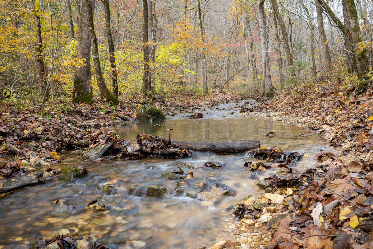
Two concrete creek crossings can be a little treacherous if water from the South Dry Sac Creek has been flowing over them. The crossings can be very slick with algae, so watch your step. Lost Hill Park got its name when the creek that flowed around the north side of a prominent hill slowly changed course. It now flows along the south side of the hill.
Watch for small caves (don’t go in them because protected bats might be there) and enjoy the clear stream where crayfish and Kingfisher birds play. Barred owls and bald eagles are also frequent visitors. When the creek is dry or barely flowing, a section near the highway bridge offers unusual creek bed rock formations that have been deeply cut and scoured by the force of water over many centuries.
The trail extends to Truman Elementary School to the east and connects with the Fulbright Spring Greenway trail if you want even more mileage.
Getting there: Lost Hill Park is at 4705 North Farm Road 151, Springfield. Travel north on Grant past Hillcrest High School where Grant becomes Farm Road 151. The park is open sunrise to sunset and has restroom facilities near the parking lot.
Sequiota Park
Located in southeast Springfield, the 28-acre Sequiota Park is a fun place to have a picnic, let your kids frolic on playground equipment, watch ducks and geese at the small pond and get some exercise on the paved Galloway Creek Greenway trail. The more adventurous can follow a rough, natural trail around the east edge of the pond.
It’s one of Springfield’s most popular parks and is a great place to people-watch while getting some fresh air. A small creek flows out of Sequiota cave, which is closed to the public because of the presence of bats. However, the park board occasionally offers canoe trips into the cave when bats aren’t there. During summer evenings, Sequiota cave comes alive when hundreds of bats stream out on their way to a nightly insect-feeding frenzy.
It’s an inspiring sight and a reminder that nature is indeed alive and thriving within the city limits of Springfield.
Getting there: Sequiota Park is at 3500 South Lone Pine, Springfield, and is open sunrise to sunset. Restrooms are available at the parking lot.
Lake Springfield trails
They’ve been around for years, but many in Springfield don’t know about the good variety of hiking trails on the north side of Lake Springfield. You don’t have to travel far to give your boots or hiking shoes a workout when these three trails are just a short drive from anywhere in town.
The 1.4-mile Lake Springfield Park Trail, a wood-chip path that traverses rolling hills north of the lake, is a family-friendly trail that even younger hikers can handle. Its east end offers a fairly steep but short climb through rocky terrain before turning west through a forested area where white-tailed deer can often be seen among the trees.
Looking for something a little more daring? The Greater Ozarks Audubon Trail takes hikers along the high bluffs overlooking Lake Springfield. One rocky vantage point gives hikers a great view of the lake to the east, where white pelicans, Canada geese, ospreys and bald eagles can often be seen overhead or plying the water below. Portions of this trail have a treacherous and steep drop to the lake below, so be mindful of your step and keep younger kids away from the edge.
The longest and easiest to hike is the 1.7-mile James River Greenway Trail, which runs along the north shoreline of Lake Springfield. It’s a kid- and stroller-friendly wide paved trail that goes past the Lake Springfield Boathouse, where canoes, kayaks and stand-up paddleboards can be rented during spring and summer months.
Getting there: Lake Springfield Park is at 5324 Kissick Avenue, Springfield. Several parking lots and restroom facilities are available when the park is open, sunrise to sunset.
Cedar Gap Conservation Area
If you’re looking for a wilder place to hike that’s within a short drive away, check out Cedar Gap Conservation Area southwest of Seymour — about 35 miles east of Springfield.
The 431-acre tract includes a hill that’s the second-highest point in Missouri and a fairly steep trail that descends to a creek that is the headwaters of crystal clear Bryant Creek. The terrain is very rocky (hiking poles are good to bring), and the creek is traversable unless there’s been heavy rain, though the rocks may be slick with mud or algae.
Hikers have about two miles of navigable trail, which loop back to the parking lot after a steep return climb. An old hunting cabin, which came with the property when the Conservation Department acquired the land in 1999, still stands along the creek's edge. This is wild country, with excellent birdwatching and the occasional glimpse of a black bear or bobcat. Take a small backpack with plenty of water since the hike back out will give you a good workout.
Getting there: From Seymour, east of Springfield, take Highway 60 4 miles east and watch for the brown Cedar Gap Conservation Area sign on the south side of the road. The parking lot with a privy restroom is about a mile south of the highway on Route O. Cedar Gap is open from 4 a.m. to 10 p.m.