While a scenic view after a long hike is certainly rewarding, you don’t always have to work that hard. Numerous gorgeous spots in the Missouri Ozarks can be enjoyed without breaking a sweat.
We’ve rounded up five easy-access beauties featuring springs, mills, and waterfalls in the Ozark National Scenic Riverways area that can be visited in a single day: Alley Mill & Spring, Rocky Falls, Klepzig Mill, Blue Spring, and Falling Spring Mill.
The best part? Enjoy them year-round, even mid-summer when it’s too hot (and buggy!) to hike most longer trails.
Just two-plus hours from Springfield, make it a day trip if you leave early enough. Or they make a great one-day itinerary while staying in the area. We’ve made it easy by listing them in the most efficient order, with helpful tips to see all five. Start with the first location or reverse the order. Want to spend more time on photography or relaxing in nature? Don’t be afraid to skip one and save it for another trip.
If you plan a weekend getaway, mix it up or add a more challenging adventure, like hiking to Greer Spring. Add a float on the Current, Jacks Fork or Eleven Point rivers; catch your limit of trout at Montauk State Park; wade in Sinking Creek at Echo Bluff State Park; or treat yourself to ice cream in Eminence, whether at The Dairy Shack for soft-serve or at Rowden’s Express for hand-dipped. There’s a wealth of reasons to visit Shannon and Oregon Counties in the southeast Missouri Ozarks.
Ready to road trip? Let’s go!
Alley Mill at Alley Spring
What: Historic red mill and spillway, exhibits and general store, spring pool, spring branch stream, walking trail, picnic area, restroom, nearby camping and Jacks Fork River access
Where: 12185 Alley Hollow Road, six miles west of Eminence on Missouri 106
GPS: 37.1551529682717, -91.44137193862508
Drive time: 2.25 hours from Springfield
Road tips: The easiest of our scenic stops, it’s simple to map your way to Alley Mill and Spring
Once you park: Walk a short, wheelchair-accessible paved path to the mill; take an optional short loop trail around the spring pool and branch
Online: nps.gov, mdc.mo.gov
We chose Alley Mill at Alley Spring as our first stop because it’s the closest location to Springfield — but it also makes a great final stop if you reverse the day trip order. Alley Mill and Alley Spring are like a painting come to life: Visitors to the 80-acre park are treated to an intact historic red mill backdropped by a serene turquoise spring pool. A small mill spillway, picturesque spring branch cascades and a short easy trail round out the experience.
It’s no wonder Alley Mill, built as a merchant mill by George Washington McCaskill between 1893-1894, is a well-photographed scenic spot in our state. (In fact, in 2017, the mill appeared on the 38th America the Beautiful quarter to represent Missouri.) Not only is it pretty to look at, but visitors also get a dose of history when the mill building is open from spring to fall. In addition to its general store, historic photos and exhibits describe the mill and its one-time community.
To see another view and enjoy the spring branch, take a short loop trail (less than half a mile) around the pool and stream, over a bridge and back to the parking area. No matter the season, the park is an easy place to visit.
Blue Spring

What: Deep blue spring, cascading spring branch creek, short trail, parking area, picnic table, toilet, nearby camping, and Current River access
Where: Northeast of Eminence about halfway to Ellington, off Missouri 106
GPS: 37.16938157603023, -91.16585912550906
Drive time: About 35 minutes from Alley Mill
Road tips: Watch for Blue Spring signage on Missouri 106 before the righthand turn onto CR 535. Follow the roughly 2.5-mile gravel road (forking to the right) to a small parking lot. (Note: the gravel road includes a steep hill for about half a mile. A four-wheel-drive vehicle may be best.)
Once you park: Walk an easy trail, .25 mile each way
Online: mdc.mo.gov, nps.gov
Imagine you could drop the Statue of Liberty into a deep blue hole filled with cool spring water — and it fits! The 310-foot-deep Blue Spring is not only one of the deepest springs nationwide, it’s so impossibly blue it looks like paint. Native Americans reportedly called it “Spring of the Summer Sky” for good reason. At the spring, a wooden boardwalk provides a closer view of the pool depths. Two other viewing areas make good spots to set up a camera.
The sixth largest spring in Missouri with an output of 90 million gallons a day, the spring is owned by the Missouri Department of Conservation but surrounded by National Park Service land. It’s reached via an easy trail that follows the Current River for a bit, then along the pretty branch flow until you reach the spring.

With its tall bluff setting and pretty cascades that flow into the Current River, Blue Spring (not to be confused with another, smaller Blue Spring on the Jacks Fork River) is worth the long gravel drive. If you prefer to skip the gravel road and hike a little farther, drive to the Powder Mill Campground instead and park near the boat launch. Look for a trailhead sign for the Powder Mill / Blue Spring Trail and follow it 1.5 miles to the Blue Spring parking area, then continue another .25 mile to the spring.
Rocky Falls
What: Impressive shut-ins waterfall, swimming hole, parking lot, picnic area, toilet, an optional trail to Klepzig Mill
Where: Southeast of Eminence off Route H to Route NN
GPS: 37.09494211900504, -91.21017064914034
Drive time: About 30 minutes from Blue Spring
Road tips: From Route NN you’ll turn right (south) onto County Road NN-526 and go about one-third of a mile; then turn left into the Rocky Falls parking area. (Note: Watch for signs. Searching “Rocky Falls” on Google maps will get you close but doesn’t show an accurate final turn. Search “Rocky Falls” on this NPS.org map for a more detailed view.
Once you park: Take a short path to the falls and pool
Online: nps.gov
If you love a good swimming hole — and plenty of company — you’ll love Rocky Falls in the summertime. If you’re looking for a more nature-centered experience, visit when it’s cooler. Once parked, walk a short path to the pool and your first view of the 40-foot high rocky waterfall that has prehistoric volcanic roots.
There’s no mistaking how this waterfall got its name: Considered a shut-in on Rocky Creek, the rushing, tumbling water flows around a slope of hard reddish rhyolite rocks, formed when molten rock spewed from the earth about 1.5 billion years ago.
The best time to go for serenity and photo-making is in autumn when leaves are turning gold. But anytime you go, the impressive shut-ins waterfall and pool are an easy natural wonder to enjoy.
Klepzig Mill and Farm
What: Historic mill and other farm remnants, shut-ins with pretty cascades, optional trail to Rocky Falls
Where: Southeast of Eminence off Route H to Route NN
GPS: 37.12729752811348, -91.19859983068748
Drive time: 4-5 minutes from Rocky Falls to the gravel turn-off
Road tips: Coming from Rocky Falls, turn right onto Route NN and continue until the pavement ends (less than 3 miles) and you see a gravel fork. Take the left fork (CR NN-522 – there’s a sign to Klepzig Mill) and go 1 mile on the narrow bumpy road to an area with open spaces to park on the left when you see an old building on your right. The mill and shut-ins are also on your right. (Note: Searching “Klepzig Mill” on Google maps will get you close but doesn’t show the accurate final turn. Search on this NPS.org map for a more precise view. In addition: This YouTube video, between 1:13-4:10, provides excellent visualization of the turnoff, the gravel road, and what it looks like when you arrive at the mill.)
Once you park: It’s right there!
Online: nps.gov
Rocky Falls and the Klepzig Mill and shut-ins are part of Rocky Creek, and there’s a 6-mile out and back trail to hike between them if desired.
But the easiest way to see Klepzig Mill and Farm is going by vehicle: Once you park, you’re there! Just be aware that the 1-mile service road to the mill is narrow, rough and could be muddy after rain (a four-wheel-drive vehicle is best). There is no official parking — look for open areas on the left; the mill and shut-ins are on your right.
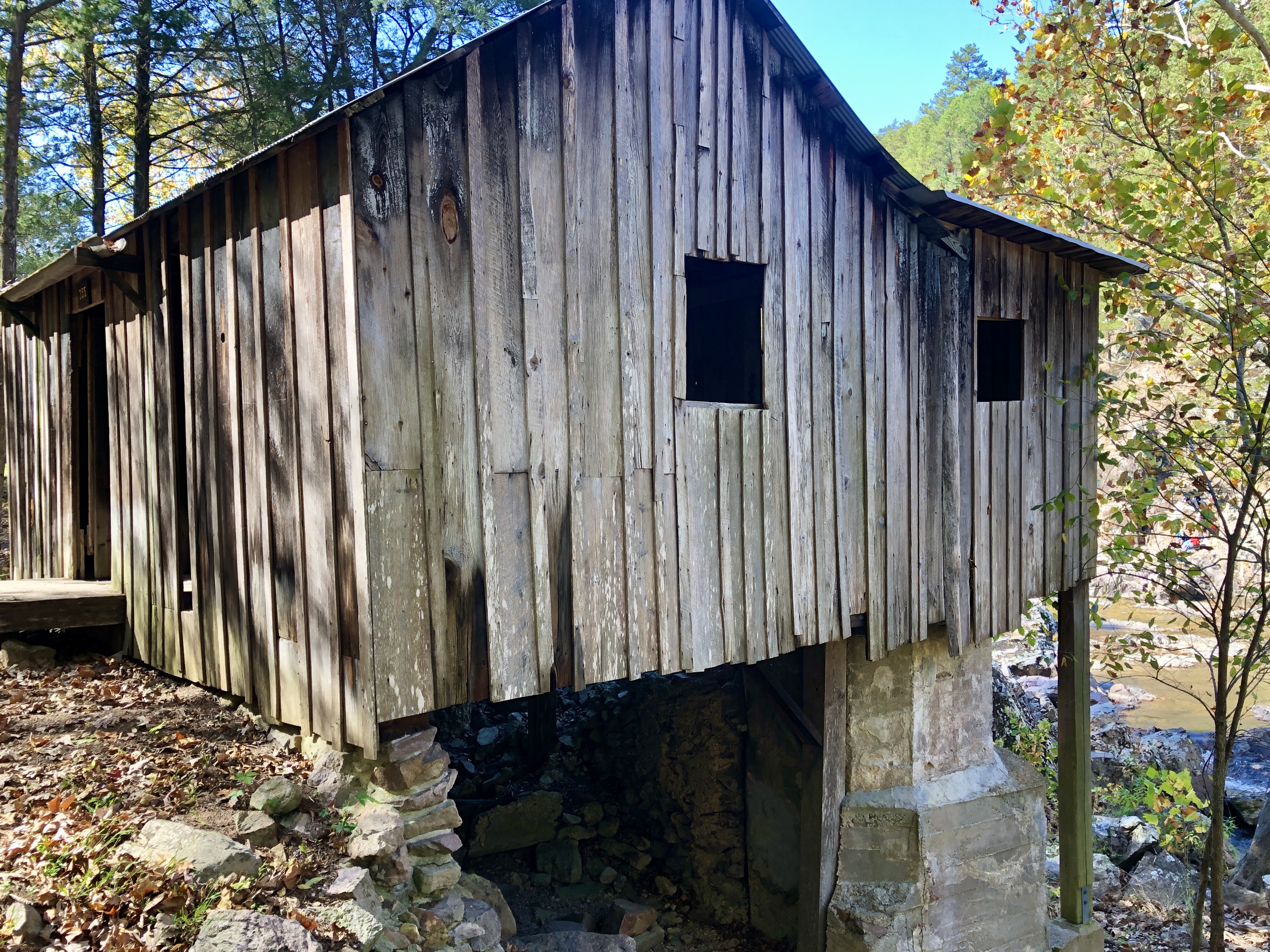
The near-century-old Klepzig Mill is nothing like Alley Mill, but it’s well worth the trip. The mill is named for Walter Klepzig, the son of a Prussian German immigrant. Klepzig, who bought the small turbine mill and farm in 1912, was known for his progressive and neighborly ways. Over time into the early 1920s, he upgraded and rebuilt the mill, a rare sawmill house structure still standing today and the only mill of its kind, according to historic documents about its significance to the Ozark National Scenic Riverways area.
The area’s true charm is the gorgeous rugged creek setting at the base of Mill Mountain. Like Rocky Falls, it’s a rhyolite shut-in canyon with water cascading and rushing through red-hued boulders and rocks. The mill and shut-ins are a photographer’s playground, and the undeveloped location is a peaceful, beautiful place for anyone to enjoy and explore.
Falling Spring Mill
What: Historic mill, historic cabin, spring waterfall, spring lake, parking area, day use picnic area, toilet
Where: South of Winona off Missouri 19
GPS: 36.86821409511994, -91.29509524348202
Drive time: About 35 minutes from Rocky Falls (2.3 hours from Springfield)
Road tips: From Missouri 19 highway, turn southeast onto Forest Road 3170 (also called County Road 156) which quickly forks; follow the left fork gravel road (FR 3164) about 2 miles to Falling Spring Picnic Area
Once you park: It’s right there!
Online: fs.usda.gov
Step back in time at Falling Spring Mill, a photo-worthy picnic area with historic significance. Homesteaded in 1851 by Thomas and Jane Brown, the first of several houses built in the area is still standing here. Now called the Thomas Brown Cabin, it's noted for its half-dovetail notched corners, which are key to the building’s survival.
The historic mill and a perpetual spring waterfall are the site’s show-stoppers. Built between 1927-1929, the mill was used to grind corn, saw shingles and firewood, and generate electricity. Its exterior is constructed of saw-board siding and its rust-red wheel once belonged to a mill 3 miles away.
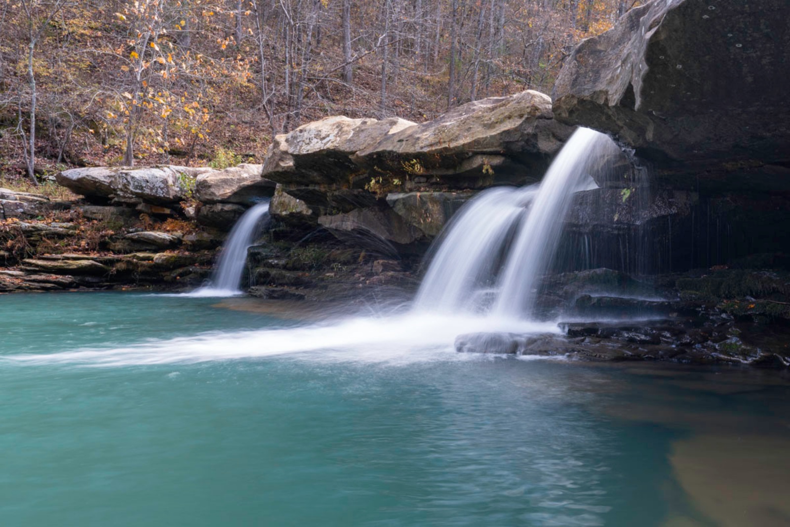
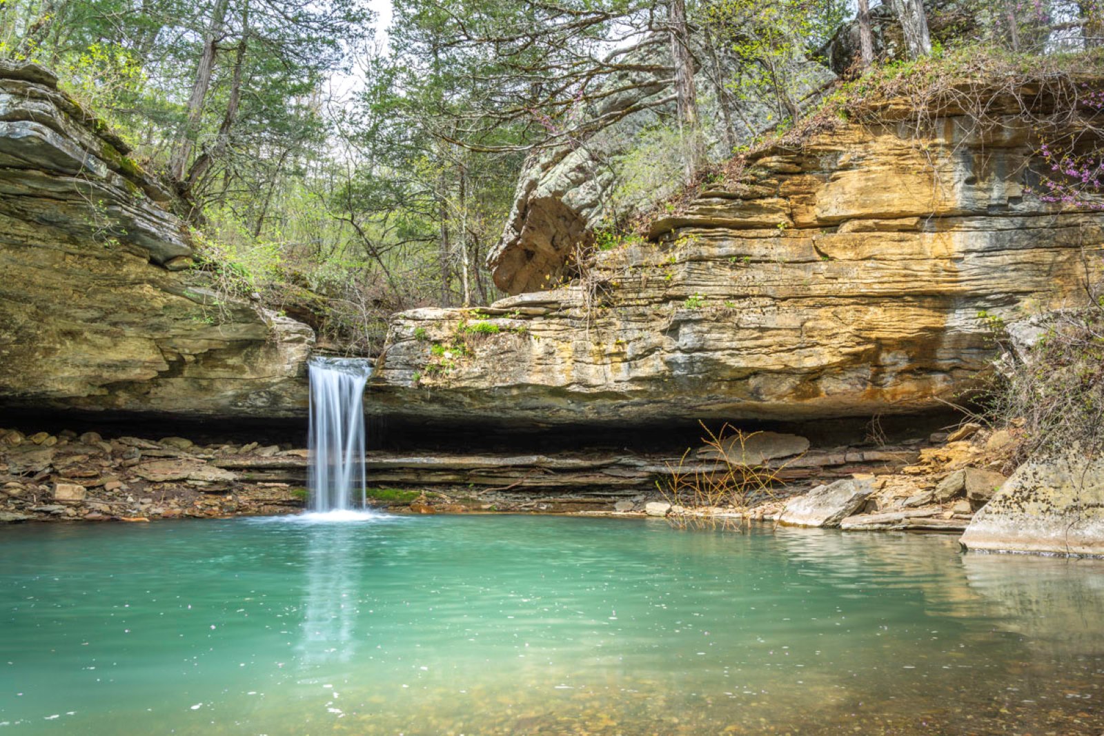
What makes it unique— and so attractive to photographers — is the spring falling from a bluff wall behind the mill. When the light is just right, the mill and spring make a beautiful reflection on the mill pond. Look inside the mill to see its old machinery. Go behind the mill to see the spring waterfall up close. Another photo-worthy sight, especially in fall, is the reflection of trees on the larger pool.
This is a great spot to end your scenic day tour because — second to Alley Mill — it’s the closest spot to Springfield, about 2.3 hours away. That’s why it works just as well to start your itinerary with Falling Spring Mill and follow it back through the list.
Enjoy the journey no matter how you do it!


