
Picture the Ozarks
This story is part of an ongoing series about photo-worthy destinations near Springfield. We call it “Picture the Ozarks.”
HIKING GUIDE |
Getting to Lost Valley Trail from Springfield (click to expand details)
Distance from Springfield: 100 miles south
Drive Time: Around 2 hours
Location: Boxley Valley Historic District and Ponca Township, Arkansas, Upper Buffalo National River area (From Arkansas 43, turn west at the “Lost Valley” sign onto Lost Valley Road, a.k.a. NC 1015)
GPS: 36°00'33.2″N 93°22'19.1″W
Parking: Large gravel lot nearly two miles southwest of Ponca
With a serene wooded path, towering bluffs, massive rock formations and seasonal picturesque waterfalls in a beautiful box canyon, Lost Valley in the Boxley Valley Historic District is a pleasure to hike nearly any time of year. It especially shines in the fall when the trees turn red and gold.
No wonder this easy-to-reach trail is the most popular hike in Arkansas!
Not only is the 2.3-mile out-and-back trail worth a two-hour day trip drive from Springfield, it’s located in one of the prettiest settings of the Arkansas Ozarks. That means you can pair your hike with other nearby adventures, including looking for elk, exploring the Buffalo River or taking a scenic drive.
Lost Valley is also one of the Ozarks' most flexible trails, suitable for families and hikers with skill levels ranging from easy to moderate to challenging.
Ready to find yourself in Lost Valley? Our guide gets you there.
Need-to-know details about the trail (click to expand)
Length: 2.3 miles out and back
Difficulty: Easy (primary trail) to moderately challenging (rocky formations and cave)
Elevation change: Roughly 275 feet to Eden Cave
Bathroom: Yes, a quarter mile from parking
Cell reception: No
Dogs allowed: No
Kid-meter: This trail is kid-friendly to a point; use caution around rock formations, bluffs, waterfall areas and the cave.
Partially accessible: From the main parking to a bathroom and picnic area (about a quarter mile) is considered accessible; the bathroom is handicap accessible and there is alternative handicapped parking nearby. Although the trail is relatively level and easy for a while beyond this point, there is a rocky creekbed crossing that makes continuing with a wheelchair prohibitive.
Photo-worthy: A wooded trail (especially beautiful during peak fall color), creekbed and extraordinary geologic formations including a natural bridge, caves, bluff shelter and seasonal waterfalls.
Online resources: National Park Service, AllTrails, Buffalo Outdoor Center
Caution: There are steep steps and bluff areas around Eden Falls, and even steeper steps leading to a cave and sheer drop. The National Park Service warns of “slippery rocks and hazardous cliff areas.”
Nearby: Read this guide for details on Boxley Valley elk and historic barns, area trails and Buffalo River activities.
Not far: Sweden Creek Falls Trail — read our guide (about 25 minutes); Glory Hole Waterfall Trail (about 25 minutes); Magnolia Falls Trail (about 20 minutes); Whitaker Point/Hawksbill Crag Trail (about 35 minutes)
Reminder: Bugs, snakes, ticks, wildlife, cliffs and other hazards may be encountered in any wilderness area. While outdoor areas in this series are recommended from the firsthand experiences of an average-ability hiker, readers must determine their own abilities and hike at their own discretion.
When to hike Lost Valley
The versatile Lost Valley Trail is beautiful any time of year but especially shines in the fall when trees are changing color along the wooded trail and around rock formations. September and October are also typically dry so there won’t be many wet creek crossings — a plus. Of course, that also means you wouldn’t find flowing waterfalls.
Early to late spring is the best time to see Eden Falls and waterfalls flowing from the Natural Bridge and Eden Cave, along with cascading creeks. Flowing falls create wet creek crossings, so expect to hop some rocks.
Winter hike? Yes, please. Winter precipitation from November through February may also produce waterfalls. Even when it’s dry, rock formations are are easier to view through bare trees.
We suggest you pass on summer hikes: The trails are too buggy, too dry and too overgrown.
Start your hike: An easy woodland stroll
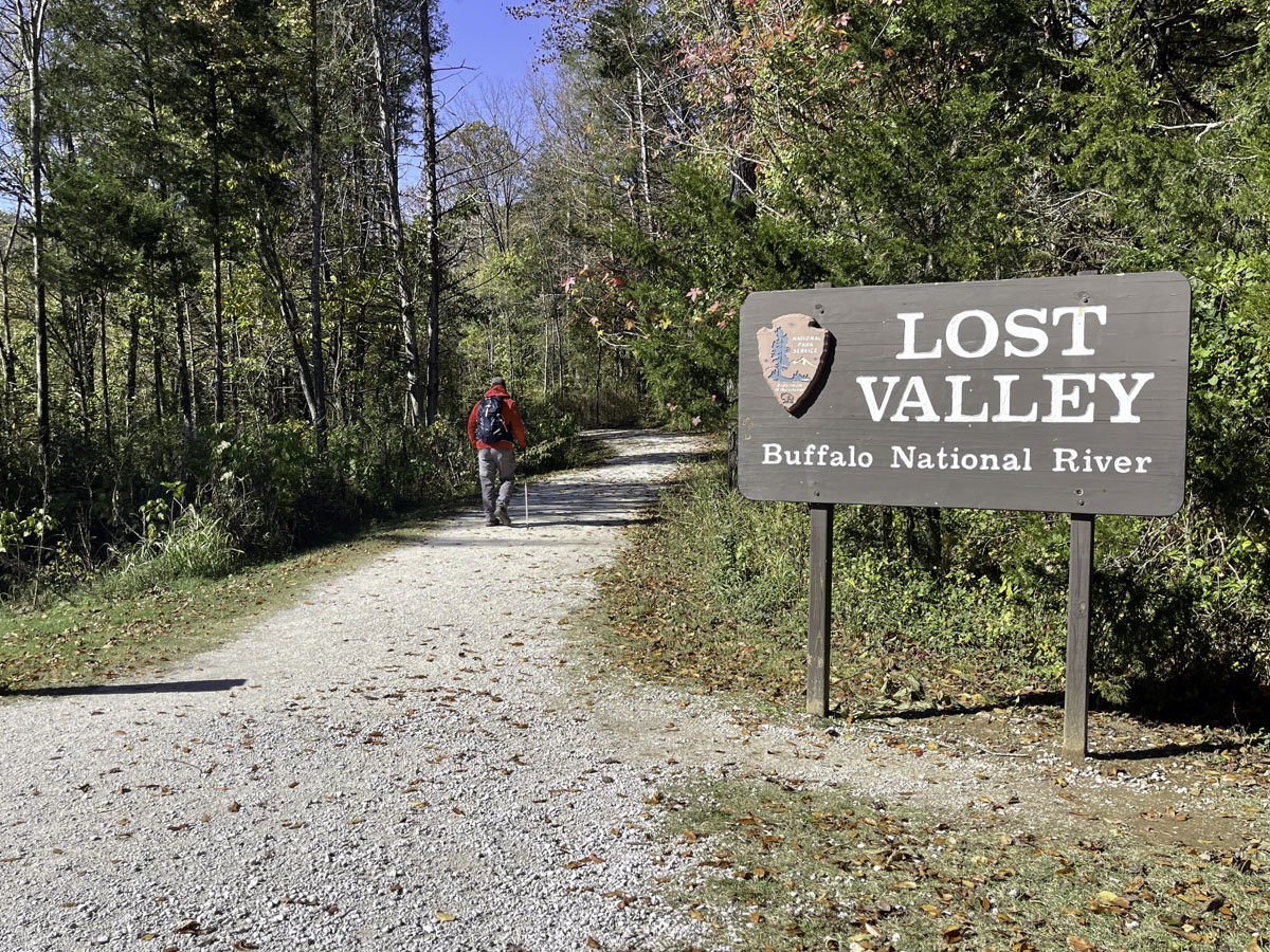
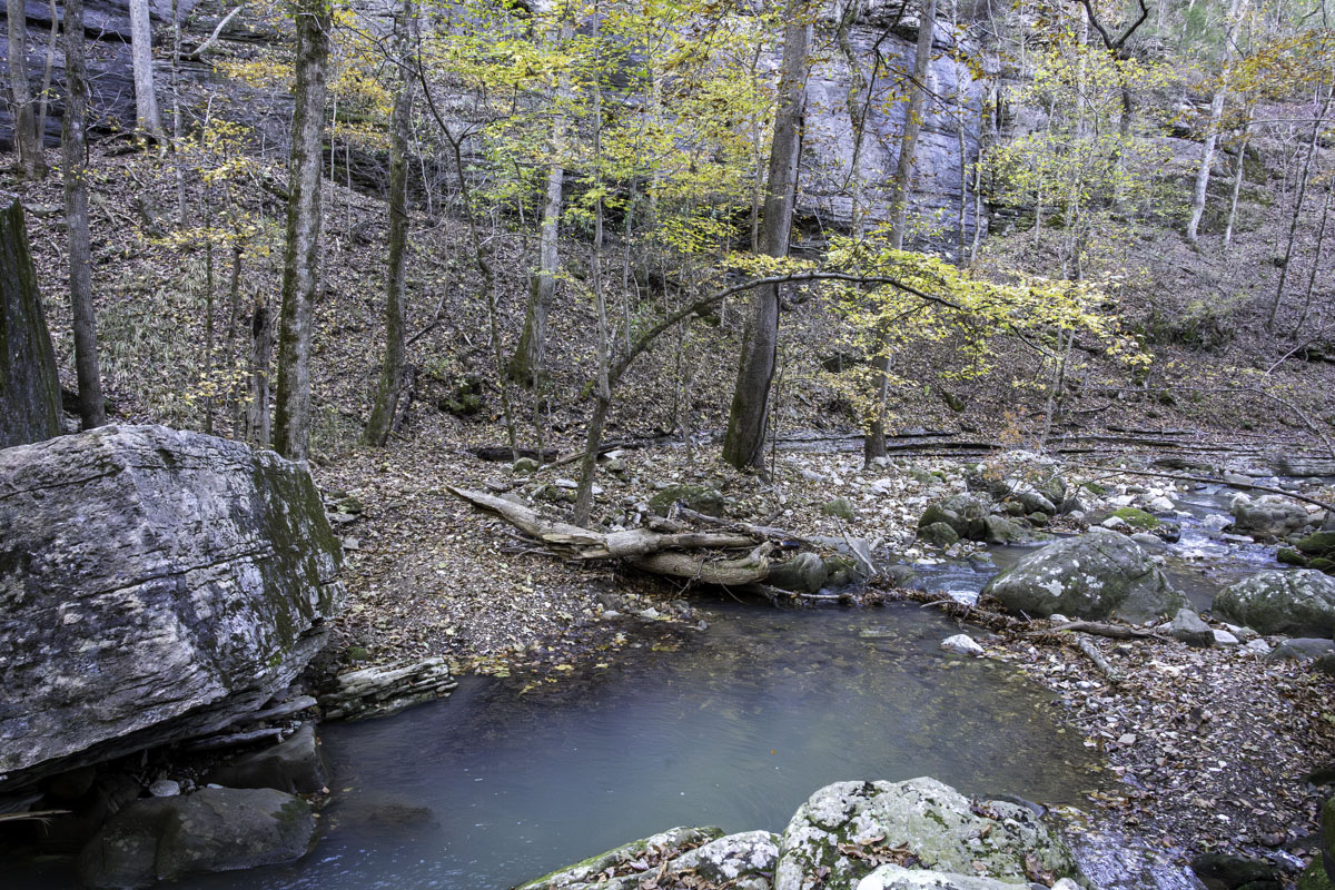
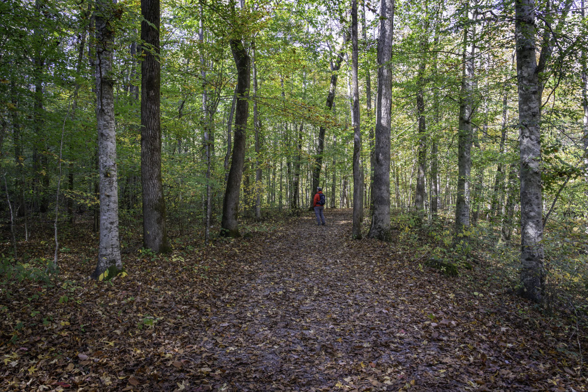
Lost Valley Trail is a bit like a zero-entry pool: You’ll “wade” into this hike, starting with an easy crushed-rock path that nearly anyone can do. This one-mile, low-elevation section of the trail meanders along a creekbed and is pretty enough to satisfy anyone’s desire for a walk in the woods.
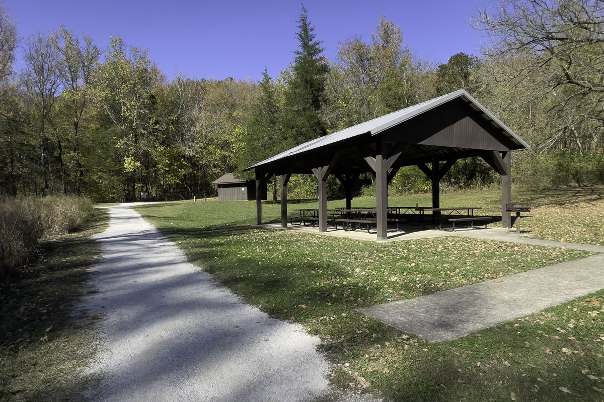
The well-marked path starts from the parking lot down a wheelchair-friendly path, reaching a picnic area in less than a quarter of a mile. With a shelter and handicap-accessible bathroom (plus alternative handicap parking), it’s a nice place to stop for lunch or a snack.
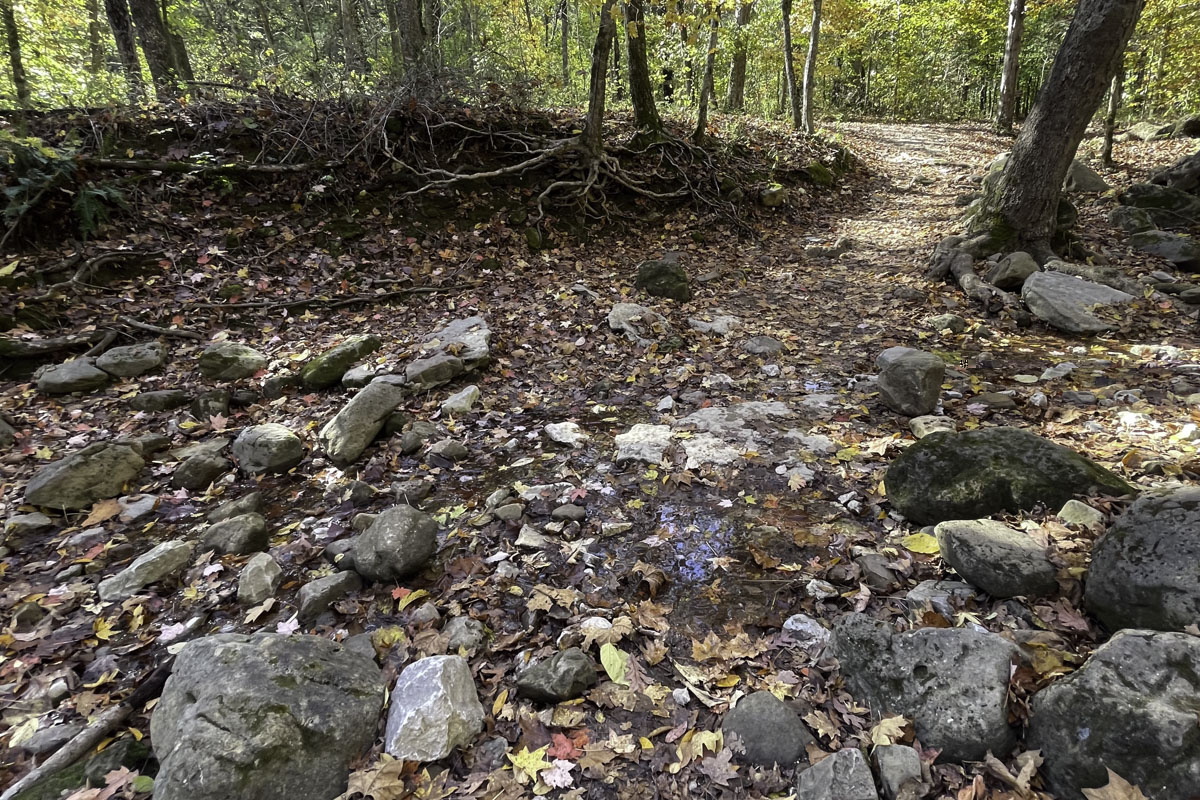
To continue from here means crossing a creekbed — easy enough if it’s a typically dry fall day (like our late-October visit), but if the creek is running, prepare to rock-hop.
Once over the creek, the path continues at a nice easy pace through the wooded canyon valley. During fall, the path is strewn with large yellow beech and occasional red maple leaves. Watch for informational signs and well–placed benches along the way for learning about the landscape and pondering the view.
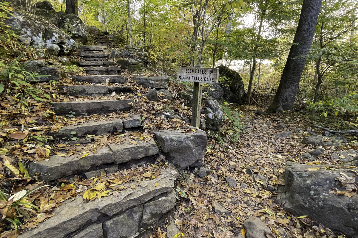
Nearly a mile in, you’ll come to a fork in the trail and a sign pointing right toward the Natural Bridge and Eden Falls. From this point forward, expect rugged terrain, dozens of stone steps and increased elevations to amazing rock formations, caves and waterfalls. Turn back here if that kind of hike is not for you.
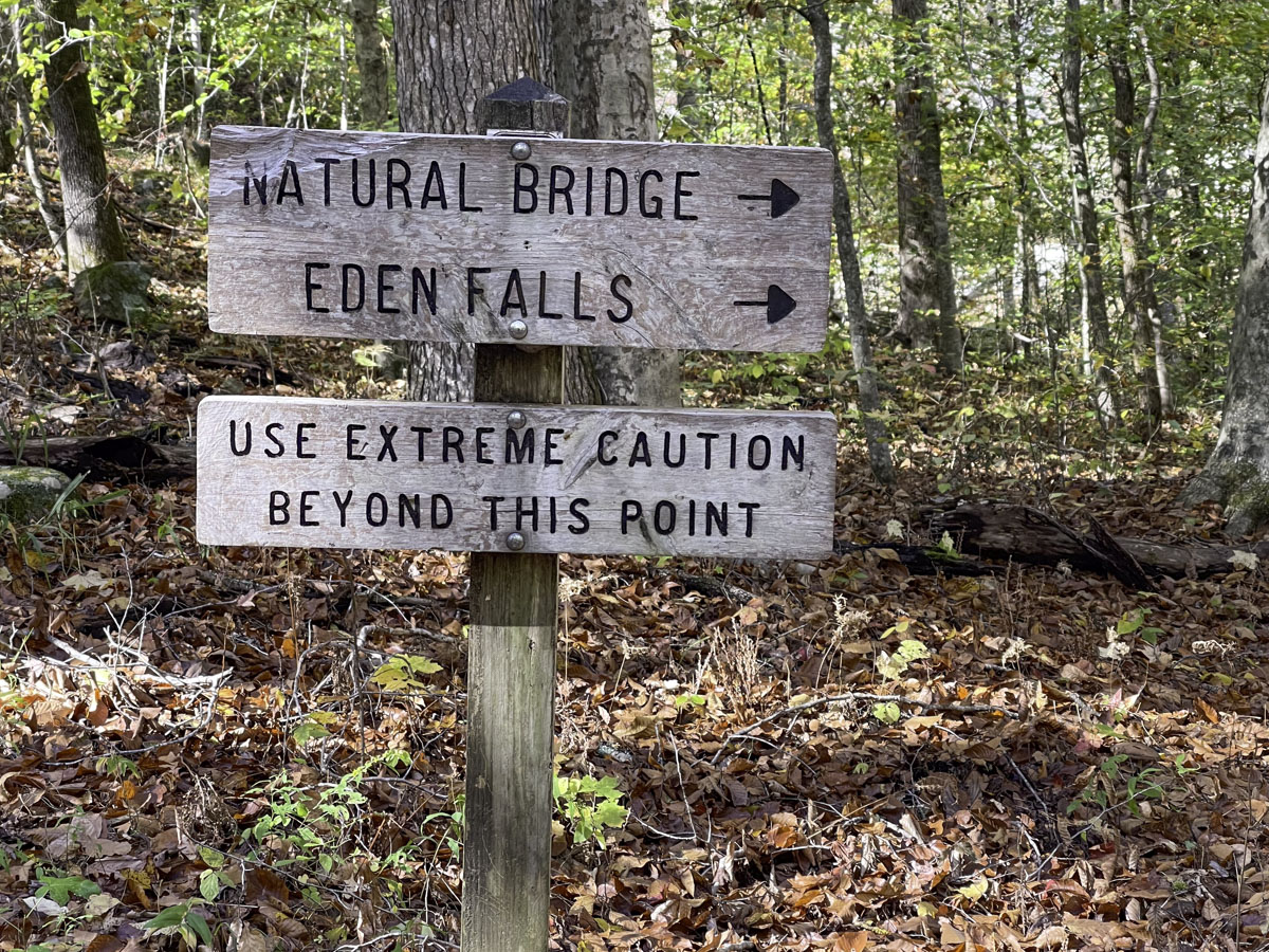
Tip: A spur at this fork heading left, bypassing the bridge and falls, is a return loop after visiting the cave or upper Eden Falls.
Explore rocky wonders and waterfalls
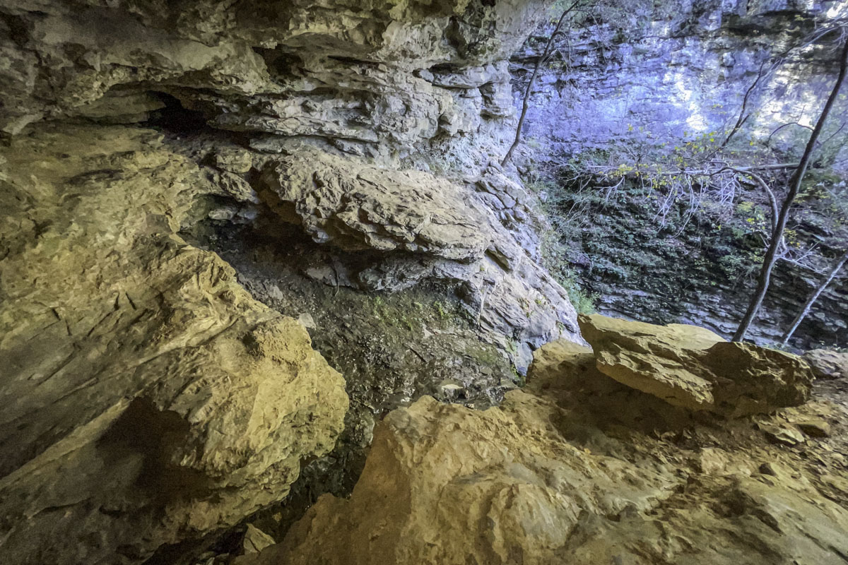
Beyond the sign to the Natural Bridge and Eden Falls, Lost Valley Trail becomes more rugged and at times steep. A series of stone steps and narrow sections of trail lead hikers past boulders and rock formations along Clark Creek.
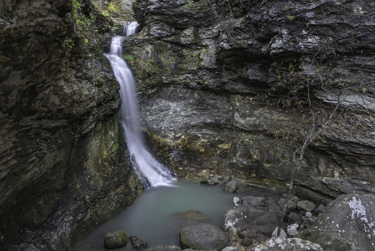
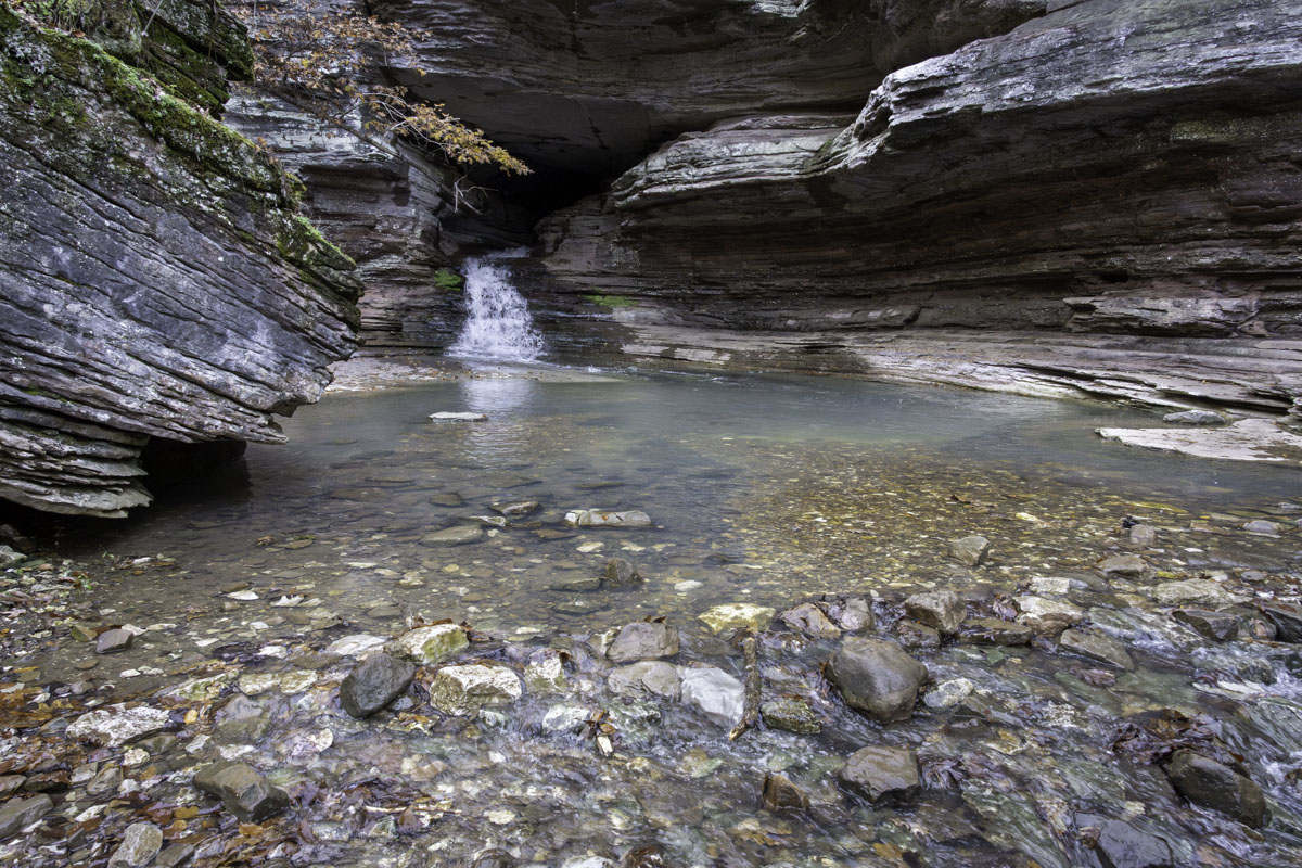
That includes the Natural Bridge, where an 8-foot waterfall flows through a small cave into a pretty pool.
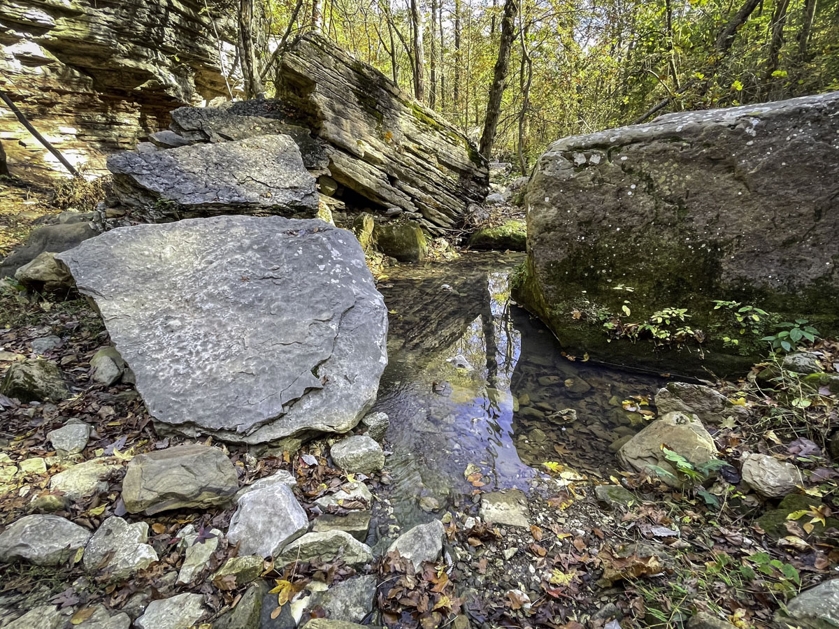
Spend some time exploring the natural bridge area, which includes a rocky overhang, a cave and many cracks and crevices. Then continue the trail up steps to Cob Cave and Eden Falls. Along the way, there’s a rugged little side path to see the backside of the Natural Bridge and up the creek.
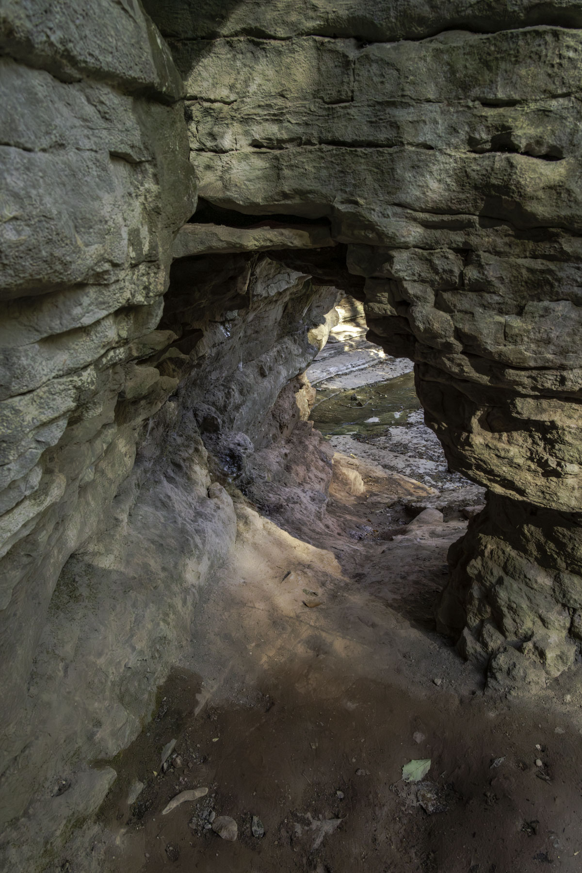
Tip: You may wonder why sections of the creek appear dry even during rainy seasons. That’s because the creek disappears underground in places, flowing through passages before reappearing downstream.
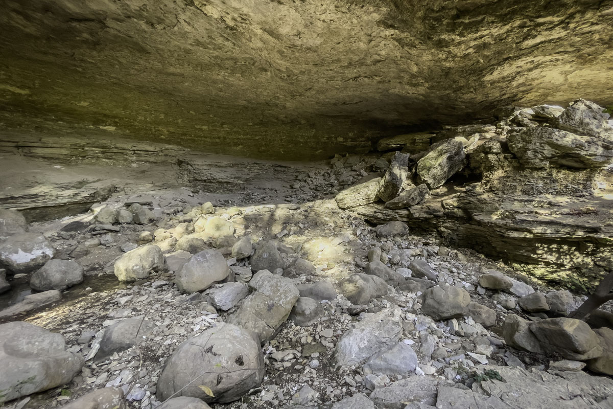
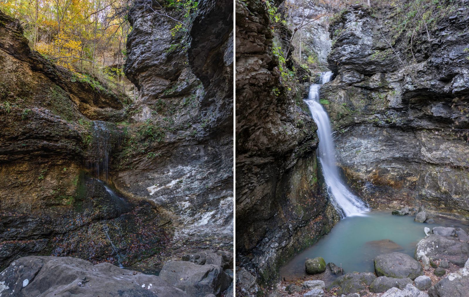
Cob Cave is a massive 200-foot bluff shelter that opens to a grotto and Eden Falls. Hikers can clamber around the shelter and the lower part of the falls. To get a more elevated waterfall view that includes more of the upper falls, climb up the rocky slope or use trail steps.
Tip: This elevated view makes a nice photograph.
Some hikers head back to the crushed-rock path after viewing Eden Falls, skipping the climb to a cave where the waterfall begins. To do that, retrace your steps back along the Natural Bridge or take an alternative loop found near the base of the Eden Cave steps.
Continuing to the cave
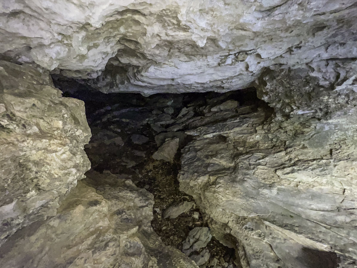
Game for one more stair climb? This last section takes hikers to Eden Falls Cave — the top of Eden Falls. Look for signage pointing the way up. (If you don’t like heights or edges, you might not like this part.)
Trail steps traverse up, hugging the bluff. Some areas are more narrow and steep than others (and in wet weather may be slick). But the 200-foot cave at the top, from which Eden Falls flows, is pretty amazing.
Tip: Space around the cave opening is tight and there’s a sheer drop where the falls spill over. Use caution, especially in a larger group or with kids.
You can walk upright into the opening, but to explore further, bring a headlamp and optional kneepads and expect to crawl or duck-walk. The cave is narrow, then opens into a space with a 25-foot seasonal waterfall — according to the National Park Service (this hiker stops at the cave opening!).
Whether you go up to the cave or not, this trail has something for everyone.