
Picture the Ozarks
This story is part of an ongoing series about photo-worthy destinations near Springfield. We call it “Picture the Ozarks.”
HIKING GUIDE |
Crisp air. Cool temps. Fewer people. No bugs. And the annual reveal of bluffs, rivers and rock formations typically hidden by leaves.
No wonder the Ozarks’ hiking season doesn’t pause for a winter break.
Getting on area trails between December and March is so rewarding. And the Buffalo River Trail between Ponca and Steel Creek — a good hike any time of year — is especially nice in winter for all those reasons. Plus, it’s easy to reach off a main rural highway, there’s plenty of parking and, best of all, it follows the beautiful Buffalo River, more visible from the trail when leaves are bare.
Not only that, a less traveled trail can be added to your outing without moving your car. The Balanced Rock Falls Trail on Leatherwood Creek is an unmarked one-mile out-and-back hidden gem that starts just yards from the BRT. It’s a pretty trail with an unusual pay-off.
We describe both trails in this guide, with special attention to the more elusive Balanced Rock to help you get there.
Getting to both trails from Springfield (click to expand details)
Distance from Springfield: 100 miles
Drive Time: One hour, 50 minutes
Location: Ponca, Arkansas, at the Ponca Low-Water Bridge off Arkansas 74 and Arkansas 43
GPS: 36.021381114515655, -93.35476229793186
Cell reception: No
Parking: Large lot with bathroom
Trailheads: Walk across the bridge to access both trails
Nearby: Boxley Valley Historic District (including elk sightings), Ponca outfitters and shops (Buffalo Outdoor Center and Lost Valley Outfitters), Ponca Nature Center, Lost Valley Trail
Related guides:
7 Ozarks trails that make great winter hikes
Road Trip Guide: Buffalo National River
Reminder: Bugs, snakes, ticks, wildlife, cliffs and other hazards may be encountered in any wilderness area. While outdoor areas in this series are recommended from the firsthand experiences of an average-ability hiker, readers must determine their own abilities and hike at their own discretion.
Buffalo River Trail, Ponca to Steel Creek
Need to know details about the trail (click to expand)
Length: 4.2 miles out and back
Difficulty: Moderate
Elevation Change: 583 feet
Dogs allowed: Yes (a rare exception for Buffalo River trails)
Kid-meter: Use your judgment for a four-mile hike with hills. There are some edgy spots near the top of the bluff line
Photo-worthy: The Buffalo River from periodic views; rocky runoff falls encountered along the way; Villines Farm near the beginning of the trail; Buffalo River at Steel Creek
Caution: A few water crossings; some sections of trail are near the bluff edge
Online resources: nps.gov, alltrails.com
Part of the 37-mile Buffalo River Trail, or BRT, this trail along the Buffalo River between the Ponca Low-Water Bridge and Steel Creek Campground makes a good winter hike in the woods, punctuated with interesting bluff formations, cascading runoffs and — from late fall through early spring — nice views of the Buffalo River.
The trail, just over four miles out and back, is an easy-to-moderate hike with an elevation gain of 583 feet. Most of the trail goes through woods with some sections near the edge of the bluff over the river.
This section of BRT is easy to access at Ponca, right off Arkansas 74 and Arkansas 43. And It’s a good place to start when you add a hike to Balanced Rock, look for elk in Boxley Valley or drive to nearby Lost Valley Trail, which we describe in this guide.
But you can also start the trail at the Steel Creek Campground, hiking to Ponca and back. No matter where you start, we suggest points of interest at either end of the trail to add to your adventure. That includes also hiking Leatherwood Creek to Balanced Rock from its hidden trailhead just a few dozen feet away.
Learn more about hiking this trail (click to expand our guide)
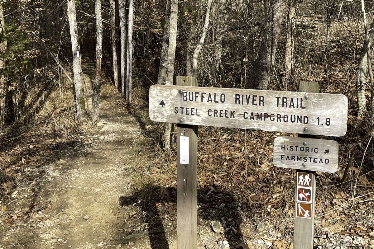
After parking, walk across the low-water bridge and continue up the left side to a clearly marked trailhead. It’s actually two trails: one for the BRT to Steel Creek and the other, pointing uphill, to the remains of an 1882 farmstead built by “Beaver Jim” Villines (a bonus adventure you can add when you return).
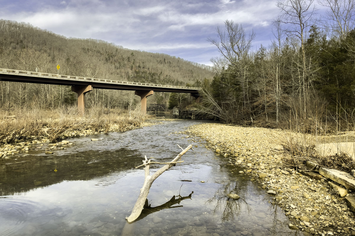
As you start out on the BRT, the trail goes under the Arkansas 74 bridge where you can see water marks indicating how high the river gets. Before long, the trail climbs up above the river.
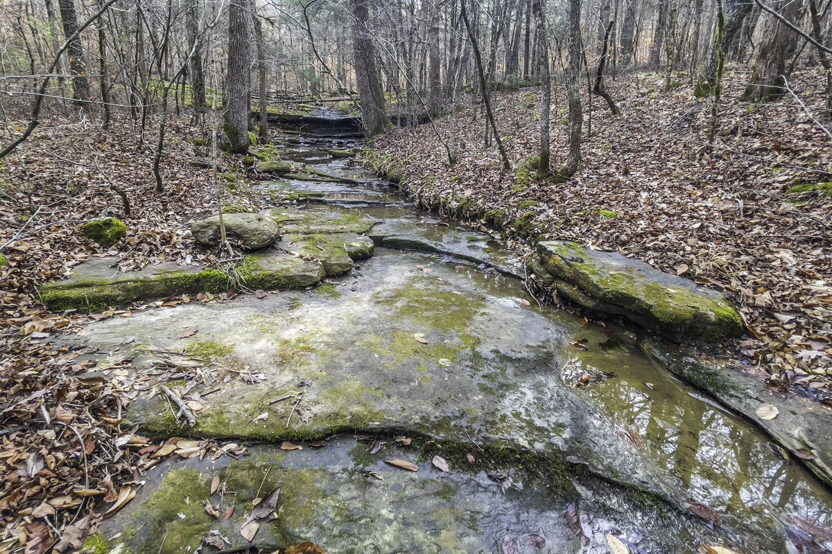
This trail includes crossing several cascading runoff creeks and the first notable one, not long into your hike, clearly flows right over the bluff during wet weather.
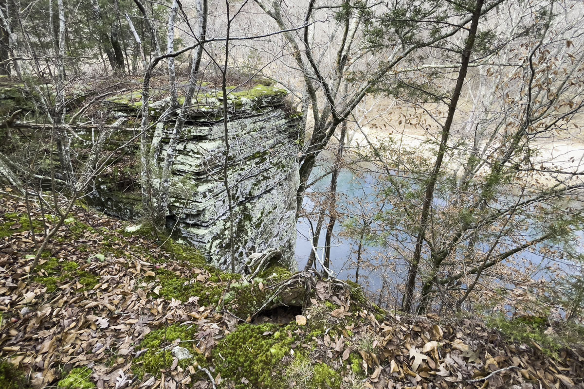
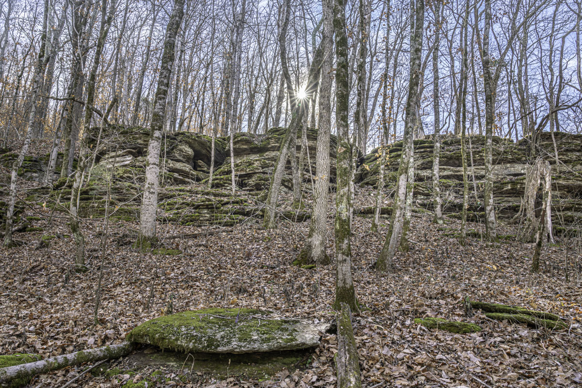
Continuing, you’ll see rock formations along the top of the bluff and open spots where you can more clearly view the river below.
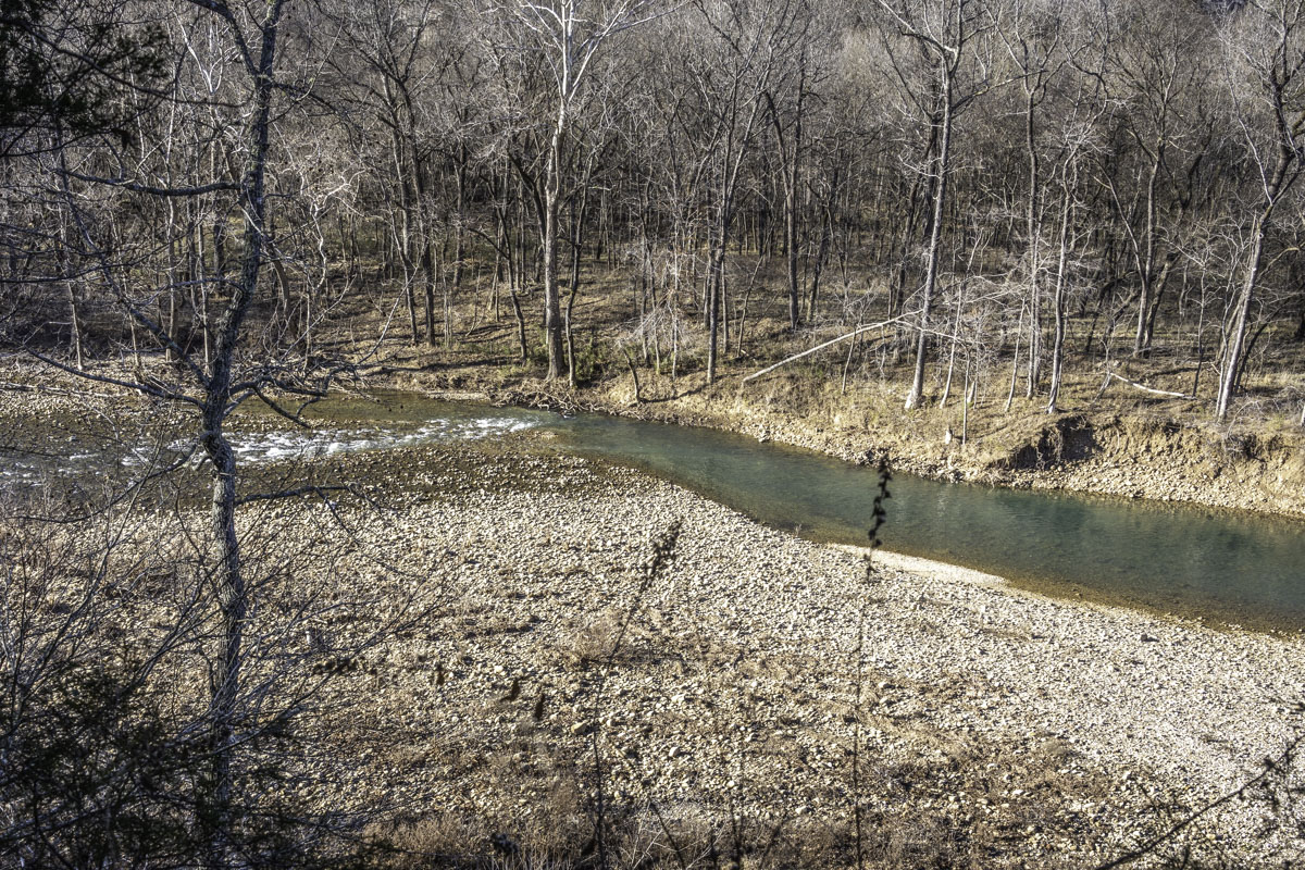
The first third of the trail in winter provides a steady view of the river through trees, plus you’ll find open views periodically along your hike.
About a third of the way to Steel Creek, the trail turns away from the river and climbs up and down hilly embankments.
When hiking this trail in winter, you’ll be amazed by the number of creek runoffs and rocky bluff lines that are hidden from view behind foliage in warmer months.
The trail works back around to river views and follows a rocky bluff line including an interesting spot where part of the bluff splits away from its base, forming a fissure you’ll hike through.
After snaking into the woods again, the trail eventually returns to river level at Steel Creek. Here, exit the trail down a short hill to the campground and bathrooms.
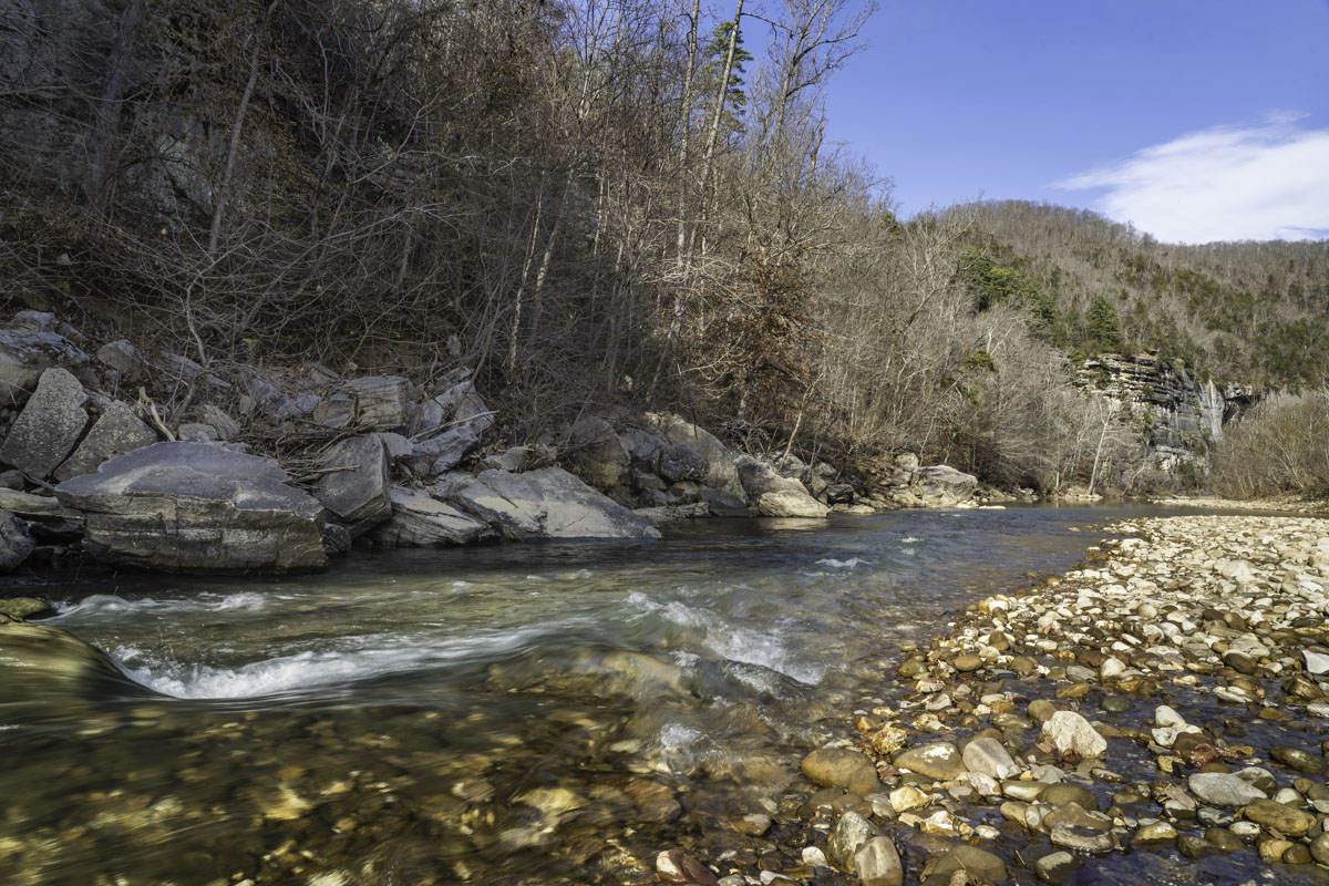
For a bonus adventure, cross into the campground and follow one of its short trails through the woods to the Buffalo to enjoy a ground-level view of the river and tall bluffs (another photo-op).
Head back to Ponca to complete your four-mile hike. Or, if you’re up for it, continue on the BRT for another mile and a half (plus even more elevation) to the Steel Creek overlook.
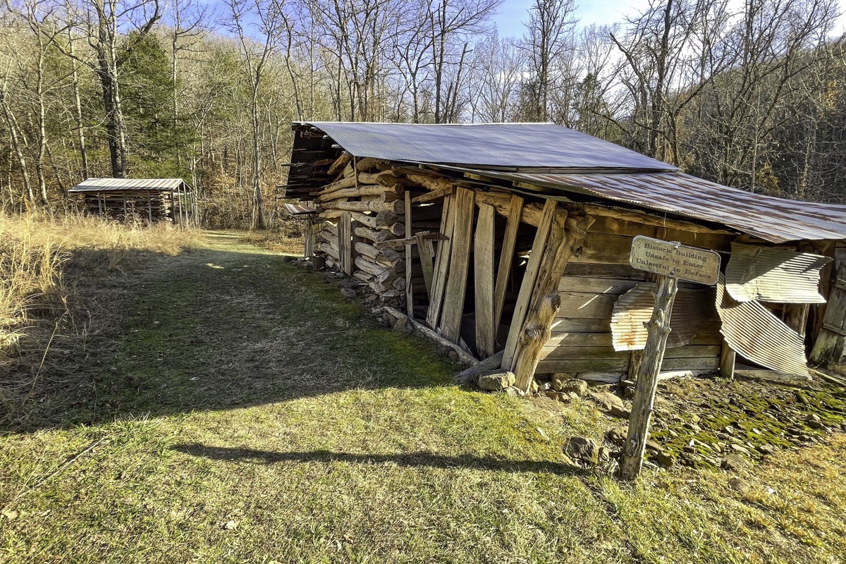
Once you return to Ponca, add the optional short spur uphill to see the “Buffalo Jim” farmstead, which includes many original buildings. James Villines was a member of one of the Buffalo River Valley’s oldest families.
Keep reading for details on how to add the Balanced Rock Falls hike, which starts nearby.
Balanced Rock Falls on Leatherwood Creek
Need to know details about the trail (click to expand)
Length: 1.2 miles out and back
Difficulty: Easy to Moderate
Elevation Change: 144 feet (the spur to Balanced Rock)
Dogs allowed: No, according to alltrails.com and pet policies at nps.gov
Kid-meter: Good for adventurous kids, per parents’ judgment. The main trail is easy; the hill climb to Balanced Rock may be challenging.
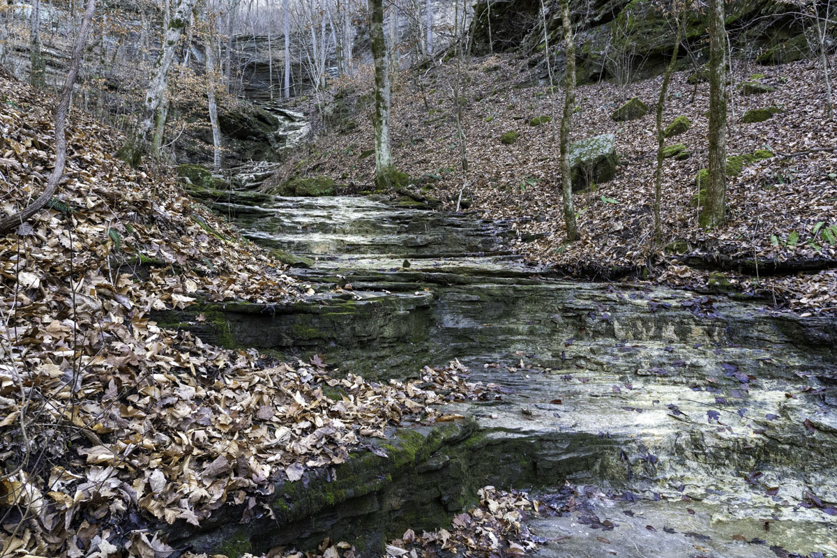
Photo-worthy: Several cascades and waterfalls along and around the creek (plus the creek itself); Balance Rock falls from below and above
Caution: Water crossings; steep spur uphill
Online resource: alltrails.com
Northwest Arkansas is rich in awe-inspiring wonders, especially rock formations and waterfalls.
Balanced Rock Falls is both.
And the trail to get there and back is only a mile or so hike along the hidden cascading Leatherwood Creek, a tributary of the Buffalo National River. That’s why this trail makes a great companion to the Buffalo River Trail from Ponca to Steel Creek (our other trail guide).
Both trails start in roughly the same place but, unlike the well-marked BRT, the path to Balanced Rock Falls is an unmarked gem hidden in plain sight. In fact, after crossing the Ponca Low-Water Bridge, you might never know that the low berm to your right hides another trail.
There are a few things you should know about this trail. First, the main path along the creek is short, pretty and easy to follow. It’s not a bushwhack, but it also isn’t marked. That’s one reason winter and early spring are good times to go: The trail is easier to see.
And while the trail is fairly easy and level (until you climb up to Balanced Rock), it’s also a bit rugged, with rocks and roots and occasional trees over the path. Expect one or two low creek crossings too, depending on how far you go. (There’s a trail that extends beyond the turn up to Balanced Rock).
Most importantly: The final stretch to Balanced Rock goes up a steep embankment after crossing the creek. (Tip: Trekking sticks are handy.) That uphill path is easy to miss unless you know where to look. This guide will help you find it.
But even if you don’t go up the hill to Balanced Rock, the trail along Leatherwood Creek makes a pretty (and photogenic) short hike on its own, with cascading falls and interesting bluffs.
Ready to discover this lesser-trekked trail? We’ve included plenty of “wayfinding” photos to help you recognize landmarks. We also created a map for this trail since it’s a little less straightforward. And bonus: We include tips for hiking beyond Balanced Rock to see more of the pretty creek and waterfalls.
Learn more about hiking this trail (click to expand our guide)
The first half-mile
To find the trailhead to Balanced Rock (and beyond), cross the Ponca Low-Water Bridge and look to your right. See where the BRT continues upstream along the Buffalo River?
A low berm just before that trail hides Leatherwood Creek. It’s easiest to see where to find the trail in winter. At other times of the year, you can generally still see a notch in the foliage where the trail begins.
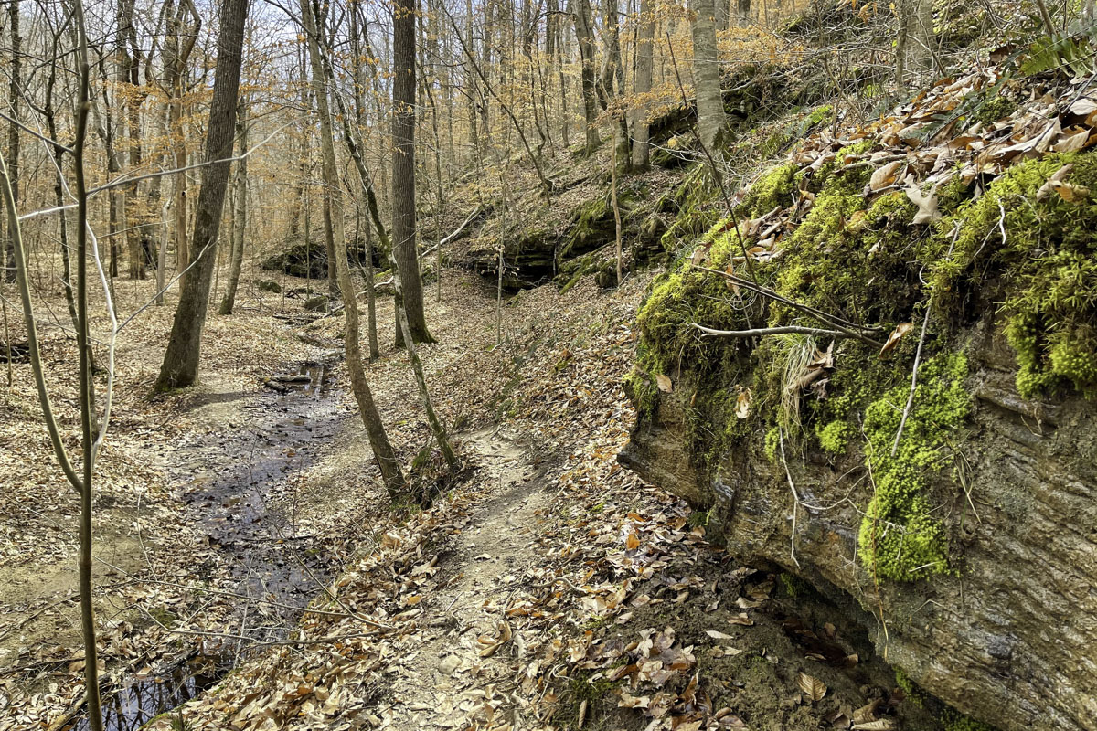
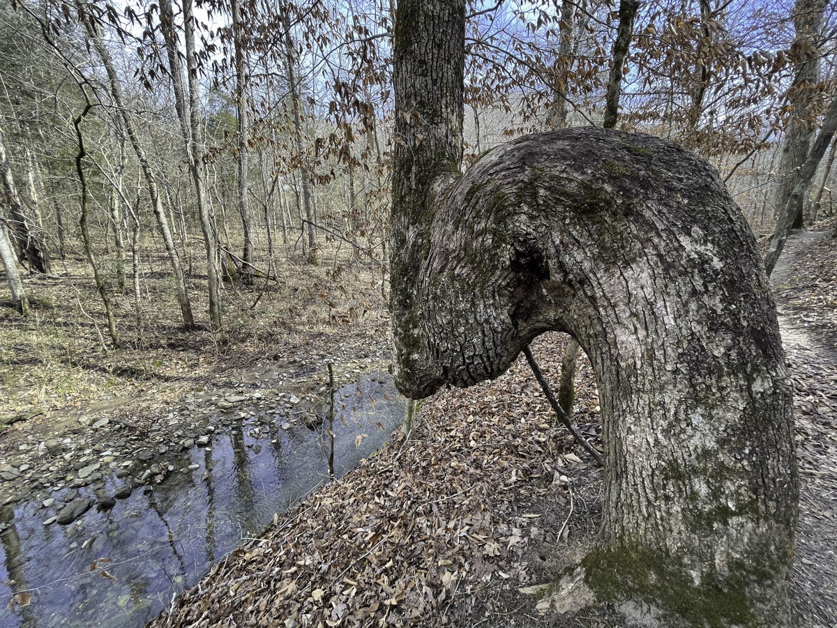
Once you step through to the shaded trail, you’ll see the creek to your left and a bent tree just ahead. Most of the trail to reach Balanced Rock follows the right (or west) side of the creek upstream, not quite half a mile. Sometimes the trail goes along the creek bank; other times it climbs a bit above. But you will always see the creek.
Tip: You can match way-finding descriptions in this guide to a map I created in Google Maps. Find it here.
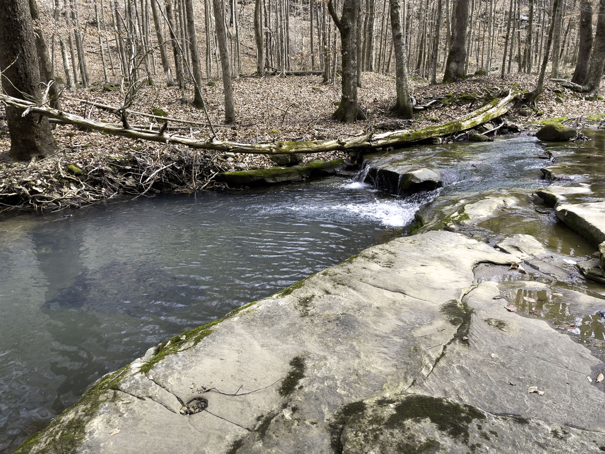
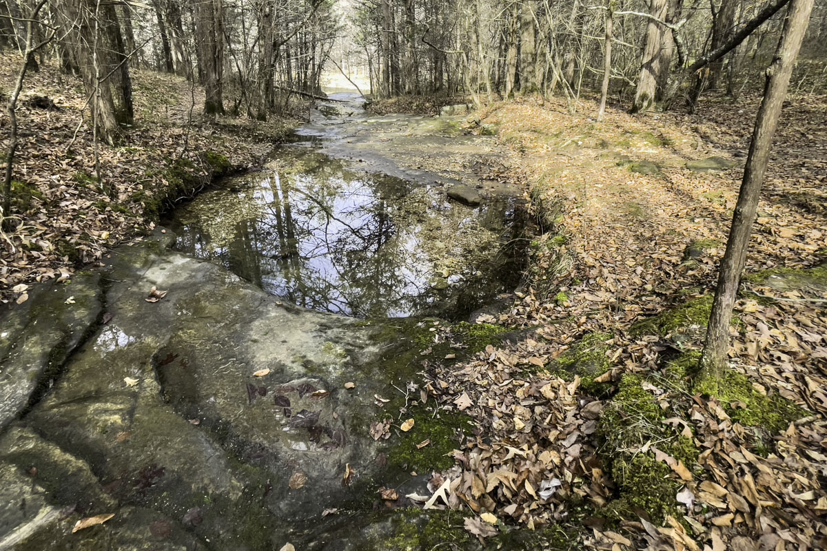
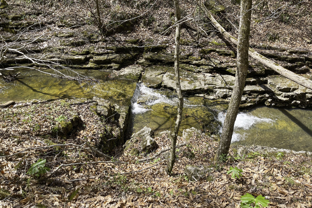
About an eighth of a mile from the start, there’s a lovely little rocky creek cascade near the trail I like to stop and photograph (Map: Cascade Falls No. 1).
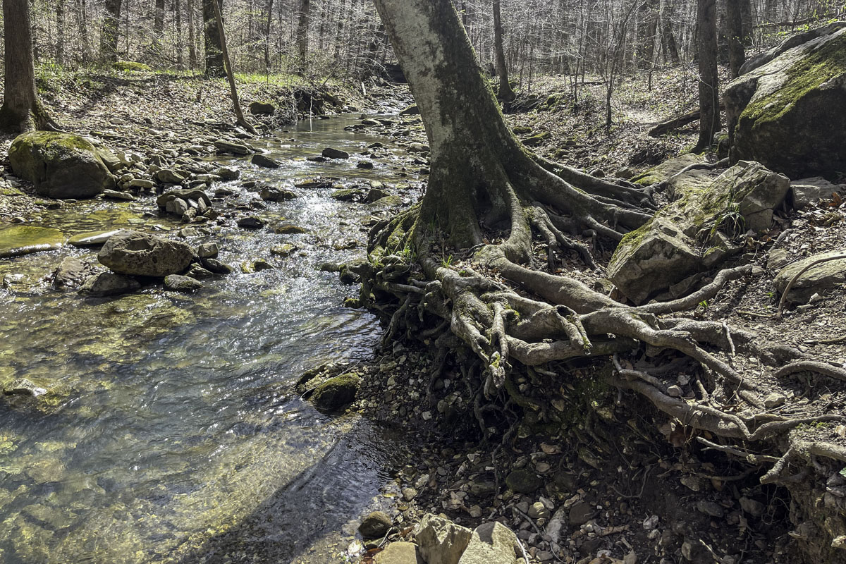
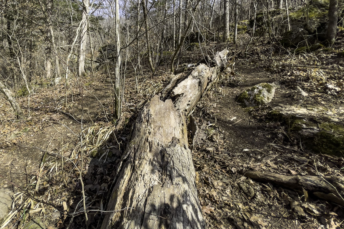
From here the trail meanders, sometimes along the bank and sometimes above it, through a grouping of rocks (on map) until you reach a leaning tree with a big root wad (on map), nearly a tenth of a mile past Cascade Falls No. 1. Take a big step up over the root wad to continue.
After about 90 yards more, watch for a small spring (on map) that runs into the creek on the opposite bank.
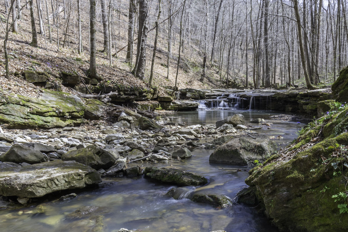
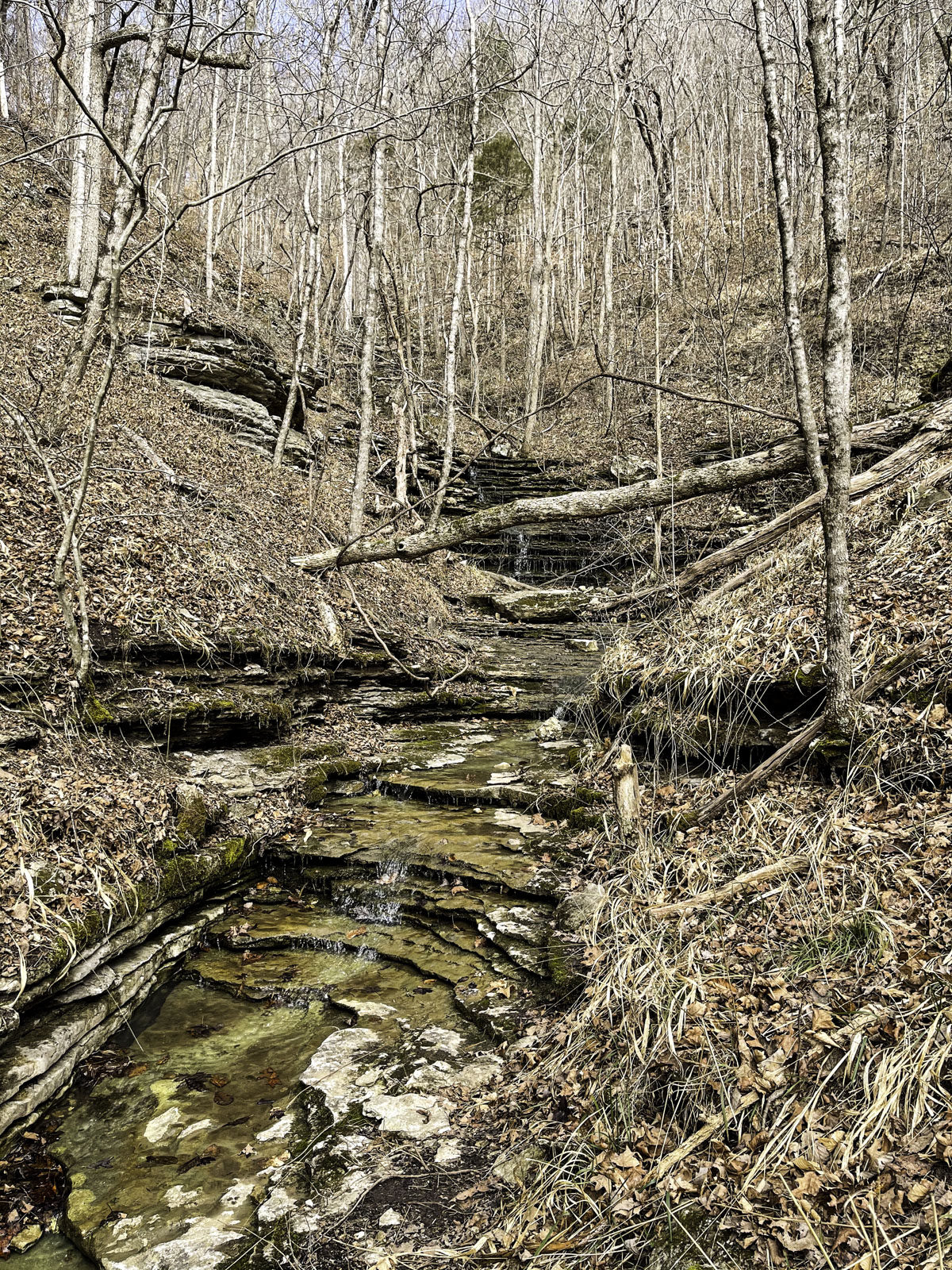
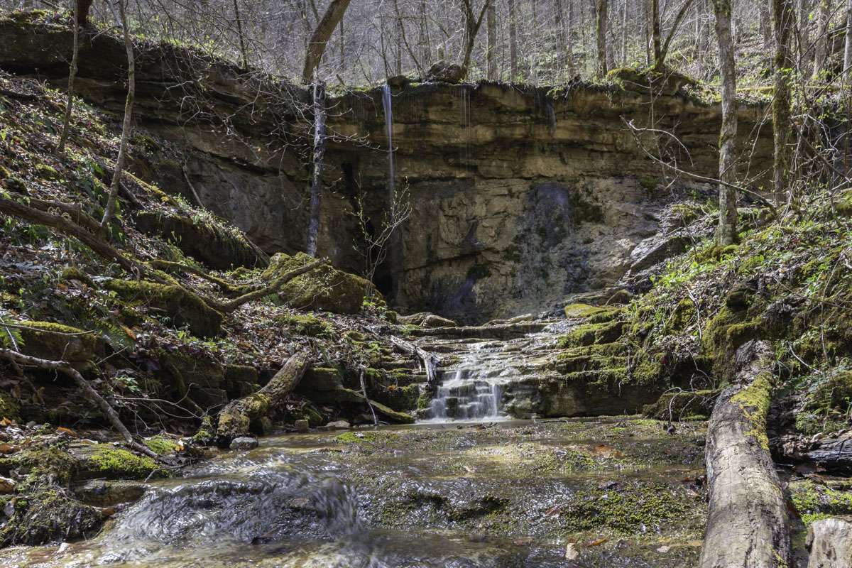
Another photo-worthy stop, you’ll come to a lovely shelf waterfall (on map) about 150 yards past the spring. You’re getting close to where the trail goes uphill.
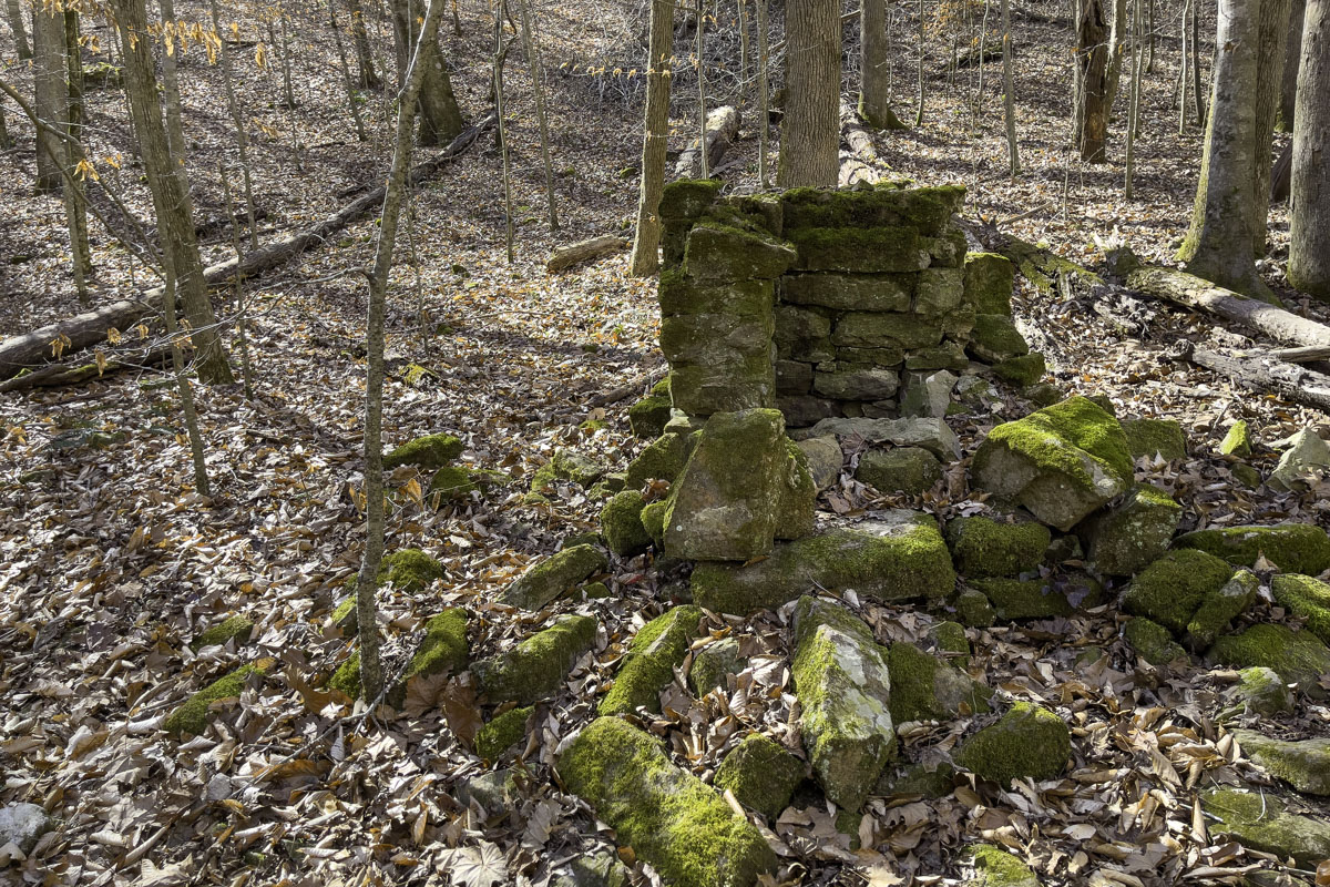
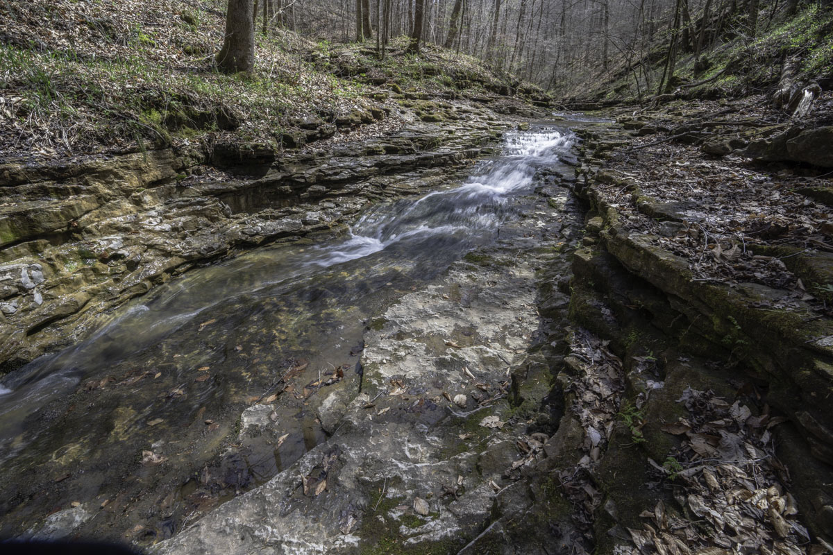
Beyond the shelf waterfall and ravine, you’ll pass a large lone boulder and some old homestead ruins. (Both are marked on the map.) Then, roughly 110 yards from the shelf waterfall, watch for a ravine on the opposite bank with a cascading creek bed that flows into Leatherwood.
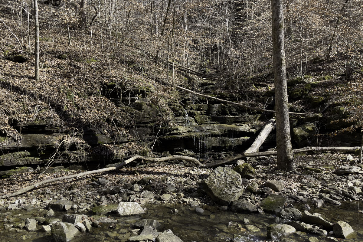
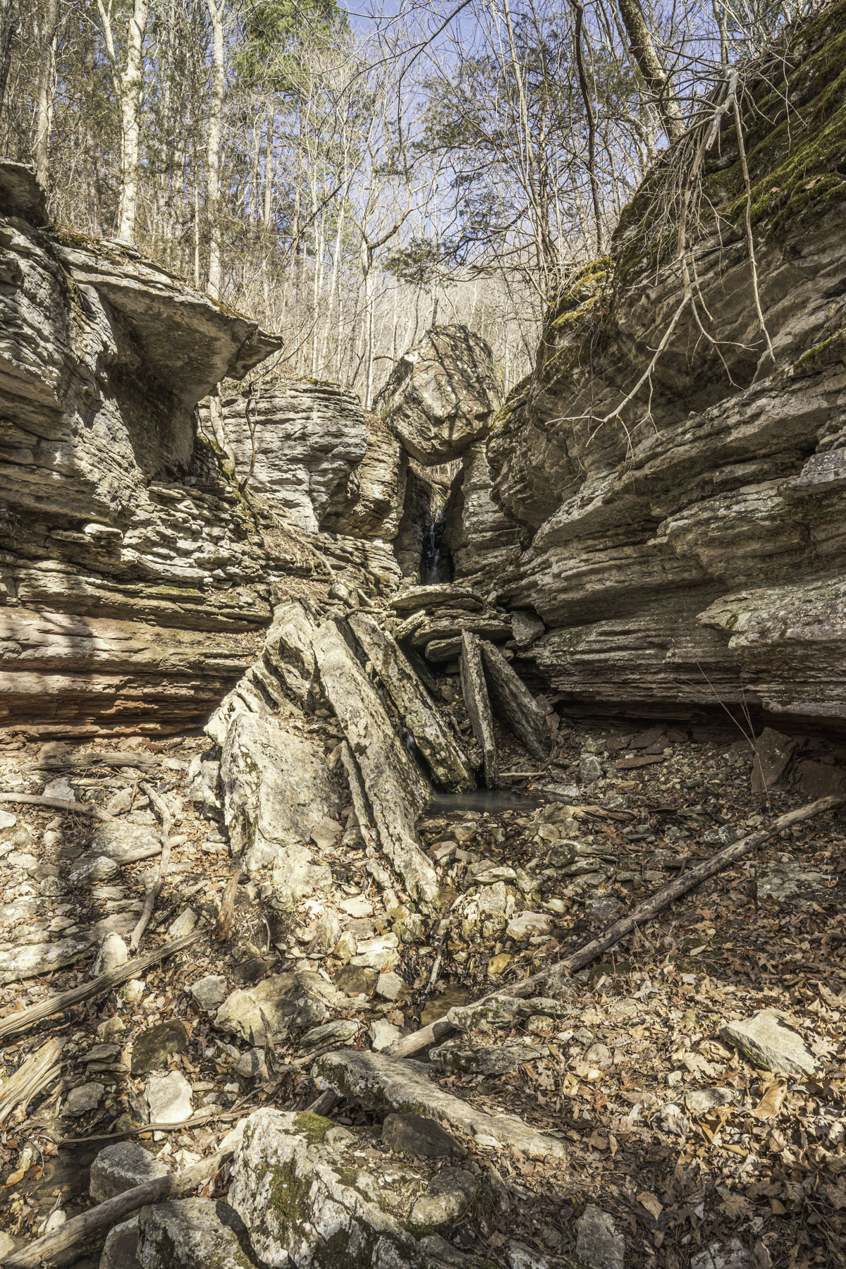
The ravine’s tributary creek is the same one that flows as a waterfall under Balanced Rock, which is why it makes a good wayfinding landmark.
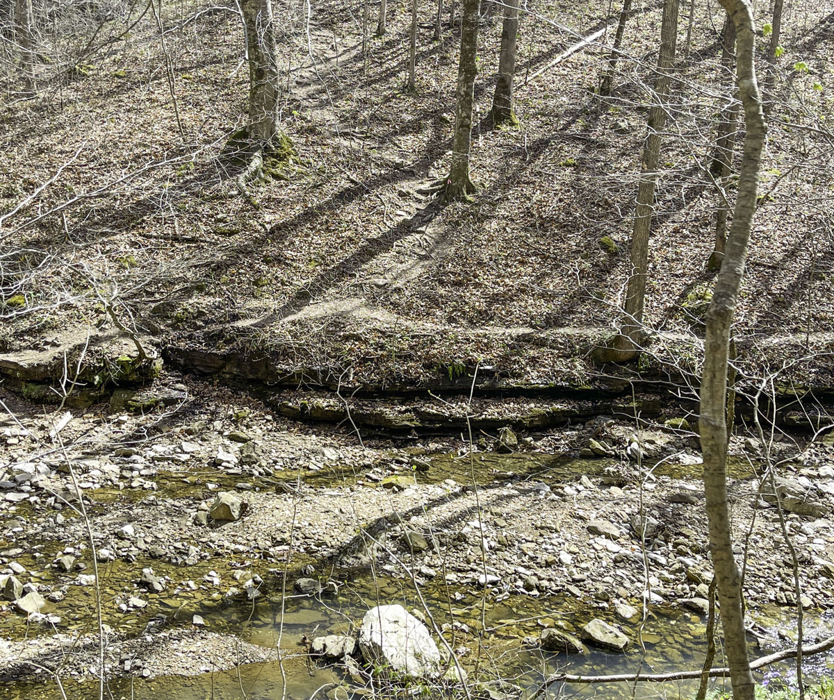
About 20 feet beyond the ravine cascades, you should see the faint spur trail to hike uphill (on map). To reach it, find a place to cross the creek. You may need to backtrack a bit or go farther upstream.
Uphill spur to Balanced Rock Falls
Once you cross the creek, just follow the trail up. It’s a steep climb but other than the extra uphill effort, the trail is relatively straightforward. We found rocks and tree stumps made handy spots to stop along the way. (Tip: Check out the ravine cascades along the way for some additional waterfalls.)
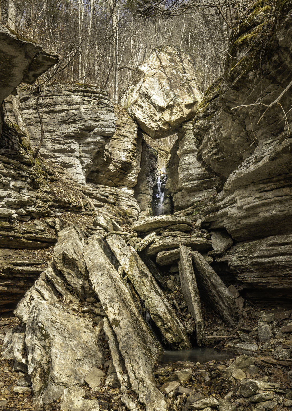
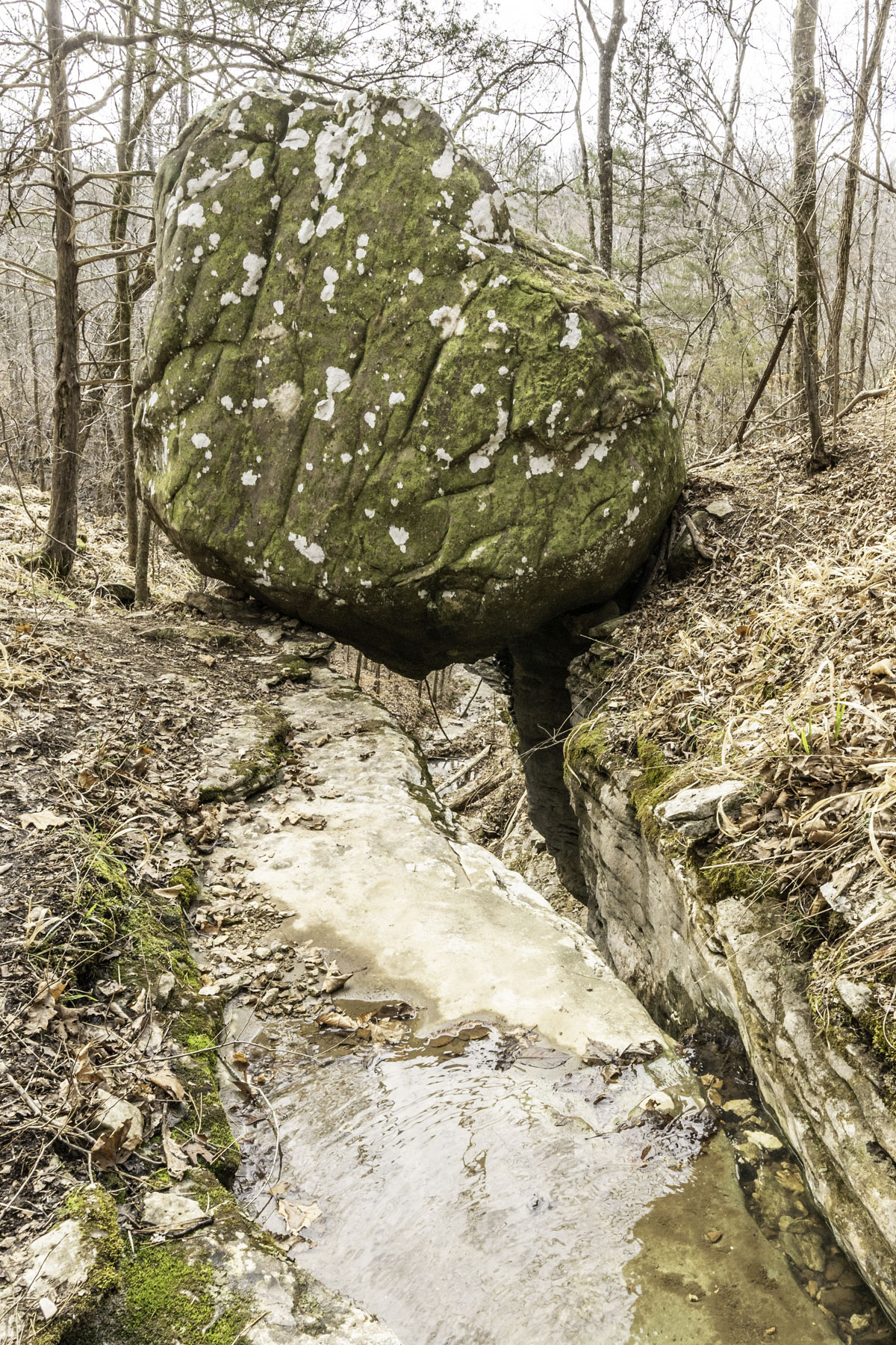
Roughly 160 yards up the hill, you should see Balanced Rock, an enormous boulder balancing on the edge of a bluff gorge. A wet-weather waterfall flows underneath the boulder from the same creek that continues down the ravine. Stop here, or scramble down to the base of the falls.
If you’re game for another short, steep climb, take the trail up to reach the top of the bluff at boulder level — another great view. From here, see more cascading falls from the creek. (Tip: If you like to explore, you could follow the drainage up to find even more cascading falls.)
Once you’ve enjoyed your time at Balanced Rock, head back downhill. If you return to the trailhead, you will have hiked a little more than one mile.
But wait, there’s more!
Beyond the Balanced Rock spur
As long as you’ve crossed the creek, and if you have the time, there’s more trail to continue. This time, the trail follows the east side of Leatherwood Creek. Find where the trail continues about 80 feet upstream from where you took the spur to Balanced Rock (also on map).
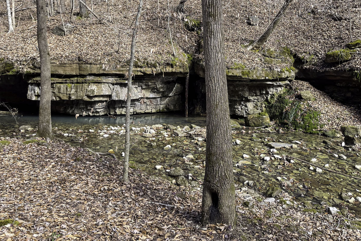
Parts of this narrow bonus trail meander high above the creek bank. Our map shows some spots along the way with pretty creek cascade views. Eventually the trail returns to the creek, right about the location of a grotto on the opposite creek bank. If there’s been rain, a waterfall from a tributary drainage flows over the top of the grotto.
You can turn back from here, or if you want to explore the grotto, cross the creek. The rest of this hike is a bushwhack. And be aware: The rocky bottom was very slippery when we hiked there, so proceed with caution.
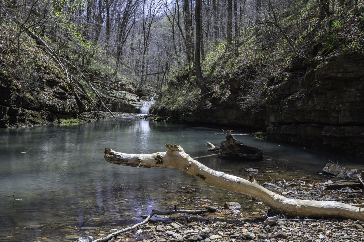
A little farther upstream from the grotto is one more waterfall you can reach. We had to step through the creek a bit (again, very slippery) to reach a little gravel island. The waterfall beyond forms a pool, ending the way forward.
From here, return the way you came.
Final tip for photographers: Remember those pretty cascades you saw from high above the creek along this bonus trail? If you’re like me, you’ll be tempted to pick your way upstream from the grotto to photograph them.
By all means, do so. But then, pick your way back to the grotto, cross the creek and take the known trail back. Don’t try to bushwhack your way downstream on the west side of the creek (as we did!) where you’ll encounter lots of brambles and slippery slopes.
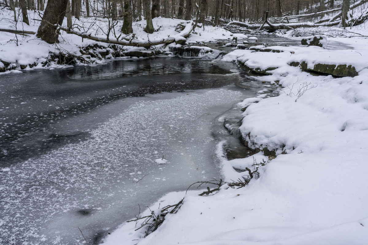
Winter hiking in snow
This guide is geared toward a no-snow winter hike when temperatures are only moderately cold, as we often see in the weather-fickle Ozarks. But the Leatherwood Creek trail also made a pretty little mini-trek after recent snows. We didn’t go far (and certainly not up that hill to Balanced Rock) but the creek was mostly frozen in a beautiful way and the snow-covered path wasn’t hard to follow.
If you follow Buffalo River or Arkansas outdoor social media groups, you know snowy trails and frozen waterfalls attract plenty of hikers. If you’re tempted to go:
- Take a four-wheel drive vehicle.
- Hike with trekking poles.
- Wear ice spikes/crampons over your boots.
- Go slow!
- Don’t go alone and make sure someone knows where you are.
- If you have one, take a device that can signal SOS should you need it.