
Oh, the fickleness of an Ozarks spring: hot and sunny one day, stormy the next. But those showers and thunderstorms are welcomed by waterfall chasers. They keep the creeks full and waterfalls flowing.
That makes hikers happy.
But you don’t have to hike long, far or hard to see some waterfalls.
Previously, we shared a round-up of waterfalls you could see from the road — or nearly so. This guide — Part 2 of our Easy Waterfall Roundup — features waterfalls that require a walk or hike.
Still, all the falls in this list are family-friendly and can be viewed within a mile of a trailhead — often much closer.
Don’t miss out before they stop flowing. There’s nothing like an Ozarks waterfall!
Click here to find our previous guide to 9 no-hike waterfalls.
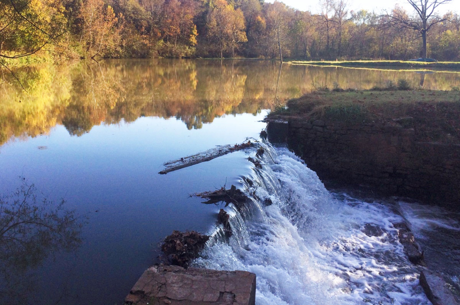
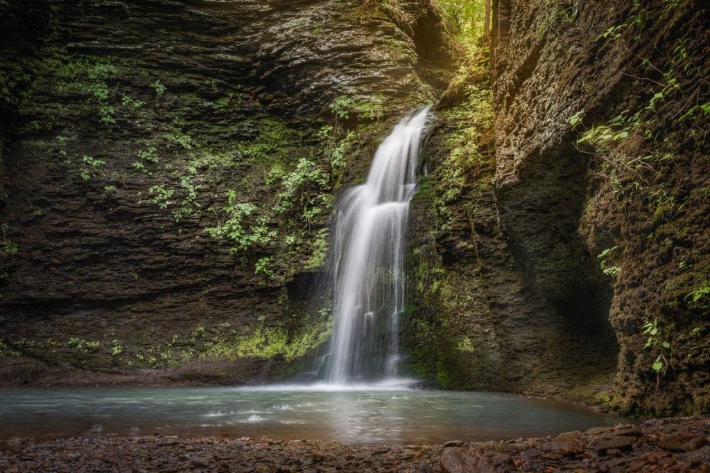
Dam falls, Ritter Springs Park
- Nearest town: In Springfield
- Distance from downtown Springfield: 8 miles (20 minutes)
- GPS coordinates: 37.283906473168955, -93.33944700018088
- Nearby natural attractions: Lost Hill Park, Fulbright Spring Trail, Valley Water Mill Park, Fellows Lake
- Daily Citizen Guide: Yes, click here
- Trail from parking to dam falls: About half a mile one way
If you’re in the mood for a waterfall and only have a couple of hours, take a stroll through Ritter Springs Park on the northwest side of Springfield. The dam falls aren’t big or tall, but they sure are pretty — especially from the bridge near the spring pond. Park near the playground and follow the old road trail to find the spring pond, spring branch and Little Sac River.
Roark Creek Waterfall Trail
- Nearest town: In Branson
- Distance from Springfield: 47 miles (50 minutes)
- GPS coordinates: 36.65247840278587, -93.26565326398693
- Nearby natural attractions: Lakeside Forest Trails, Ruth and Paul Henning Conservation Area, White River Valley Trail System, Busiek State Forrest and Wildlife Area
- Daily Citizen Guide: No, but learn more here
- Trail to waterfall: .6 miles out and back
If you need a waterfall and you need one now, check out the Waterfall Trail along a Roark Creek tributary in the heart of Branson. The trailhead is off Roark Valley Road just north of Shepherd of the Hills Expressway and there is limited parking near the charcoal plant. After parking, walk south on Roark Valley Road back toward Shepherd of the Hills; the trailhead is on the west side of the road. The relatively easy trail follows a creek and passes by nearby lodging. The pretty wooded trail eventually comes to the waterfall. While it doesn’t match the waterfalls you find in Arkansas, it’s a nice little outdoor excursion. (Do note, the trail may be impassable after heavy rains.)
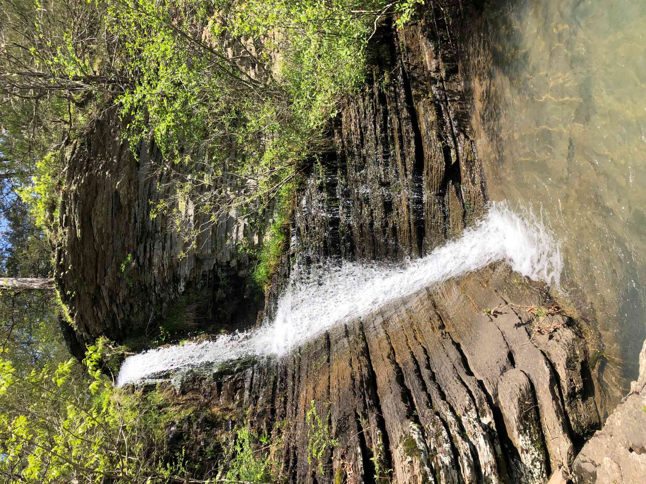
Tanyard Creek Nature Trail Falls
- Nearest town: Bella Vista, Arkansas
- Distance from Springfield: 114 miles (1.75 hours)
- GPS coordinates: 36.47195142060164, -94.26012032187832
- Nearby natural attractions: Pinion Creek Falls, Blowing Springs Park
- Daily Citizen Guide: No, but learn more here
- Trail to falls: .4 miles one way
This 2.2-mile trail system with several loops is something like going to the Springfield Nature Center or Valley Water Mill Park. It’s a beautiful, natural, family-friendly park near an urban setting. Tanyard Creek Falls, reached directly via an easy .4-mile one-way section of the trail, is only one of this creek-centered park’s outstanding points of interest. You’ll also find a downhill “rapids” area near a pretty bridge; creek-walkable areas off one of the trails; a view of Lake Windsor; a side trail to interesting rocky formations; and a swinging bridge. While the trails are easy, it’s an uphill walk to see the falls and uphill even farther to see the spillway at Lake Windsor. If you have time, also drive over to see nearby Pinion Creek Falls.
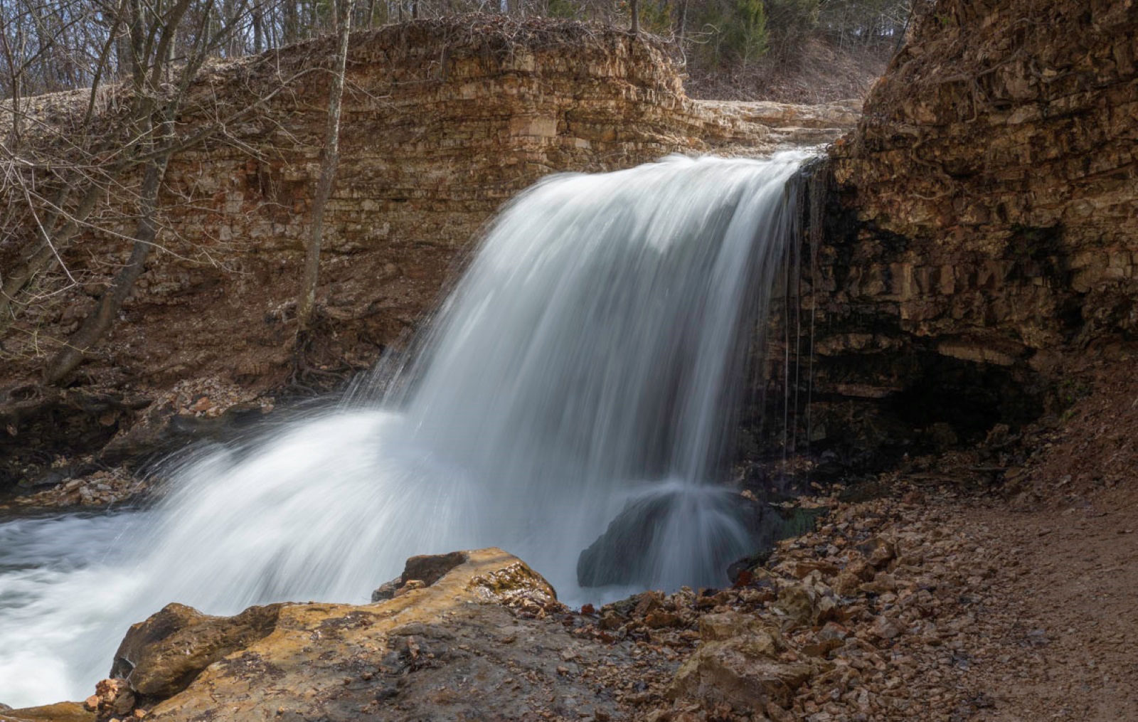
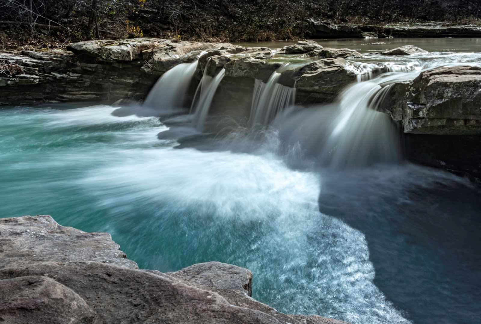
Triple (aka Twin) Falls near Camp Orr
- Nearest towns: Ponca, Compton and Mt. Sherman, Arkansas
- Distance from Springfield: 104 miles (2 hours)
- GPS coordinates: 36.0571944952775, -93.25504507932169
- Nearby natural attractions: Upper Buffalo National River and area trails
- Daily Citizen Guide: No, but learn more here
- Trail to base of falls: About 800 feet one way
Whether you call it Twin Falls or Triple Falls, it’s an easy walk down a level path to reach the base of this beautiful waterfall area near the Boy Scouts’ Camp Orr. But take your four-wheel drive vehicle to reach it (or go really, really slow): The gravel road to the trailhead can be steep and bumpy. But once you reach the trailhead, it’s a short walk along the creek to reach the base of the falls. (If you have the time or capability, you can also hike up to the top for a half-mile hike.) This oft-photographed waterfall was originally named Twin Falls but it’s most often a triple after good rains.
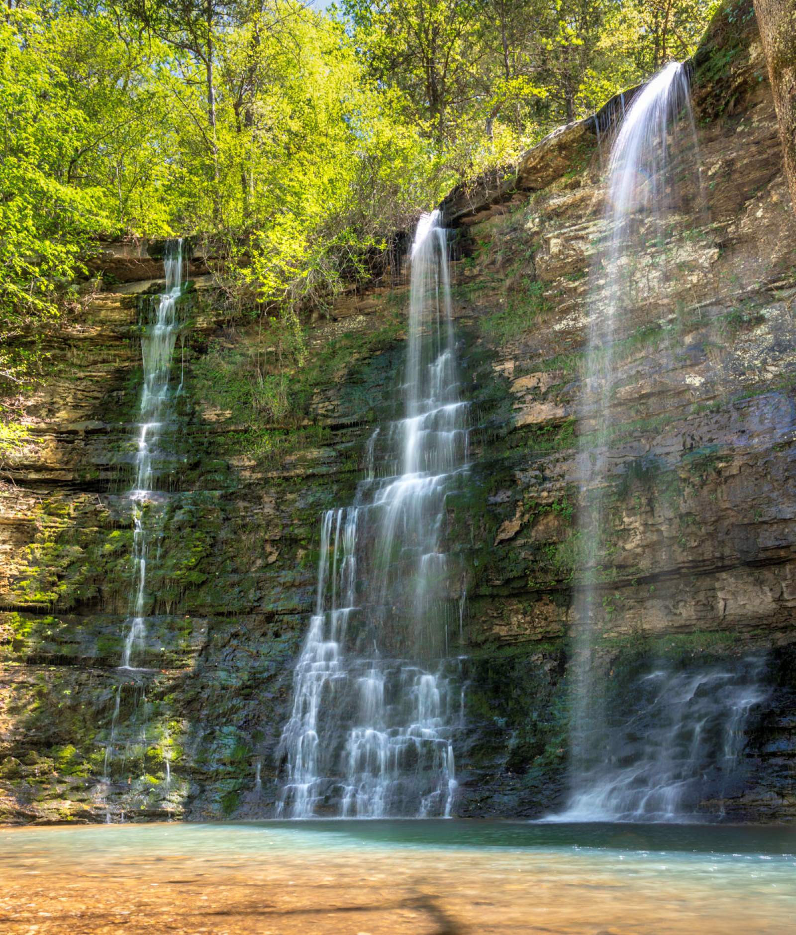
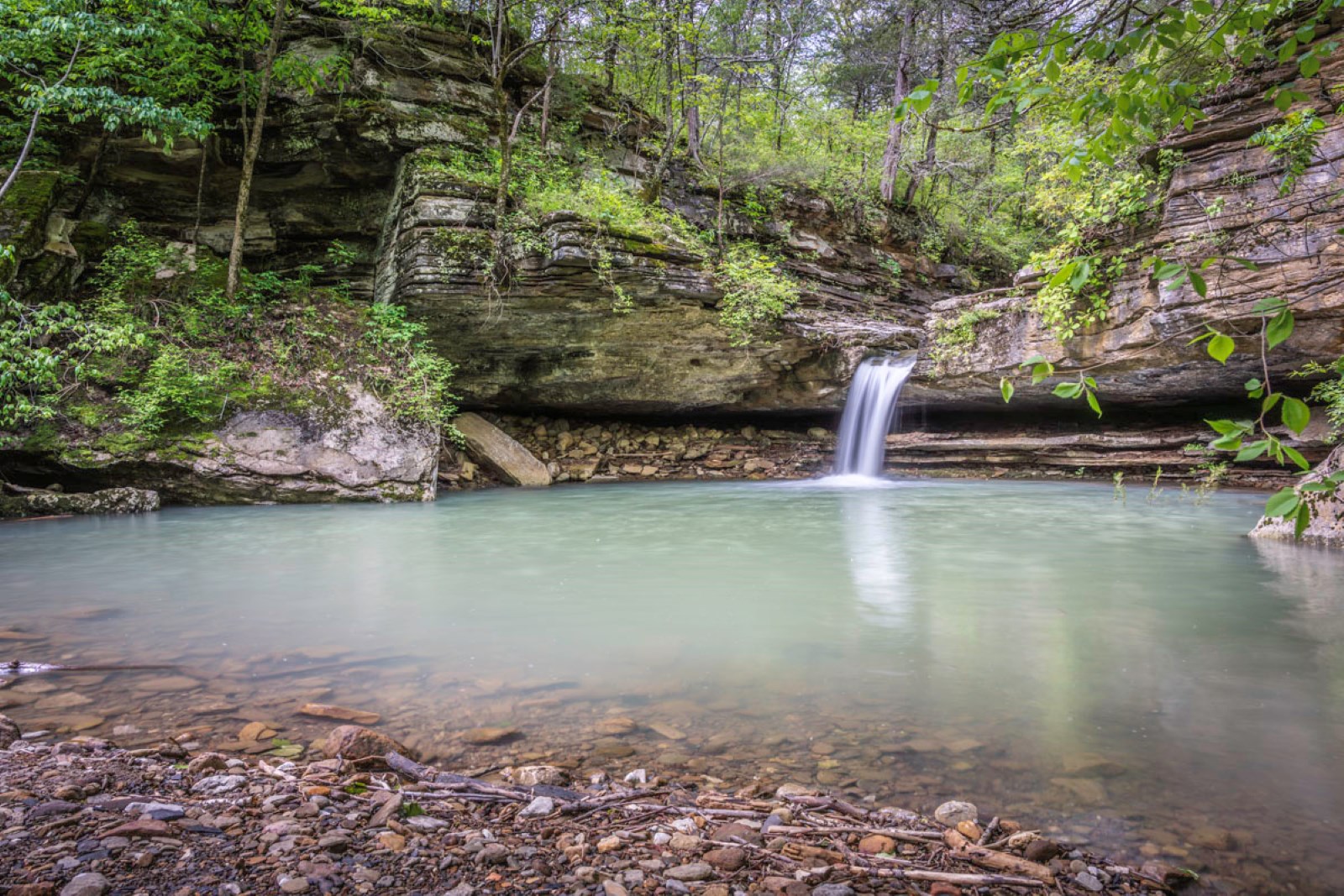
Kings River Falls
- Nearest town: Witter, Arkansas
- Distance from Springfield: 126 miles (2.33 hours)
- GPS coordinates: 35.89473280125273, -93.58341517599433
- Nearby natural attractions: Kings River, War Eagle Creek
- Daily Citizen Guide: Yes, click here
- Trail to main falls: 1 mile one way
An isolated but easy-ish 2-mile out-and-back trail leads to Kings River Falls, one of our favorite waterfall areas to enjoy for a picnic and photography. The scenic trail includes plenty of pretty cascades along the way. At the Kings River Falls, plan to explore and stay awhile. In the summer, the pool below the falls becomes a popular swimming hole. And bonus: There’s a hilly cascade you can climb near the main falls if you are so inclined. Do note that while this trail is mostly level and relatively short, it’s also rocky and uneven in many spots, plus you’ll cross a small metal bridge and encounter wet areas after rain.
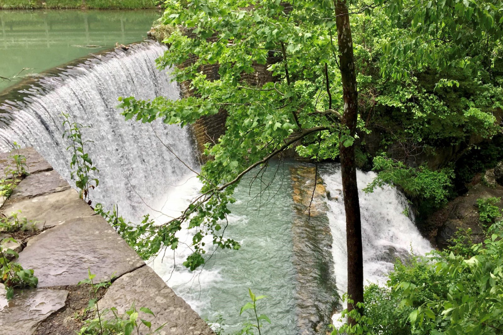
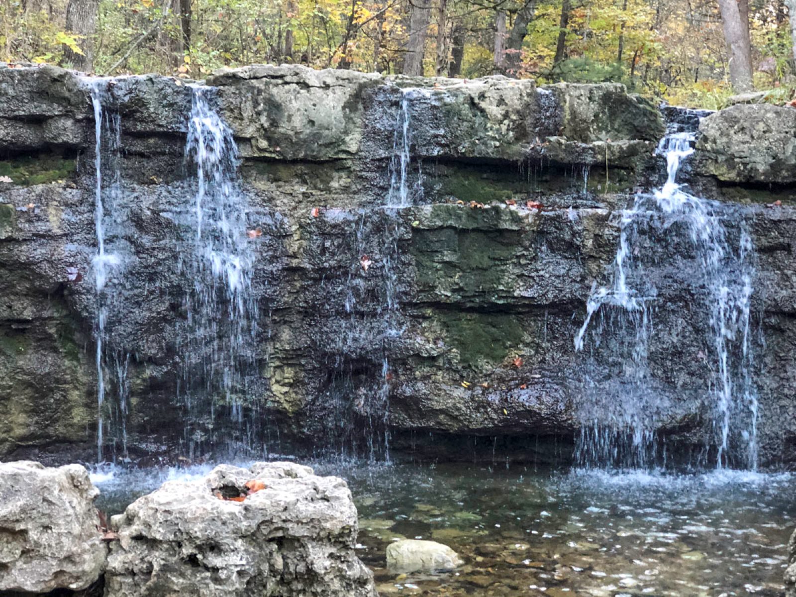
Blanchard Springs Falls and Mirror Lake dam falls
- Nearest town: Mountain View, Arkansas
- Distance from Springfield: 155 miles (3 hours)
- GPS coordinates: 35.969416796485426, -92.17031724931161
- Nearby natural attractions: Blanchard Springs Caverns, White River, Gunner Pool Recreation Area
- Daily Citizen Guide: No, but learn more here
- Trail to falls: .2-mile out and back (ADA) for Blanchard Springs Waterfall; .9-mile out and back for Mirror Lake and dam falls
Blanchard Springs Recreation Area — a nice destination for a weekend road trip — features easy-to-see waterfalls, a pretty lake for fishing, camping and picnic areas, plus the nearby Blanchard Springs Cavern where you can book a ticketed tour through the intricate cave system. It’s also a nice day trip if you’re staying in or near Mountain View for its music festivals or fishing on the White River. Blanchard Springs has two short trails leading to waterfalls. A paved trail, only a tenth of a mile one way, leads to Blanchard Springs and its low waterfall emerging from a cave. (There’s another waterfall flowing down a hill to the left of the spring.) The other easy waterfall is actually a dam flow from Mirror Lake. That designated .9-mile out-and-back trail takes you along the lake and includes a view of the waterfall from the top, but you can follow more trail down to the creek level and base of the falls.
Paige & Broadwater Hollow Falls
- Nearest town: Compton, Arkansas
- Distance from Springfield: 95 miles (1.75 hours)
- GPS coordinates: 36.10538140159696, -93.26419467208298
- Nearby natural attractions: Buffalo National River and many nearby trails
- Daily Citizen Guide: Yes, click here
- Trail to falls: Less than half a mile out and back
These two falls — and several more small falls and cascades — were featured in a recent full-length guide, but the trail to reach them is so short we included them on this list, too. The gravel road drive to Paige and Broadwater Hollow Falls is two miles downhill, but once you park, you’ll see waterfalls in a matter of minutes. While the trail is natural and narrow in places, it’s not hard for people who can handle rocks and roots. Learn all about the trail in this comprehensive guide.
Note: The next three waterfalls in this list are all in the same area and make a good day out. We are including them here and you’ll find more details in this previous hiking guide.
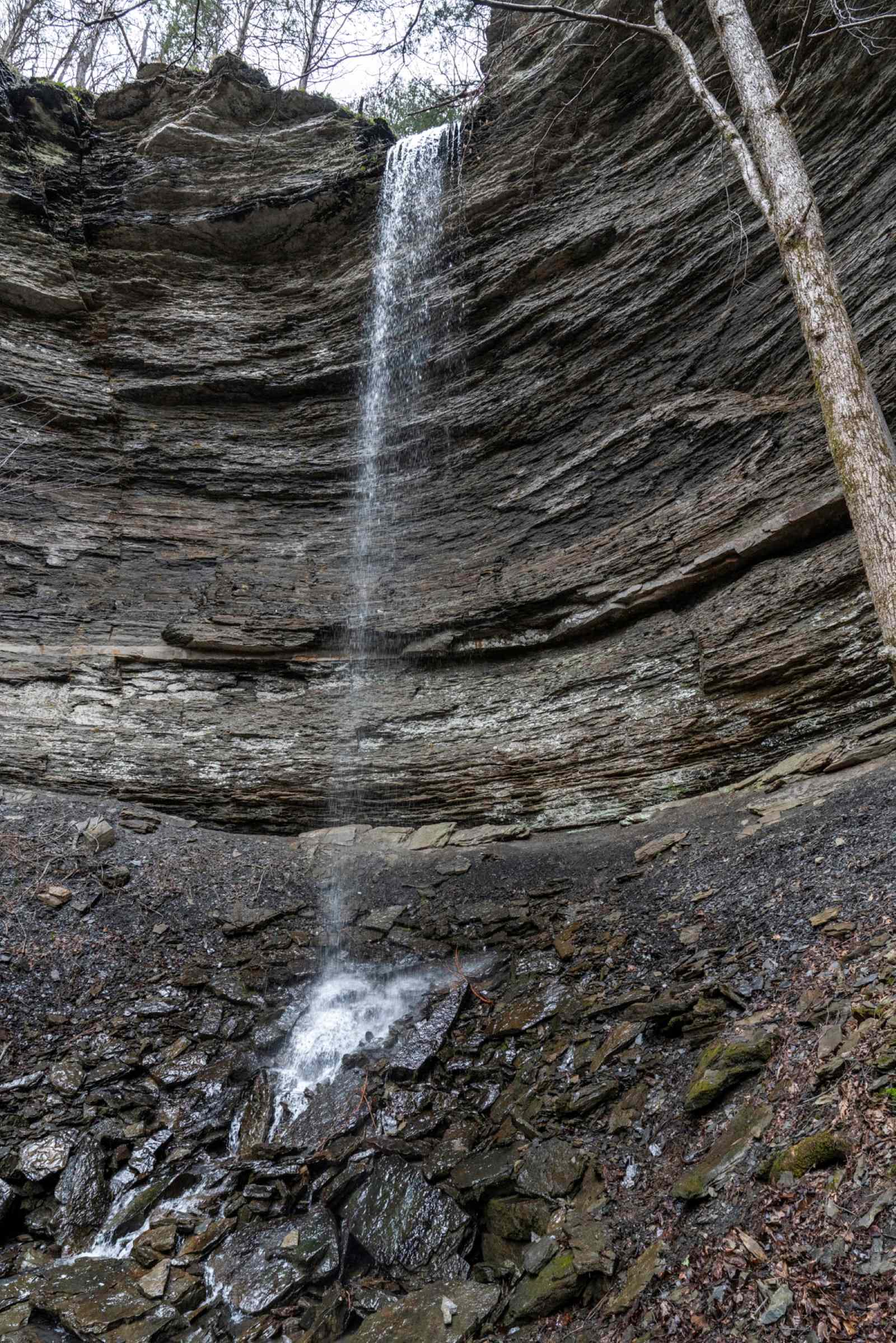
Terry Keefe Falls
- Nearest town: Ben Hur, Arkansas
- Distance from Springfield: 138 miles (2.66 hours)
- GPS coordinates: 35.765565599582736, -92.9333724933329
- Nearby natural attractions: Falling Water Falls, Six Finger Falls, Fuzzy Butt Falls, Intersection Falls
- Daily Citizen Guide: Yes, click here
- Trail to waterfall: 1.1 miles out and back (easy to moderate)
This 78-foot grotto waterfall is best viewed after good rains. You’ll reach it via a 1.1-mile out-and-back trail off the road, less than half a mile downstream of Six Finger Falls (on the side of the road opposite the creek and described in our Part 1 roundup). The extraordinarily pretty trail isn’t hard or long, but it’s narrow and goes steadily uphill to the waterfall. However, we hiked it near a family with young kids and they all did just fine. The best way to find the unmarked trail is to review this Daily Citizen guide which includes a photo of the trailhead and detailed directions.
Fuzzy Butt Falls
- Nearest town: Ben Hur, Arkansas
- Distance from Springfield: 138 miles (2.75 hours)
- GPS coordinates: 35.76386, -92.93839
- Nearby natural attractions: Falling Water Falls, Six Finger Falls, Terry O’Keefe Falls, Fuzzy, Intersection Falls
- Daily Citizen Guide: Yes, click here
- Trail to falls: 2 miles out and back (easy to moderate)
According to an Arkansas tourism site, Fuzzy Butt Falls is officially called Box Canyon Falls — but most hikers know it by its humorous moniker bestowed by regionally famous waterfall hunter/photographer Tim Ernst in his book “Waterfalls of Arkansas.” The trailhead is found about three miles downstream from Falling Water Falls, just prior to crossing a low-water bridge. The trail is two miles out and back and easy to follow, but it does include some hill-climbing and can be wet in some areas. The grotto waterfall is in a fairy-like setting, plus along the trail, you’ll cross a small creek with a bonus waterfall. Do note: The trail to Fuzzy Butt Falls, like other nearby waterfalls, is not marked. But we have detailed directions in this Daily Citizen guide to the easy Richland Creek Recreation Area waterfalls as a group.
Intersection Falls
- Nearest town: Ben Hur, Arkansas
- Distance from Springfield: 137 miles (2.66 hours)
- GPS coordinates: 35.75821, -92.93647
- Nearby natural attractions: Falling Water Falls, Six Finger Falls, Terry O’Keefe Falls, Fuzzy Butt Falls
- Daily Citizen Guide: Yes, click here
Upstream from Six Finger Falls, the trail to this waterfall is just past an intersection but otherwise hard to find. Use the GPS coordinates and look carefully for the trail off the road. The trail is fairly short but, near the last part, a bit steep as you near the creek. The waterfall tumbling off the bluff is nice, but the beautiful cascade area makes this trail worth doing. Do note: Intersection Falls, like three others in this list, are not marked trails. But we have detailed directions in this Daily Citizen guide to the easiest Richland Creek waterfalls as a group.
Find more Daily Citizen outdoor guides
Natural outdoor areas are among our community’s greatest assets. That’s why the Daily Citizen features a rich array of Ozarks getaway and hiking guides — many with wonderful waterfalls. These guides — some of which are linked within this roundup — include map links, photos, way-finding information and details from first-hand experience to help readers know what to expect.
To find our list of guides, visit the Daily Citizen website and look for “Things to Do” at the top. Select Springfield Area Guides from the drop-down menu. The best guides for waterfalls (or any outdoor adventure) are under “Nearby Roadtrip Destinations” and “Hiking Guides.”
Keep checking back: We add new guides most months.
Reminder: Bugs, snakes, ticks, slippery rocks and other hazards may be encountered in any wilderness area. Outdoor areas in this series are described from the firsthand experience of an average-ability hiker, however, readers must determine their own abilities.