There is nothing like that first step onto a nature trail on Day One of a new year. Breathe in — you breathe better in the woods — and let it go.
The crunch of old leaves underfoot, the whisper of a breeze punctuated with bird calls or the scurry of a squirrel — it simply feels fresh. Cleansing. New.
Goodbye 2023; hello 2024.
Getting outdoors is my favorite way to start a new year, and if that appeals to you — even if you’re not a typical hiker — the First Day Hikes program can help.
This nationwide initiative launched by America’s State Parks offers hundreds of guided hikes each January 1. Last New Year’s Day, nearly 55,000 people collectively hiked more than 133,000 miles nationwide according to the American Hiking Society. And no wonder: Across our nation, 8,565 state parks provide 14,672 trails comprising 53,603 miles. That includes state parks with a plethora of paths within the Missouri and Arkansas Ozarks.
To help you plan your hike, check out our roundup of First Day guided hikes in Missouri and Arkansas state parks that you can reach between 30 minutes and no more than two-and-half hours. The shortest trails are half a mile, the longest is seven miles. Trail levels range from easy to moderately difficult. (Find the drop-down lists just below.)
Or if you want to hike on your own, we’ve got some great winter trail ideas for you, too (look for the dropdown below guided hikes).
Ready for a great year ahead in the Ozarks outdoors? Look for more handy hiking guides to come in 2024.
While hiking on New Year’s Day isn’t always possible, a winter hike anytime late December into January is a great way to get out of the house. Use this guide for whenever you can get out!
Winter hiking tips
Whether you hike on your own or join a guided hike, follow these winter hiking tips. For more tips, visit americanhiking.org/first-day-hikes and arkansasstateparks.com/first-day-hikes.
- Dress for the weather and wear warm layers. Your base layer should be a wicking fabric to pull your sweat away from the skin. It’s better to wear layers you can peel off and put on than a thin layer with a heavy ski parka. Prevent overheating under layers because excessive moisture can freeze, causing hypothermia.
- Bring gloves and a hat.
- Wear sturdy shoes or boots with traction. Some trails may include potential mud or water crossings so waterproof boots are helpful.
- Bring water and snacks. If it’s very cold, consider bringing warm water; use insulation to keep it warm.
- Wear sunscreen — even a winter sun can burn.
- Pack first aid items in your backpack and include a flashlight in case you are on the trail too late with short winter days that turn dark early.
- Avoid hiking if you are experiencing cold, flu or COVID symptoms.
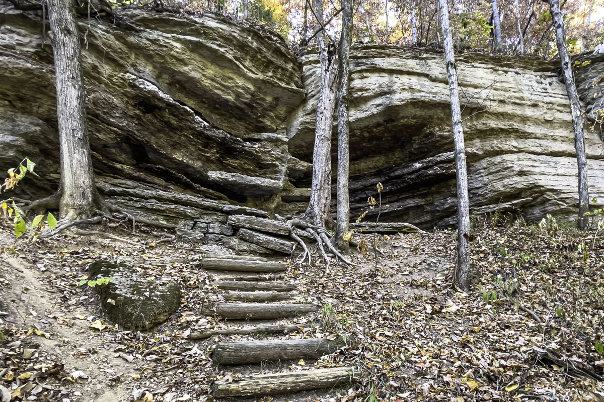
Missouri First Day Guided Hikes
First Day Hikes at Missouri State Parks are free but may be limited in size. Participants must preregister to join a hike. To register for any hike, click here and use the “choose date” box, selecting 01/01/2024, to find the hike event listing. Pets are welcome on a leash for most hikes unless otherwise noted.
Guided First Day hikes listed below are no more than two-and-a-half hours from Springfield. Visit mostateparks.com for more First Day Hikes farther away.
Click here for our list of nearby Missouri First Day Hikes.
Bennett Spring State Park, Lebanon
- From Springfield: 1 hour northeast
- Trail: Natural Tunnel Trail
- Distance: 7.4 miles
- Difficulty: Moderately difficult
- Meet: Natural Tunnel Trailhead
- Time: 10 a.m.-4 p.m.
- More: Bring a lunch to enjoy at the 296-foot-long natural tunnel with a guiding naturalist (limit 30). For shorter, self-guided 1-mile hikes (no registration), try Bridge, Oak-Hickory or Whistle trails. In addition, the nature center (normally closed in January) will be open 10 a.m.-4 p.m. Call the park at 417-532-3925 for help or check the Facebook group.
- Learn more here.
Big Sugar Creek State Park, Pineville
- From Springfield: 1 hour, 50 minutes southwest
- Trail: Ozark Chinquapin Trail
- Distance: 3.3 miles
- Difficulty: Moderate
- Meet: Ozark Chinquapin Trail trailhead
- Time: 9:30 a.m.-12:30 p.m. (suggested to meet at 9)
- More: Be prepared for potential water crossings (waterproof boots recommended). Hikers under 18 must be accompanied by an adult. Trailhead is located on the south side of the park, on Big Sugar Creek Road. Call 417-847-3742 or visit the Roaring River State Park Facebook page for updates.
- Learn more here and here.
Nathan and Olive Boone Homestead State Historic Site, Ash Grove
- From Springfield: 30 minutes northwest
- Trails: Portions of Spring Box, Interpretive and Prairie View trails
- Distance: 2 miles
- Difficulty: Moderately difficult
- Meet: Picnic shelter
- Time: 10 a.m.-noon
- More: Visit a once-thriving 19th century homestead while learning the Boone Homestead history and stories from Ash Grove past (limit 35). Call 417-751-3266.
- Learn more here and here.
Bryant Creek State Park, Ava
- From Springfield: 90 minutes southeast
- Trail: Section of Pine Hollow Trail
- Distance: 3.25-mile loop
- Difficulty: Moderately difficult
- Meet: At the park’s main trailhead
- Time: Noon-3:30 p.m.
- More: Not recommended for ages 4 and under unless they are carried; please leave pets at home. A mobility track chair is available for the first mile (reserve 48 hours in advance). Call 417-683-2520.
- Learn more here and here.
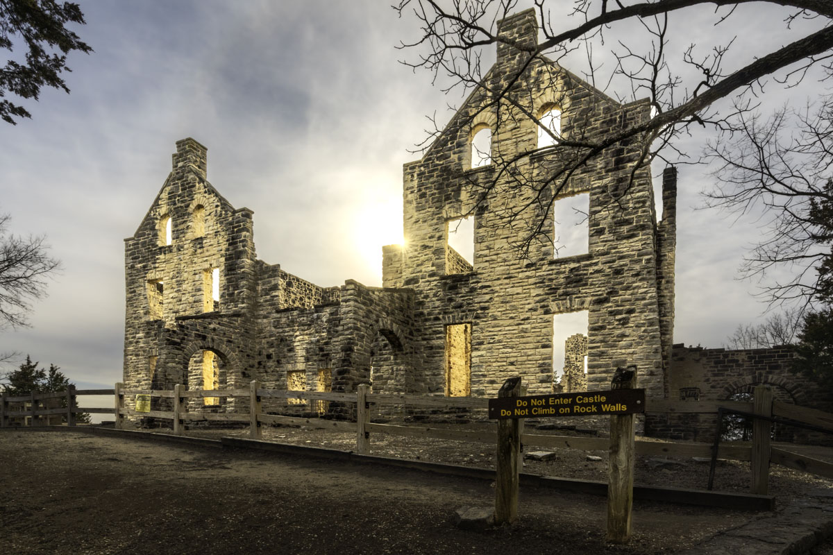
Ha Ha Tonka State Park, Camdenton
- From Springfield: 1.3 hours northeast
- Trail: Spring Trail
- Distance: About 2 miles
- Difficulty: Moderate
- Meet: Spring Trail trailhead near the lake parking lot
- Time: 9 -11 a.m.
- More: Learn about park history while hiking to the spring, up the 316 steps to the castle ruins and back. A hiking stick is recommended.
- Learn more here and here.
Lake of the Ozarks State Park, Kaiser
- From Springfield: 1 hour 40 minutes northeast
- Trail: Hidden Springs Trail
- Distance: 2.5 miles
- Difficulty: Moderately difficult
- Meet: Hidden Springs trailhead, 3.5 miles south of the park office at 403 Highway 134, Kaiser
- Time: Noon-2 p.m.
- More: A natural surface trail with 10% steep grade. Call 573-690-0450 for more information.
- Learn more here.
Montauk State Park, Salem
- From Springfield: 2 hours 10 minutes northeast
- Trail: Pine Ridge Trail
- Distance: Just under 2 miles
- Difficulty: Moderately difficult
- Meet: Naturalist office/Nature Center by the old hatchery
- Time: 10 a.m.-noon
- More: Includes some steep sections through a ridge of mature pines. Call 573-548-2225.
- Learn more here and here.
Roaring River State Park, Cassville
- From Springfield: 1.5 hours southwest
- Trail: Devil’s Kitchen Trail
- Distance: 1.5 miles
- Difficulty: Moderate
- Meet: Devil’s Kitchen trailhead across from the CCC Lodge
- Time: 1-3 p.m.
- More: Hike to the limestone bluff and to the Devil’s Kitchen rock feature; bring a flashlight if you go into a cave. Trail is steep in some places and could be muddy. Call 417-847-3742 or visit the Roaring River State Park Facebook page for updates.
- Learn more here and here.
Table Rock State Park, Branson
- From Springfield: 1 hour south
- Trail: Table Rock Lakeshore Trail
- Distance: About 2 miles
- Difficulty: Easy
- Meet: Table Rock Lakeshore trailhead in the State Park Marina parking lot
- Time: Noon-2 p.m.
- More: The relatively flat paved trail runs along the lake shore from the State Park Marina to the U.S. Army Corps of Engineers Dewey Short Visitor Center adjacent to the dam. Call 417-334-4704.
- Learn more here and here.
Ruth and Paul Henning Conservation Area, Branson
While not a state park, the Missouri Department of Conservation (MDC) is hosting a First Day Hike at the 1,534-acre conservation area on the west side of Branson. MDC’s Shepherd of the Hills Conservation Center staff will lead the two-hour hike.
- From Springfield: Less than 1 hour south
- Trail: To be determined
- Distance: About 1.5 miles
- Difficulty: Moderate
- Meet: Henning area’s main parking lot, U.S. 76/376, three-fourths of a mile west of the Butterfly Palace.
- Time: 10 a.m.-noon
- More: Register for the hike on the MDC website. Staff suggest bringing binoculars for wildlife viewing. For more information, call 417-334-4865, ext. 0.
- Learn more here and here.

Arkansas First Day Guided Hikes
Guided First Day Hikes at Arkansas state parks are free and found throughout the state. Participants who hike in a park the New Year weekend, Dec. 30-Jan. 1, will receive a “Hike Arkansas State Parks” sticker, either at a guided event or by filling out a form available Dec. 30.
Guided hikes listed below are no more than two-and-a-half hours from Springfield.
Learn more about First Day Hikes in Arkansas State Parks, or find a hike farther away if you will be traveling, on the parks website at arkansasstateparks.com.
Click here for the list of nearby Arkansas First Day Hikes.
Withrow Springs State Park, Huntsville
- From Springfield: 2 hours southwest
- Trail: Cabin Loop Trail
- Distance: 0.5-mile loop
- Difficulty: Lightly moderate
- Meet: Woolly Cabin next to visitors center
- Time: 2-3 p.m.
- More: Explore the 1800s Woolly Cabin Homestead
- Learn more here.
Bull Shoals-White River State Park, Bull Shoals
- From Springfield: 2.25 hours southeast
- Trail: Big Bluff Trail
- Distance: 1.75 miles
- Difficulty: Moderately strenuous
- Meet: Big Bluff Trailhead
- Time: 9 a.m.-11 a.m.
- Learn more here.
Hobbs State Park-Conservation Area, Rogers
From Springfield: 2.25 hours southwest
Several First Day Hikes are happening at Hobbs (see below). Before or after your hike, enjoy a campfire, hot drinks and s’mores between 11 a.m. and 4 p.m. at the visitors center.
- Trail: Ozark Plateau Trail
- Distance: 0.5 mile
- Difficulty: Easy / ADA accessible
- Meet: Education Pavilion near the visitors center
- Time: 11-11:45 a.m.
- More: Learn how animals survive in winter
- Learn more here.
- Trail: Historic Van Winkle Trail
- Distance: 0.5 mile
- Difficulty: Easy / ADA accessible
- Meet: Van Winkle Trailhead
- Time: Noon-1 p.m.
- More: Learn about the Van Winkle family and their 1870s mill.
- Learn more here.
- Trail: Shaddox Hollow Trail
- Distance: 1.5-mile loop
- Difficulty: Moderately difficult
- Meet: Shaddox Hollow Trailhead
- Time: 2-3:30 p.m.
- More: Learn about park geology and the Shaddox family that settled there.
- Learn more here.
Prairie Grove Battlefield State Park, Prairie Grove
- From Springfield: 2.5 hours southwest
- Trail: Battlefield Trail
- Distance: 1-mile loop
- Difficulty: Easy
- Meet: Battlefield Trailhead next to the Latta Barn
- Time: 2-3 p.m.
- More: Enjoy nature while learning about the Civil War battle.
- Learn more here.
Plan your own hike!
Last New Year’s Day, we drove to the Ponca area and did a section of the Buffalo River Trail between Ponca and Steel Creek. It’s one of many trails in the Buffalo National River area that make a good first day hike. Or stick close to home: The Springfield metro area has a number of trails that are particularly nice in the winter. In this section you will find suggestions for winter hikes (including photos and links to previous Daily Citizen hiking guides):
- In and around Springfield metro
- Around the Missouri Ozarks
- Around the Arkansas Ozarks
Click here for on-your-own suggestions.
Winter hikes in and around Springfield metro
Springfield Conservation Nature Center, Southeast Springfield — One of Springfield’s easiest trail areas to access for bird-watching and lake-gazing for the whole family. You’ll find several options whether you want a short hike or something longer. Learn more about Nature Center trails in Daily Citizen guides here and here.
Lake Springfield, Southeast Springfield — Lake Springfield trails provide a brisk walk with water views and plenty of woods to wander. (Or if it’s nice enough, put in your kayak for a winter float!) Learn more about Lake Springfield trails in Daily Citizen guides here and here.
Fellows Lake, Northeast Springfield — With more than 25 Dirt 66 trails at Fellows Lake, you’re sure to find a trail for New Year’s Day. Learn more about Fellows Lake trails in Daily Citizen guides here and here.
Wilson’s Creek National Battlefield, Republic — Not only can you walk the tour road, the battlefield has a network of trails crossing through the grounds. Learn more about Wilson’s Creek Battlefield trails in this Daily Citizen guide.
Valley Water Mill Park, Northeast Springfield — This great park features a lake, wooded trails and nice overlooks, perfect for a winter hike. Learn more about Valley Water Mill Park in this Daily Citizen guide.
Ritter Springs Park, Northwest Springfield — For a taste of wilderness in a city park, hike the trail at Ritter Springs Park in the rural part of northwest Springfield. Learn more about the park in this Daily Citizen guide.
Two Rivers Bike Park, south of Nixa — Yes, it’s a bike park. Yes, you can hike the trails. In fact, they are particularly great to hike in winter when you can see the two rivers. Learn more about hiking the bike park in this Daily Citizen guide.
Any Ozark Greenways trail — Too many great trails to name only a few but you can find a list on the Greenways website for a trail near you.
Around the Missouri Ozarks
Lake Forest Wilderness Trail, Branson — You would never know you’ll encounter great wilderness and wooded areas when you turn off for this trail area in the heart of Branson. But there it is — a wonderful escape an hour from Springfield. Learn more about the trail system in this Daily Citizen guide.
Roaring River State Park, Cassville — The park has a guided hike on New Year’s Day (see our list) but the park has multiple trails of all levels you can do if you prefer to go on your own. This beautiful river park is less than 90 minutes from Springfield. Learn more about the park and its trails in this Daily Citizen guide.
Cedar Gap Conservation Area, near Seymour — This short, albeit hilly trail is a delight and only 35 minutes from Springfield. The trail leads to an old cabin and includes a creek, woods and a plateau. Learn more in this Daily Citizen guide.
Alley Mill and Spring Trail (and other springs), Eminence — The iconic red mill and spring near Eminence features an easy trail anyone can do. It’s a perfect first day out destination, especially because it’s close to four other great spring and waterfall spots that are easy to see (although given short days, choose no more than three). Learn more about five scenic areas in this Daily Citizen guide.
Busiek State Forest and Wildlife Area — About 30 minutes south of Springfield, this hilly wilderness area with a creek features a network of trails. Learn more about it on the Missouri Department of Conservation website.
Around the Arkansas Ozarks
Buffalo River Trail between Ponca and Steel Creek, Buffalo National River — This is one of our favorite sections of the BRT. It’s easy to get to and the trail is perfect for winter hiking when you can see the river through bare trees. Learn more about the trail in this Daily Citizen guide.
Sweden Creek Falls Trail, Buffalo National River — About two hours south into Arkansas, not far from Ponca, this is a great hike to a waterfall with two ways to see it. Learn more about the trail in this Daily Citizen Guide.
Lost Valley Trail, Buffalo National River — One of the best first hikes to do in the Buffalo National River this trail is easy in the first mile, then moderate when it leads to two waterfalls and natural bridge. And there’s a challenging bit to a cave. Learn more about the trail in this Daily Citizen Guide.
Kings River Waterfall Natural Area, Witter — About two-and-a-half hours away, this hike is remote but a dream for photographers when the water is running. Not only does it lead to a great waterfall, the trail follows the river and smaller falls and cascades, especially easy to see in the winter. Learn more about this trail in this Daily Citizen Guide.
Round Top Mountain Trail, Northwest Arkansas — This trail leads to a great overview, especially easy to see in winter, and the trailhead is just off Arkansas 7. Learn more in this Daily Citizen Guide.
Alum Cove Natural Bridge Recreation Area, Northwest Arkansas — This trail includes a natural bridge so large, you walk over it to get to the rest of the hike which includes a wet weather waterfall and lots of cool rock formations. Learn more in this Daily Citizen Guide.
Pedestal Rocks Scenic Area, Pelsor — While it’s a little farther to drive for a day, this trail makes a great winter’s day hike because you’ll easily see all the rock formations. Be aware if you have kids: It’s near lots of edges. Learn more in this Daily Citizen Guide.


