
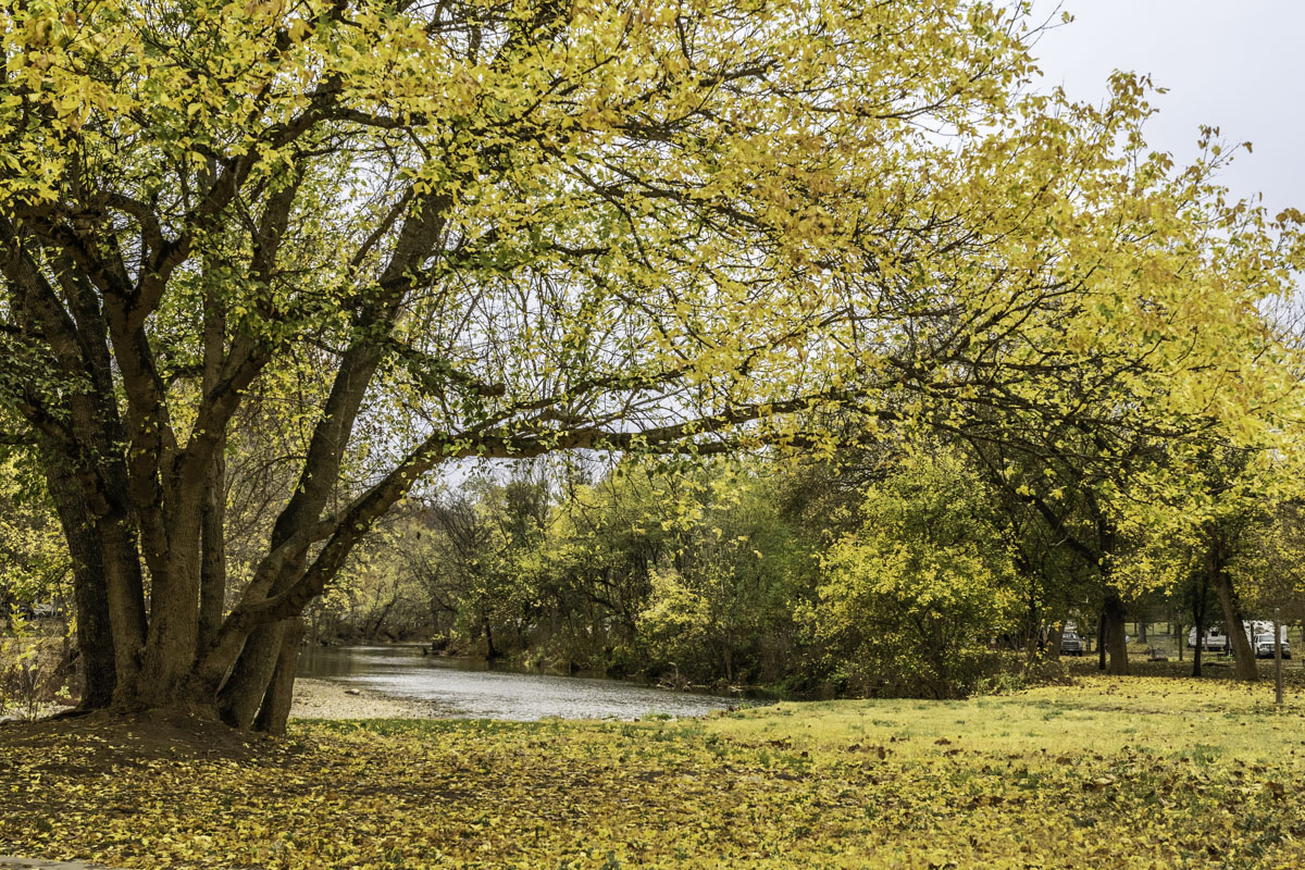
Just south of Cassville, where a scenic highway drops into a winding river valley, you’ll come to Roaring River State Park, a Missouri gem on the edge of the Ozark Plateau. Families, couples, anglers and friends enjoy the scenic park year-round, but it’s especially beautiful when leaves turn in the fall.
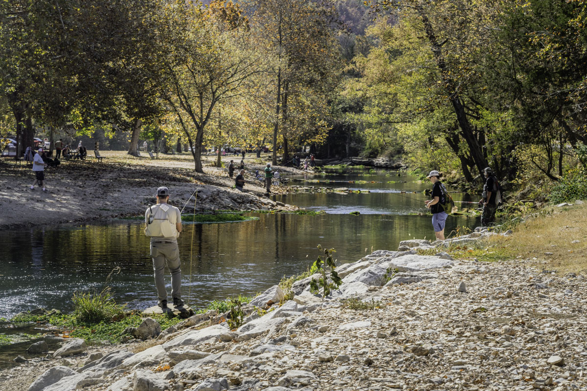
Experienced anglers whip fly rods back and forth from the bank of a favorite pool, while just downriver, moms and dads guide young budding anglers. But if you think Roaring River is only for anglers, think again. This family-friendly park — one of Missouri’s oldest — has something for anyone who enjoys the outdoors.
Like hiking trails? This park has seven. Enjoy the beauty of a natural spring? Roaring River’s spring is Missouri’s deepest.
Your kids or grandkids will love feeding fish at the hatchery. Plus, this park has a plethora of picnic areas, two playgrounds, three campgrounds and a variety of lodging options from modern rooms to rustic cabins.
Of course, there’s trout fishing.
Best of all, the park is just more than an hour’s drive from Springfield. Whether you go for an easy day trip or want to stay a few nights, we’ve got your guide for what to see and do.
What to know first
Roaring River State Park is about 1 hour, 25 minutes from Springfield, an easy drive along rural highways to 12716 Farm Road 2239, Cassville, Missouri. To get you started, we rounded up basic driving directions, park contacts, websites and a short history.
Click here for more information.
From Springfield: Take U.S. Highway 60 to Aurora; turn south on Missouri Highway 39, then west on Missouri Highway 248 to Cassville; from Cassville turn south on Missouri Highway 112 to the park.
Map: Check out the Missouri State Parks website to see a map of the park. A better map is in the park brochure, which you can pick up at the park office, store or nature center when open.
Park information and camping: Visit the Missouri State Parks website or call (417) 847-2539; for camping reservations call (877) 422-6766
Emory Melton Inn & Conference Center, lodging and park store: Visit the Roaring River State Park website; for lodging and dining call (417) 847-2330; for the park store call (417) 847-4971
More online resources: Park photos; On Facebook: Roaring River State Park
Note: The Emory Melton Inn, dining, park store and lodging accommodations are closed November through February. Camping is limited to a few sites in Campground 1 during that time.
History: Like other Missouri wilderness areas, the rugged features around Roaring River were home to indigenous people 5,000-7,000 years ago, and to settlers in the early 1800s. And its rocky terrain hid outlaws during the Civil War.
By the early 1900s, the valley area had become a retreat for wealthy outdoor seekers. One of those, Thomas Sayman from St. Louis, bought 2,400 acres of land around the spring and river, donating it to the state in 1928. That allowed for the development of Roaring River State Park in the 1930s when Civilian Conservation Corps and Works Progress Administration workers built many of the structures that still exist today. They include picnic shelters, the hatchery, many of the trails, cabins and the historic Camp Smokey, now a group camp area. Learn more from the Missouri Department of Natural Resources.
Visit the hatchery and spring
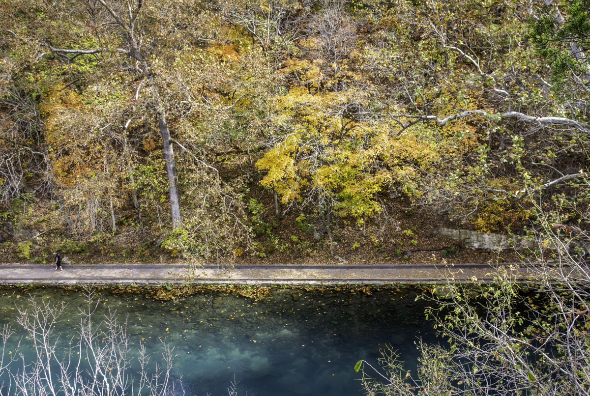
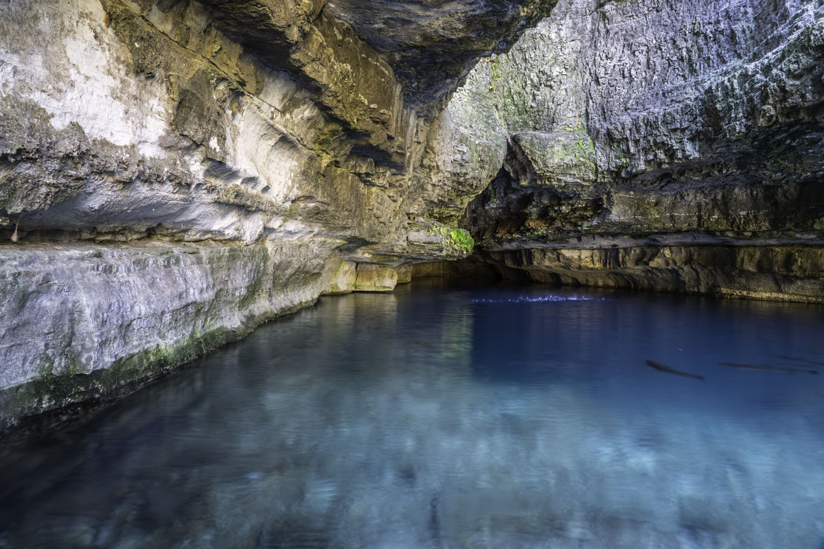
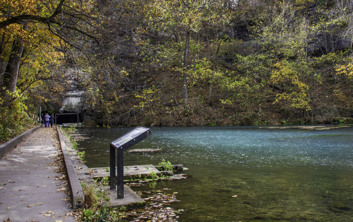
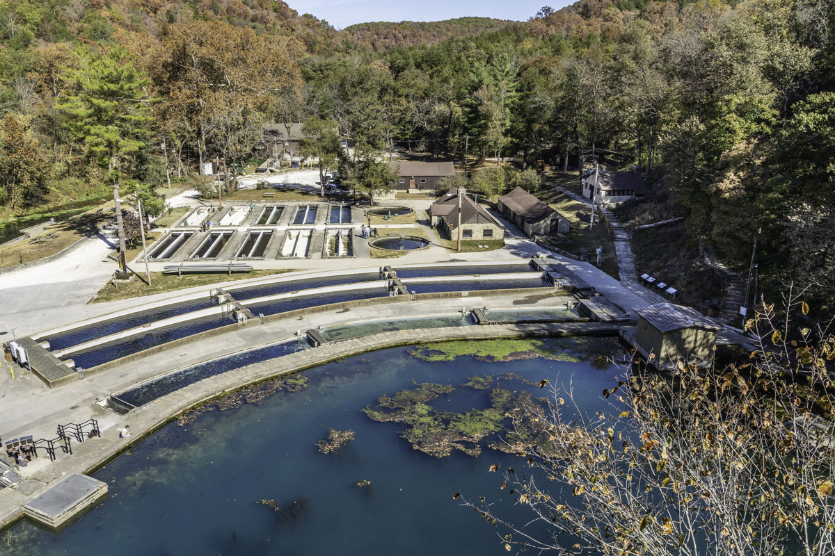
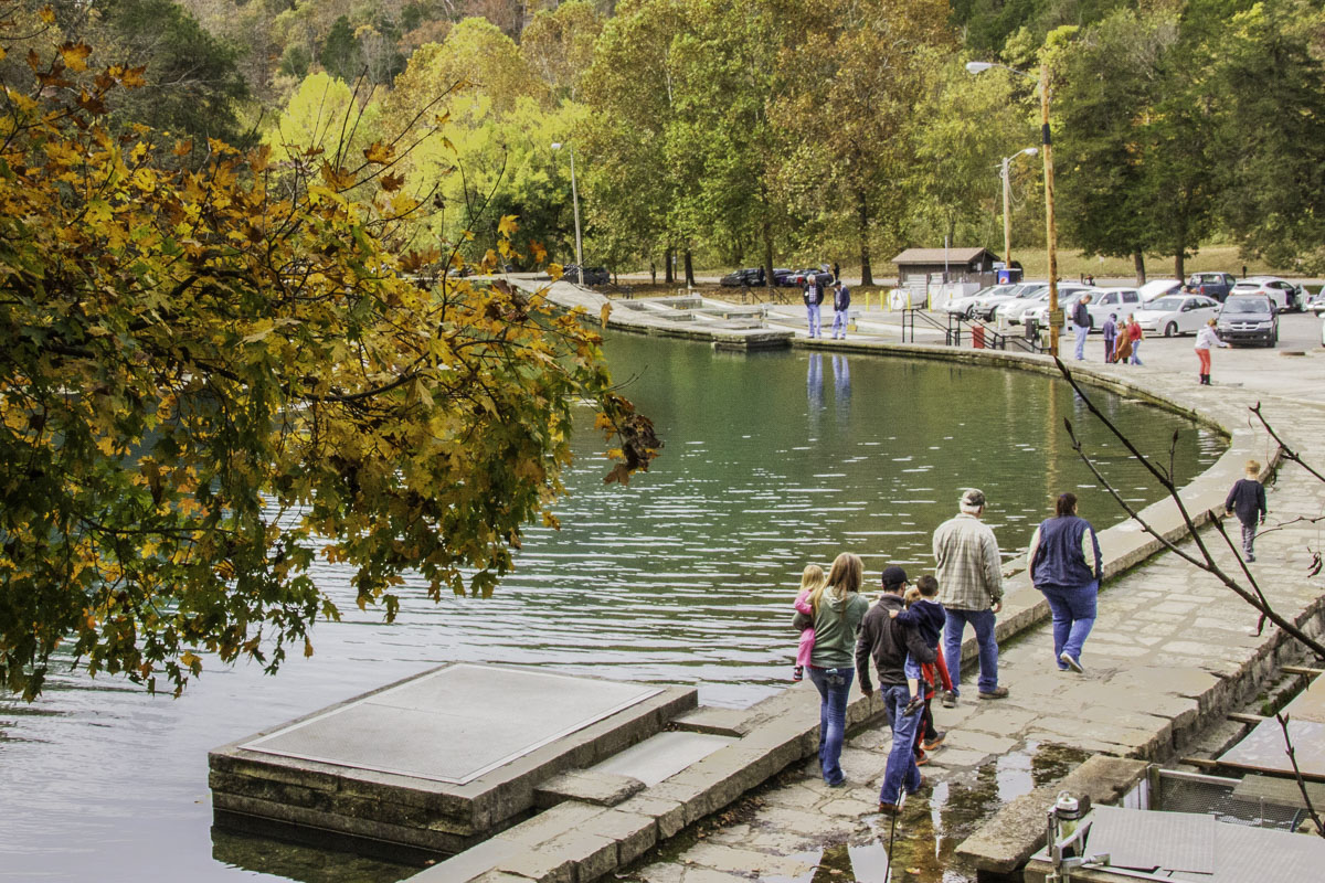
If you’ve never been to the park, start your adventure at the hatchery and spring. The must-see Roaring River Spring entices visitors of all ages to make the short pilgrimage along a paved path to its deep gorge. Here the clear spring, appearing turquoise, produces a daily average of 20.4 million gallons of water from deep within an underground cave, making it Missouri’s 20th largest spring by flow.
In recent years, it has also been designated Missouri’s deepest spring after divers explored it down to 472 feet in November 2021, setting the record for the deepest explored spring nationwide. And the cave is even deeper than that, the divers have said.
Emerging into a pool, the 57-degree spring water then rushes over a dam, forming the headwaters of Roaring River, a tributary of the White River.
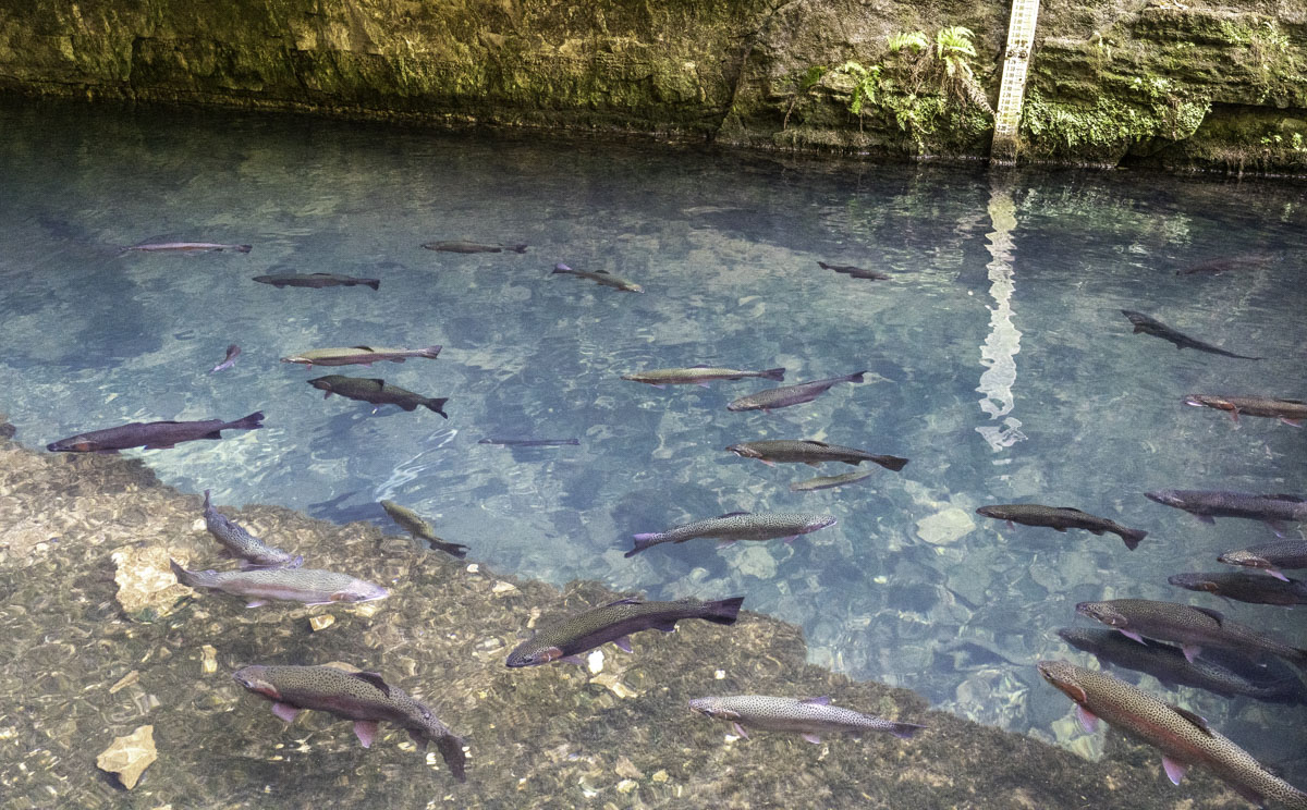
When you walk by the spring pool, look for its resident lunkers. Trout here (where no fishing is allowed) grow huge! The hatchery runs, built along the spring pool, are a favorite of youngsters and it's common to find dozens of families wandering the hatchery on nice weather weekends. The renovated CCC Lodge is also in this section, along with the amphitheater where many programs and occasional live music performances are held. And there are plenty of picnic tables, benches and a playground.
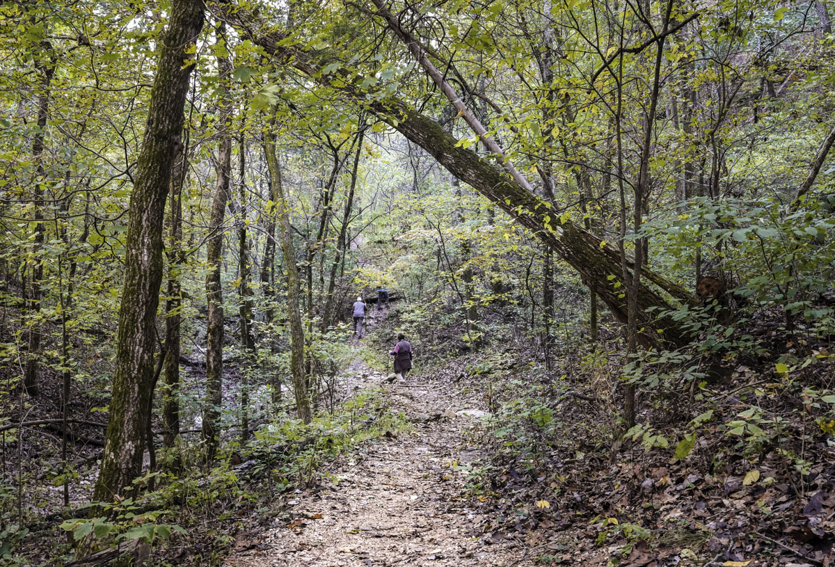
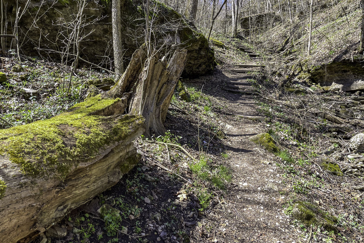
Hike the trails
What makes Roaring River stand out among Missouri trout parks is a 10-mile network of seven trails with varying lengths and challenges. Most trails are relatively short, but may be moderate to challenging for their rugged terrain and elevation gains. Find three trailheads in the section of the park near the hatchery and spring. The short but steep Deer Leap Trail starts just yards from the spring and provides a birds-eye view of the hatchery from above. Dogs on leashes are allowed on trails. Learn more about pet rules on the Missouri State Parks website.
Click here for descriptions and tips for each trail.
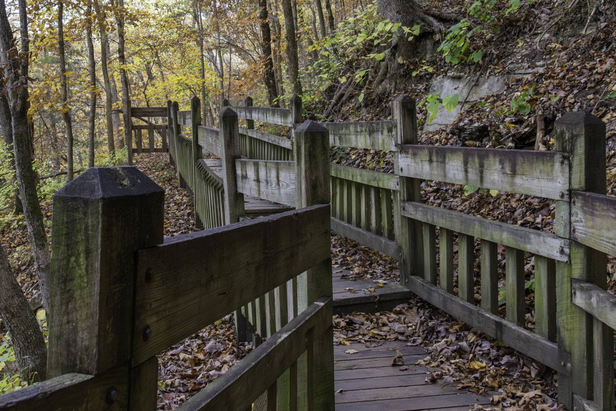
Deer Leap Trail, .2-mile one way: This pretty trail is popular for its proximity to the spring and scenic overlook of the hatchery and pool. But don’t let the short length fool you: The CCC-built trail quickly climbs more than 60 feet via concrete steps and a rocky path. (At its highest level, there’s a connector to the Fire Tower Trail.) At the top, Deer Leap continues over a wooden bridge and walkway — pause to look down over the spring gorge — leading to an overlook of the park’s hatchery and spring pool.
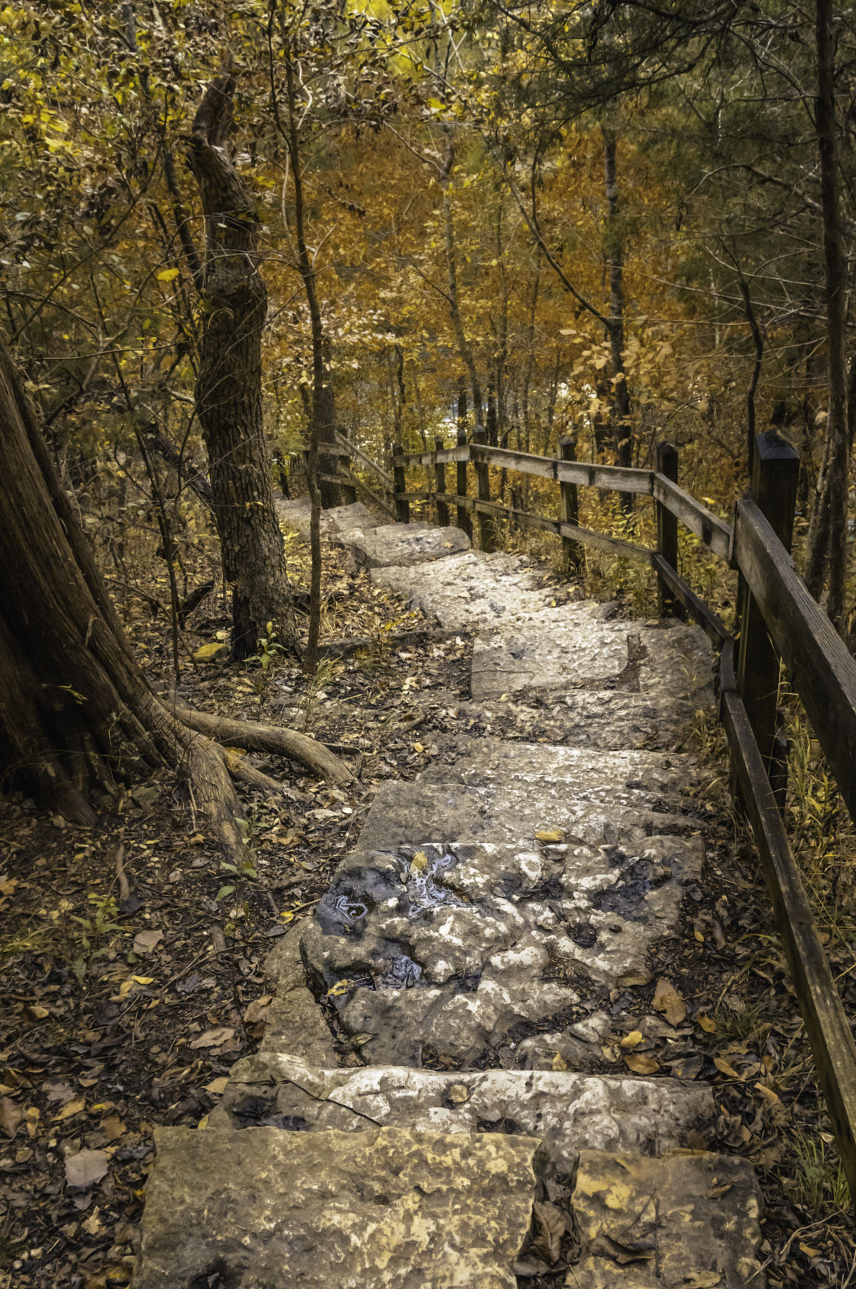
The trail finishes by descending more stone steps to a path leading to the CCC Lodge, or take a bridge over the dam and back to the hatchery.
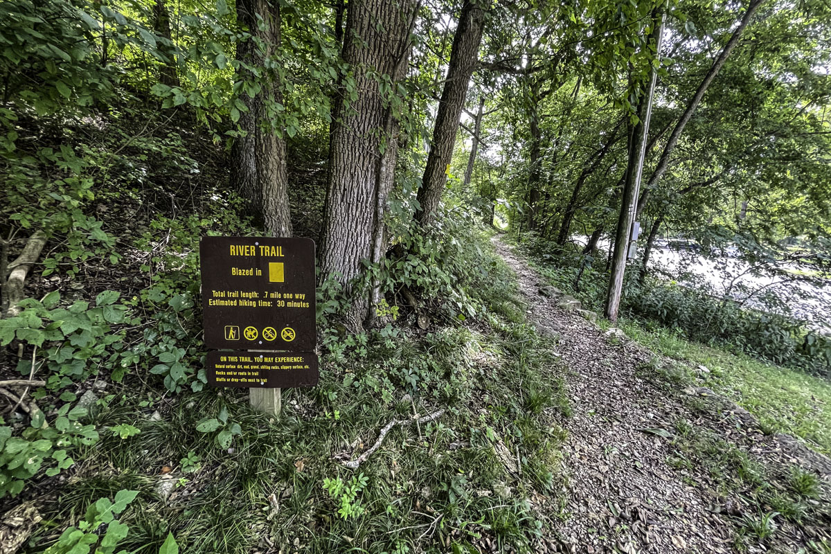
River Trail, .07-mile one way: A relatively easy hike, elevation-wise, the River Trail starts just south of the CCC Lodge. It makes a nice 1.4-mile hike out and back, or it can be used as a way to get from the hatchery area to Campgrounds 2 and 3 without walking on the highway. A short section of trail starts just past the CCC Lodge and goes through wildflowers along the parking area, popping back out, then picking up again just south of the amphitheater. (Tip: South of the amphitheater is a better place to start). From here the narrow, sometimes rocky trail follows the river, curving away from parking areas to less populated sections of the river and along some interesting bluffs. The trail ends in a clearing near the Missouri F bridge. You can see the river while hiking this trail in summer months, but the view gets better when leaves are fewer.
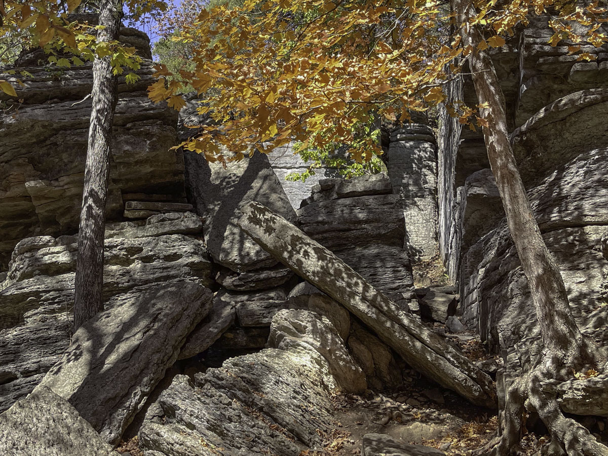
Devil’s Kitchen Trail, 1.4-mile loop: This rugged, sometimes steep trail — especially nice in the fall — also starts just south of the hatchery. The trail goes from the river valley to the top of the hill (with a 314-foot elevation gain) and back down again, revealing a variety of plants, trees and geology. It was named for a formation that once formed a room of sorts by shifting rocks, said to be a refuge of Civil War guerrillas. The roof of the “kitchen” collapsed in 1985 and further in 2001.
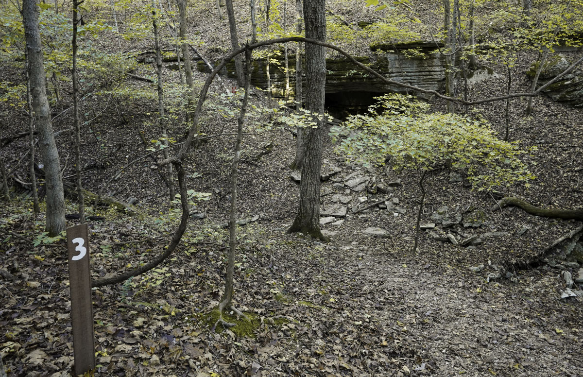
This trail is marked with numbers keyed to descriptions in a brochure you can pick up at the park office in Campground 1 or at the Ozark Chinquapin Nature Center across from Campground 3. A few features you’ll pass include several caves, outcrops and the ridge top, with a few short side trails to reach some spots. (Tip: You can go counter-clockwise but some hikers consider clockwise a tad easier with elevation changes.)
Springhouse Trail, .4-mile loop: A little off the river area, this short trail starts on the edge of the Emory Melton Inn & Conference Center parking lot and goes through a wooded hilly area, passing by a pretty creek and a small cave.
Eagles Nest Trail, 2.6-mile loop: This trail starts at the back of Campground 2 behind Campsite 94 (there’s a small parking area). The first section follows the river in Fishing Zone 2, then at the loop fork, ascends with a 465-foot elevation gain to one of the park’s highest points. The loop section includes a gravel service road. Several Alltrails reviews suggest doing the loop clockwise and taking hiking sticks. This trail could also be done as an out and back just along the river, skipping the loop.
Pibern Trail, 1.1 miles one way: A hidden gem, the Pibern trailhead is at the end of Campground 1, where there’s a small parking area near a bathroom. The trail starts by crossing the Dry Hollow Creek. (Sometimes bone dry, it may curtail your hike if the water is up.) Follow a level path to another section of the creek to cross at a bluff overhang, then climb steep steps uphill. (This is the hardest part and a hiking stick is useful.) Once you’re up, the rest of the trail is pretty easy and overlooks the creek and camping area, especially when leaves thin out. The trail ends at the entrance to a private resort next to the park. To return to your car, walk down the campground road or take the trail back.
Fire Tower Trail, 4.4-mile loop: This trail — Roaring River’s longest — takes hikers into wild areas of the 2,075-acre park, where its natural features include dolomite glades and the rare Ozark chinquapin trees. There are several trailheads and connectors to the Fire Tower Trail so it could be done in sections if you don’t want to do the entire loop. One access point from the Deer Leap Trail is a steep uphill connector (White Connector 1) to the main loop trail. Go left at the main trail to reach the CCC-built Fire Tower with the shortest distance. Continue the loop from here or you could return to the hatchery.
If you use the Alltrails app, it features the trailhead at Campground 3 near the shower house. To go clockwise from here, you’ll cross Missouri F to continue the trail from there. If you hike counterclockwise, walk along the campground road or take the prettier rocky path along the river until you reach the east end of Campground 3. There is parking here, too, and another spot to pick up the trail. Follow the trail east from here (see map), again crossing Missouri F and eventually looping northwest to the Fire Tower. From the tower, continue west then south, back to your starting point. (Either way, you’ll pass White Connector 1 to the Deer Leap Trail if you care to take it.) Note that the Fire Tower is rickety and hikers are discouraged from climbing it.
Fish for rainbow trout
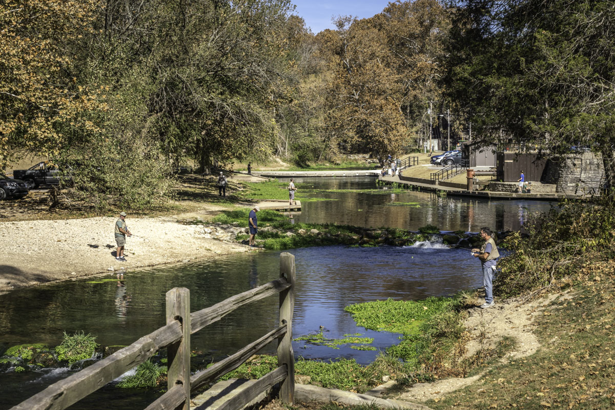
Stocked each night of the catching season with rainbow trout (and periodically during catch and release season), Roaring River is loved by anglers of all ages. The river is so easy to access in two separate areas of the park, you’ll find as many families and budding anglers as experienced trout slayers casting a line. Plus, there are several areas with concrete platforms for accessible fishing.
There are two main areas of the park where people fish and most anglers cast from the bank. In each, the river has been dammed with low rocks, creating scenic cascades and forming pools where trout can be seen teasing anglers in the clear water.
Click here to expand tips, requirements and links.
The first section of Roaring River emerges from the spring and dam in Zone 1, winding through the park with plenty of spots to cast a line. This zone only allows artificial lures and no wading.
Zone 2, near Campgrounds 2 and 3, has two sections with different fishing rules. Both areas only allow the use of artificial flies.
The section between the old dam on the east end of Campground 3 (near the fish cleaning station) to just past the handicap platform on the west end, is catch and keep or release, and no wading is allowed. But upstream from here, past a nearby sign, it's catch and release only, plus anglers (or anyone) can wade in the stream up to a sign at the mouth of Dry Hollow Creek.
There is also a more remote Zone 3 where artificial lures, flies and natural or scented baits are allowed.
Missouri trout parks require anglers have a state fishing permit plus an in-season daily trout tag, which can be purchased at Roaring River’s park store. Fishing is limited between designated opening times and ending times each day, which change throughout the catch-and-keep season, March 1 to October 31. A horn goes off alerting anglers when they can start or must stop. Learn more about Roaring River zones and trout fishing hours and seasons on the Missouri State Parks website.
For more information about Missouri trout fishing during the catch-and-keep season, March 1 to October 31, read this guide.
For more information about Missouri trout fishing during the catch-and-release season, mid-November through mid-February, read this guide.
Camp or lodge for an extended stay
While Roaring River State Park is less than 90 minutes' drive from Springfield — an easy day trip — there are plenty of reasons to stick around. Fall is particularly beautiful whether hiking, fishing or using the park as a basecamp for more adventures.
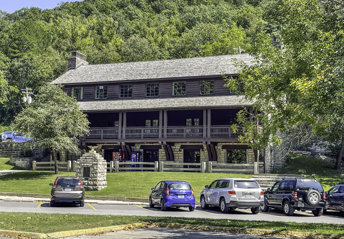
Accommodations inside park boundaries include modern rooms at the Emory Melton Inn and Conference Center, or lodging with a kitchen in a cabin, duplex, fourplex, or at the CCC Lodge. And the park features three campgrounds for tent and RV camping.
Click here to expand tips and information about where to stay.
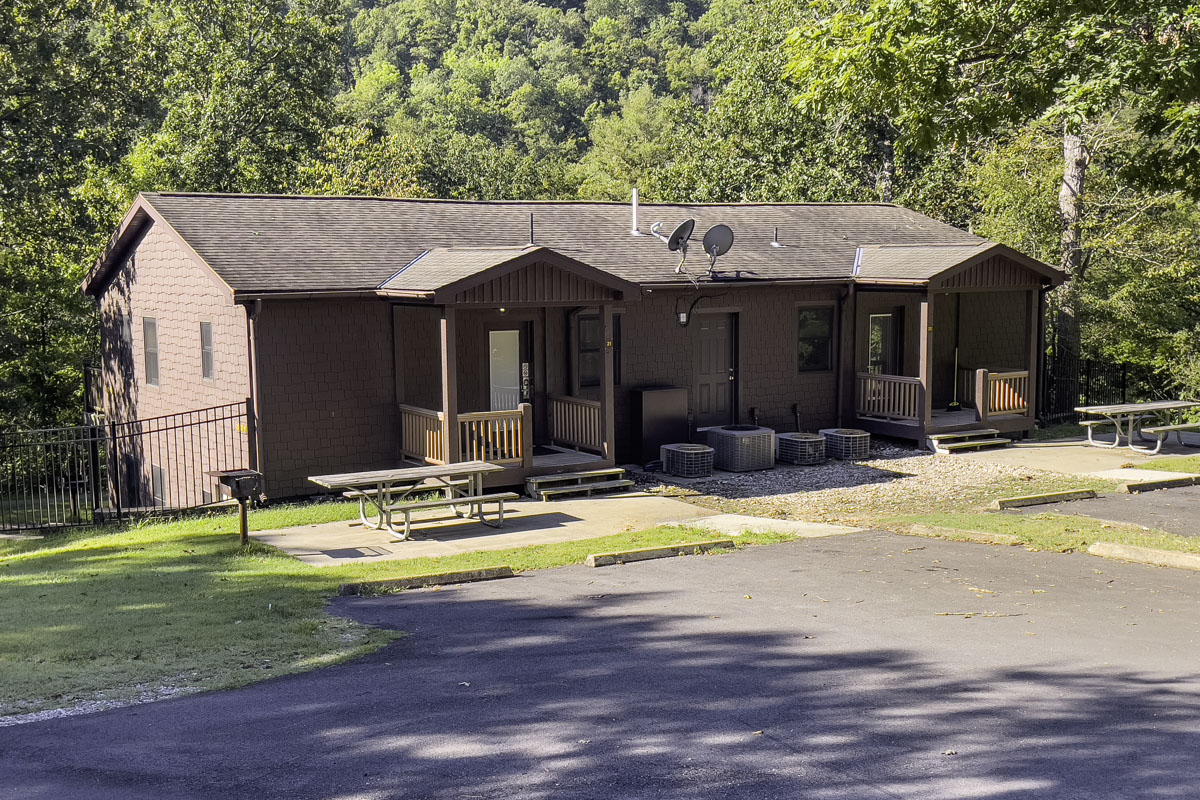
Lodging in the park is open during the catch-and-keep season, March 1 through October 31. To book lodging, visit the Roaring River State Park website or call (417) 847-2330. Cabins and the CCC Lodge are available near the hatchery; duplex and fourplex units are closer to Campgrounds 2 and 3. If you prefer a modern hotel room with dining available, stay at the Emory Melton Inn and Conference Center inside the park.
A nearby alternative is the Roaring River Resort, just up the road from the park, at 23359 Missouri 112. Visit their website or call (417) 847-3235. The resort is open year-round and offers standard motel rooms, kitchen rooms, multi-room units and cabins.
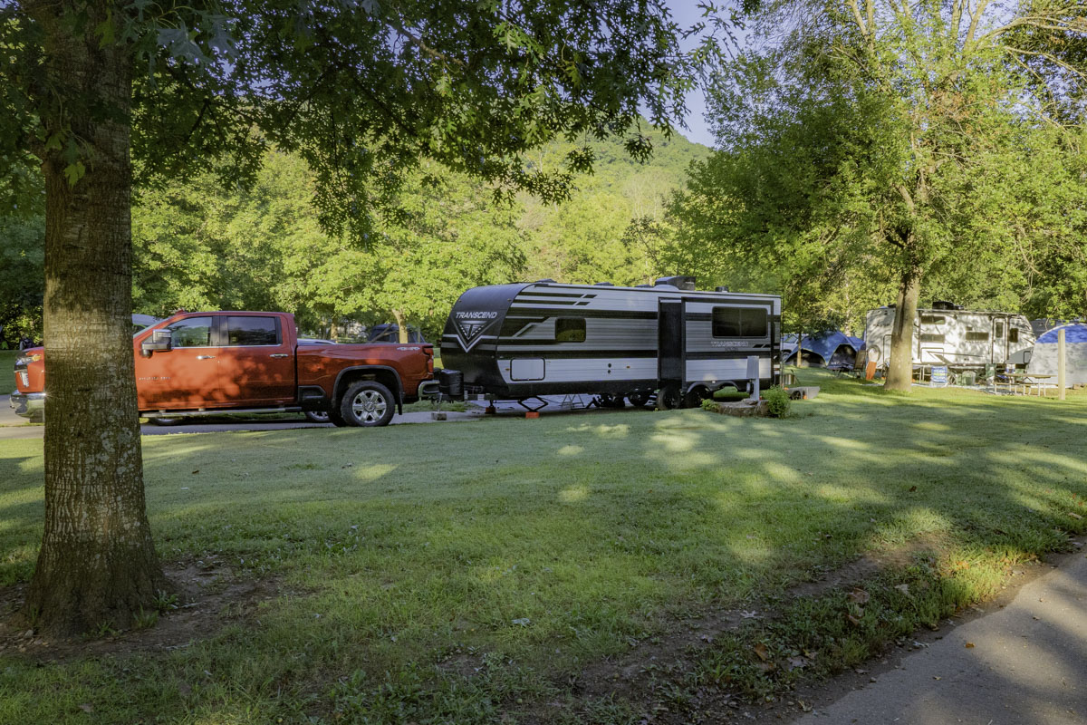
If you like to camp, there are three campgrounds for tent and camper/RV setups. All three are open March through October. From November through February, a limited number of campsites are available in a section of Campsite 1.
To book camping, start here.
Campground 1 has two sections. A narrow row of sites between a bluff and Dry Hollow Creek (unusable if there’s high water/flooding) include several pull-through sites, preferred by RV campers. Another section of Campground 1 is between the old swimming pool (not operational) and the road. There are bathrooms, showers, laundry and an RV dump station. Some campsites here are open year-round. Fishing is not available directly from this campground. (Map)
Campground 2, with electric sites including a couple of pull-throughs, is on the southwest side of the river in Zone 2. There is a bathroom and shower house as you enter the campground. Fishing is available but limited from this campground. (Map)
Campground 3 on the northeast section of river in Zone 2 has a long section for tent camping, plus more tent camping along the river near electric sites for RVs. There is a central bathroom, laundry, showers and an RV dump station. You can easily fish all along the river in Zone 2 from this campground. Plus, the Nature Center is walkable from here. (Map)
If Roaring River campsites are full, a nearby alternative is the Eagle Rock Campground, 30925 Missouri 86, managed by the Corps of Engineers. (Reserve campsites here.)
Picnic, play, shop and learn
When we said this park offers more than trout fishing, we meant it. It’s a great spot to spend a day out having a picnic, playing, visiting the nature center and hatchery, participating in a program or taking a creek walk. There’s even a park store where you can pick up souvenirs, snacks and soft-serve ice cream.
Click here for information about shelters, playgrounds, the store and nature center.
If you’re looking for a great place to host a family picnic, try this park. Its shelters make festive gathering places for birthdays and reunions. Not only that, there are dozens of picnic tables in a shaded grassy area near the entrance of Fishing Zone 1 off Missouri F, in addition to picnic tables scattered all along the river near the hatchery.
The park also has two playgrounds: One is located in the picnic and shelter area; the other is near the CCC Lodge and hatchery. At the hatchery, kids love to feed the fish with pellets purchased from a container with the turn of a dial (bring quarters!).
And during warm summer months, it’s not unusual to find families and kids wading in the river or taking a creek walk where allowed.
Tip: Watch for signs where it’s OK to swim, wade or even fish while wading, only allowed in a designated catch-and-release section of Zone 2. One such sign is near the handicap fishing platform in Zone 2. The wading area ends at the mouth of Dry Hollow Creek where another sign is posted. Also: Many signs warn that river water is not monitored for quality; you swim at your own risk.
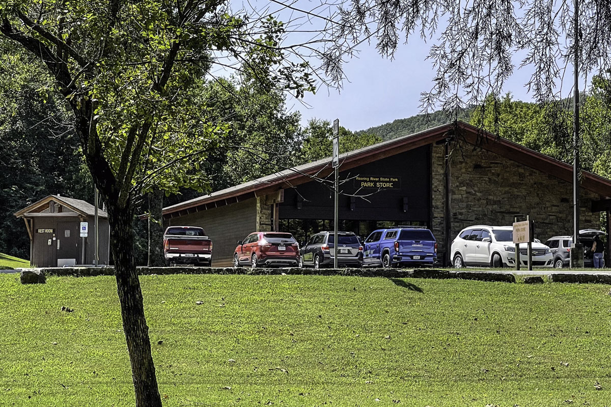
A great first stop is the park store, located where Missouri 112 and Missouri F intersect after entering the park. Not only can you purchase fishing tags here, you can also pick up coffee, fountain drinks, snacks, soft-serve ice cream, fishing and hiking gear, souvenirs, T-shirts and more. Plus, there’s a bathroom. Call the store at (417) 847-4971.
Lastly, stop by the Ozark Chinquapin Nature Center to explore interpretive exhibits, see a few live animals on display and learn about the park’s history and natural features. The center also sells books, guides and souvenirs, and has park brochures and maps. The Nature Center is open March 1 through October 31, with hours varying throughout the season (check online).
The Nature Center is also one location for many park programs and events. Descriptions and contacts can be found on the Missouri State Parks website. Follow the park’s Facebook page, a great way to stay updated on events.
Dine out or take a day trip
Dining in the park is easy: Pack a picnic or cook out at your campsite. But if you want someone to cook for you, there are several options nearby. Roaring River also makes a great basecamp for excursions and day trips to nearby activities and places of interest.
Click here to expand the tips and ideas for dining and day trips.
The closest place to eat in the park is the dining room at the Emory Melton Inn and Conference Center, open breakfast through dinner during the catch-and-keep season, March 1 through October 31. Call (417) 847-2330.
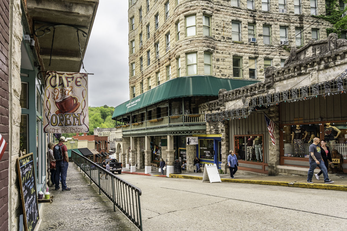
You can also venture back into Cassville, 15 minutes north, to find restaurants with Italian, Asian, Mexican and barbecue fare, a steak house, coffee shop, several chain drive-throughs and the Sunrise Family Restaurant.
Treasure-seekers might also enjoy Cassville’s two Main Street flea market shops.
If you’re staying at the park for several days, you might add a day trip or two. Eureka Springs is only 30 minutes south and has dozens of dining and brewery/wine venues, not to mention a walking tour of its springs, art shops and boutiques, plus many other sites of interest. (Learn all about this eclectic town in our Eureka Springs guide and find dining suggestions in this guide.)
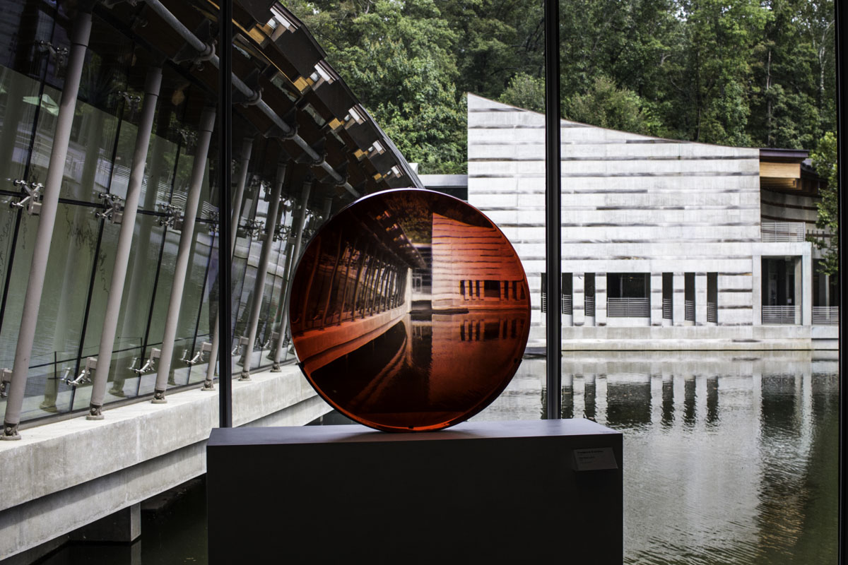
If you like a little art with your outdoors, take a day trip to Crystal Bridges Museum of American Art, 45 minutes southwest. (We once fished in the morning, went to the Ansel Adams exhibit in the afternoon, then returned to fish into the evening.)
If you enjoy history and battlefields, pop over to Pea Ridge National Military Park, less than 30 minutes southwest.
And if it’s warm enough to swim or rent a boat, Eagle Rock Marina and campsite (with swim beach) is less than 15 minutes southeast.